THE ADVENTURE COLLECTIVE® · Independent discovery and booking for outdoor travel

Climb to the crater rim of Mt. Usu, peer into recent volcanic scars, then descend to Lake Toya for geological context at the Toya-Usu Geopark. This small-group day tour pairs a hands-on volcano hike with lake viewpoints and on-site interpretation.
Climb to the crater rim of Mt. Usu, peer into recent volcanic scars, then descend to Lake Toya for geological context at the Toya-Usu Geopark. This small-group day tour pairs a hands-on volcano hike with lake viewpoints and on-site interpretation.
A cool wind from the crater rim cuts across the trail as you climb—pines crackle on the slope and the crater breathes faint steam. Below, Lake Toya opens in a wide, blue bowl with a black volcanic shoreline; boats are small dots, and the island in the center holds ancient forest. The day begins with a short drive to the trailhead, then a steady ascent through mixed forest to the crater rim where the raw geometry of recent eruptions is visible.
Verified experiences and guided adventures in the surrounding area.
Operated by Nobo Tours · Toyako, Hokkaido
A cool wind from the crater rim cuts across the trail as you climb—pines crackle on the slope and the crater breathes faint steam. Below, Lake Toya opens in a wide, blue bowl with a black volcanic shoreline; boats are small dots, and the island in the center holds ancient forest. The day begins with a short drive to the trailhead, then a steady ascent through mixed forest to the crater rim where the raw geometry of recent eruptions is visible.
Mt. Usu is one of Hokkaido's most active volcanoes; eruptions in the 20th century reshaped the slope and the 2000 event left fresh craters you can observe. The lake itself sits in a caldera, and the Toya-Usu Geopark Centre frames the geology with displays on magma, lahar deposits, and human responses to volcanic change. Local onsen culture in nearby Toyako grew in parallel—hot springs warmed by the same subterranean heat that keeps Mt. Usu restless.
Practically, expect a 2–3 hour round-trip hike on well-defined but sometimes steep paths with loose scree near the rim. Bring sturdy footwear, layers for wind and sun, and a camera for the viewpoint overlooking Uchiura Bay. The tour's small-group format and included pickup keep logistics simple; guides often explain eruption chronology and point out Showa-shinzan, the volcanic dome that rose during the 1940s. Leave time after the hike to visit the Geopark Visitor Center and the best photographic outlook by the lake. Hydrate early, pace the climb, and respect signage on thermal areas—this is active geology, not a museum.
moderate.
4–6 hours.
Suitable for those with moderate fitness able to manage 2–3 hours of uphill hiking and some uneven, steep sections.
Moderate fitness is required: expect 2–3 hours of hiking with some steep, uneven terrain; no technical climbing skills needed.
Yes—this small-group tour includes pickup and drop-off, which reduces local transport planning.
Children can join if they have the stamina for the uphill sections; check with the operator about age suitability and safety considerations.
Mt. Usu is active but monitored; tours avoid hazardous areas and guides follow safety protocols and signage. Weather or volcanic conditions can cancel the tour.
The Usu area experienced significant eruptions in the 20th and 21st centuries; Showa-shinzan famously emerged during the 1940s and the 2000 eruption reshaped the summit area.
The Toya-Usu Geopark promotes trail stewardship and volcanic education—stick to marked routes to protect fragile regrowth and minimize erosion.
Nobo Tours operates guided outdoor trips and adventures with an emphasis on safety, stewardship, and memorable experiences.
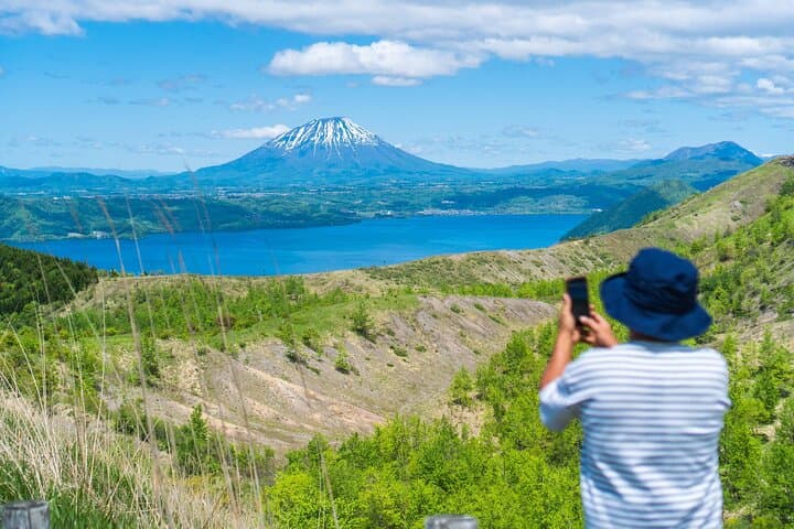
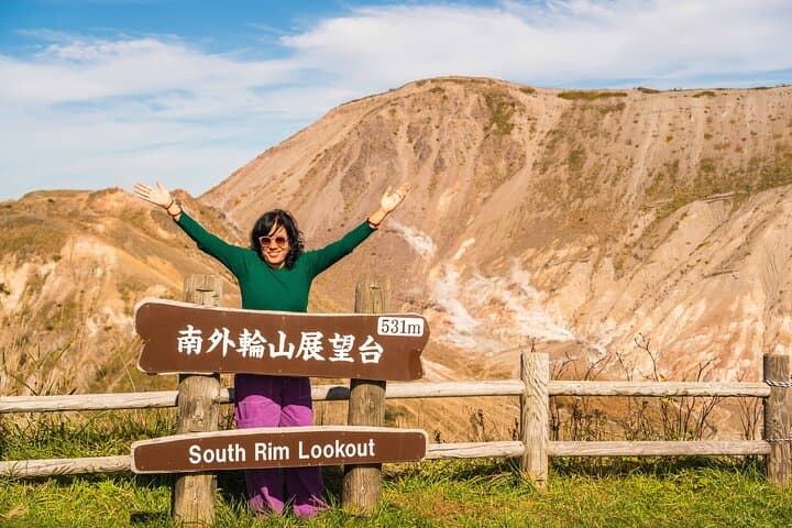
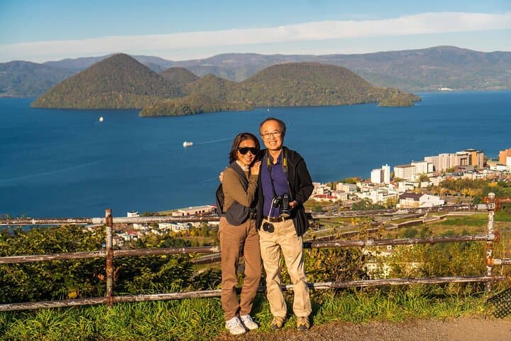
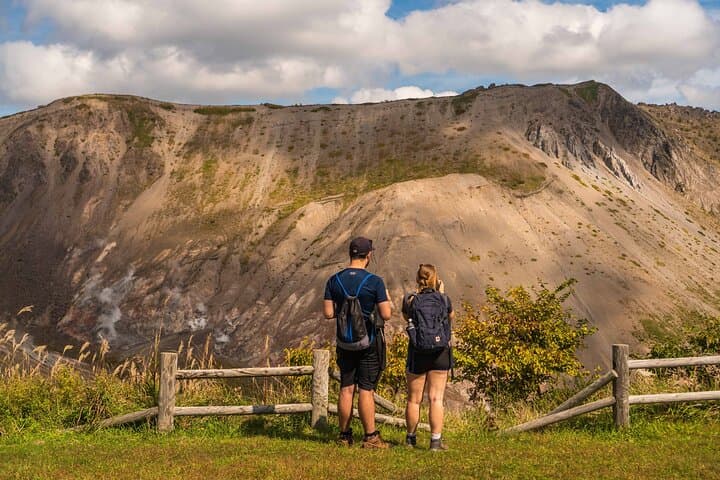
A cool wind from the crater rim cuts across the trail as you climb—pines crackle on the slope and the crater breathes faint steam. Below, Lake Toya opens in a wide, blue bowl with a black volcanic shoreline; boats are small dots, and the island in the center holds ancient forest. The day begins with a short drive to the trailhead, then a steady ascent through mixed forest to the crater rim where the raw geometry of recent eruptions is visible.
A cool wind from the crater rim cuts across the trail as you climb—pines crackle on the slope and the crater breathes faint steam. Below, Lake Toya opens in a wide, blue bowl with a black volcanic shoreline; boats are small dots, and the island in the center holds ancient forest. The day begins with a short drive to the trailhead, then a steady ascent through mixed forest to the crater rim where the raw geometry of recent eruptions is visible.
Mt. Usu is one of Hokkaido's most active volcanoes; eruptions in the 20th century reshaped the slope and the 2000 event left fresh craters you can observe. The lake itself sits in a caldera, and the Toya-Usu Geopark Centre frames the geology with displays on magma, lahar deposits, and human responses to volcanic change. Local onsen culture in nearby Toyako grew in parallel—hot springs warmed by the same subterranean heat that keeps Mt. Usu restless.
Practically, expect a 2–3 hour round-trip hike on well-defined but sometimes steep paths with loose scree near the rim. Bring sturdy footwear, layers for wind and sun, and a camera for the viewpoint overlooking Uchiura Bay. The tour's small-group format and included pickup keep logistics simple; guides often explain eruption chronology and point out Showa-shinzan, the volcanic dome that rose during the 1940s. Leave time after the hike to visit the Geopark Visitor Center and the best photographic outlook by the lake. Hydrate early, pace the climb, and respect signage on thermal areas—this is active geology, not a museum.