THE ADVENTURE COLLECTIVE® · Independent discovery and booking for outdoor travel

Follow a stream through shaded forest to a treeline summit with sweeping views of the Japan Alps and, on clear days, Mt. Fuji. This 10 km roundtrip hike from about 1,000 m to 1,900 m is a solid half-day outing for moderately fit hikers.
Follow a stream through shaded forest to a treeline summit with sweeping views of the Japan Alps and, on clear days, Mt. Fuji. This 10 km roundtrip hike from about 1,000 m to 1,900 m is a solid half-day outing for moderately fit hikers.
Fog lifts off the stream as hikers step into a cool, green corridor. The trail begins around 1,000 m, following a clear mountain stream and the quiet rhythm of birdcalls. For three hours the path climbs through fir and beech, the forest shading each switchback until the canopy thins—then the summit opens: a raw, 360-degree bowl that can show the Japan Alps, the city of Matsumoto, the local lake and, on a clear day, a distant silhouette of Mt. Fuji.
Verified experiences and guided adventures in the surrounding area.
Operated by MMGuide · Matsumoto, Nagano Prefecture
Fog lifts off the stream as hikers step into a cool, green corridor. The trail begins around 1,000 m, following a clear mountain stream and the quiet rhythm of birdcalls. For three hours the path climbs through fir and beech, the forest shading each switchback until the canopy thins—then the summit opens: a raw, 360-degree bowl that can show the Japan Alps, the city of Matsumoto, the local lake and, on a clear day, a distant silhouette of Mt. Fuji.
Geologically the route climbs ancient volcanic foothills that feed the high ranges of central Honshu; soil is rocky in places and the final 20–30 minutes are above treeline on exposed ridgeline. Culturally this is a working landscape—forests managed for timber and historically used by local mountain communities—and the summit is a modest tourist lookout rather than a commercial peak, so crowds are lighter than on busier Alpine summits.
Practically, expect about 10 km roundtrip with 900 m of elevation gain (roughly 3 hours up, 2 hours down for an average hiker). The trail stays mostly in cover until the final ascent; streams and muddy sections are common after rain. The recommended season runs May–November (no snow season); private pickup is available for small groups. Bring layered clothing, adequate water, and sturdy footwear. Plan a steady pace uphill, pause for summit lunch, and leave time for descending before late afternoon light fades. The route rewards steady effort with wide views and a sense of high-country openness without the logistics of a multi-day trek.
moderate.
5–6 hours.
Good aerobic fitness; comfortable walking on uneven terrain and sustained uphill for several hours
About 10 km roundtrip with approximately 900 m of elevation gain—average times are ~3 hours up and ~2 hours down.
The tour operates May through November; there is no winter (snow) season for this route.
Reasonable fitness is required; experienced younger children may manage with frequent breaks, but it's not recommended for very young or unfit walkers.
Private pickup and drop-off from Matsumoto hotels is available for up to three people; public transport options are also nearby.
The mountain sits on foothills historically used by local villagers for seasonal woodcutting and upland pasture; the wider Matsumoto area has centuries of mountain culture and castle-town history.
Stick to existing trails to protect fragile alpine plants above treeline; carry out all waste and avoid feeding wildlife to keep natural behavior intact.
MMGuide operates guided outdoor trips and adventures with an emphasis on safety, stewardship, and memorable experiences.
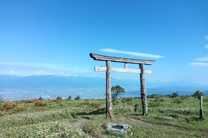
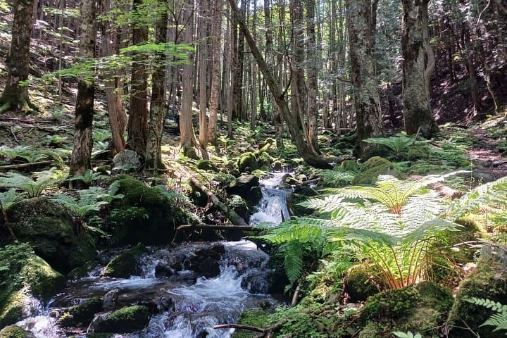
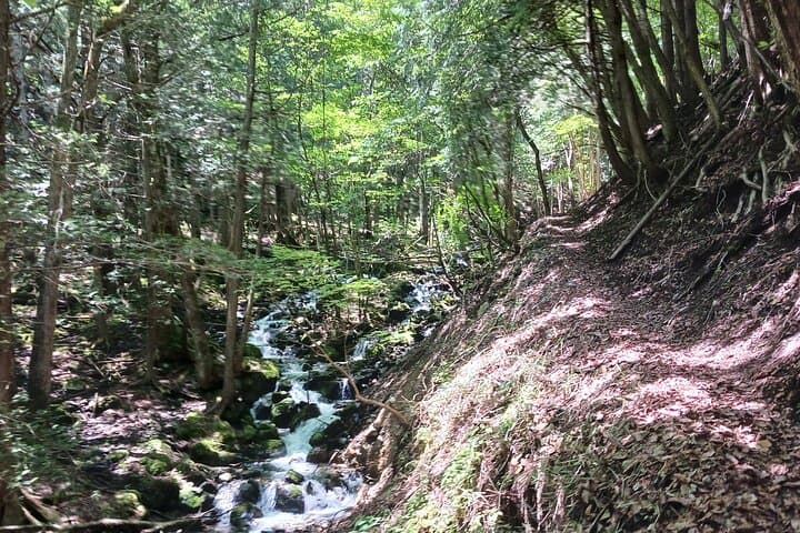
Fog lifts off the stream as hikers step into a cool, green corridor. The trail begins around 1,000 m, following a clear mountain stream and the quiet rhythm of birdcalls. For three hours the path climbs through fir and beech, the forest shading each switchback until the canopy thins—then the summit opens: a raw, 360-degree bowl that can show the Japan Alps, the city of Matsumoto, the local lake and, on a clear day, a distant silhouette of Mt. Fuji.
Fog lifts off the stream as hikers step into a cool, green corridor. The trail begins around 1,000 m, following a clear mountain stream and the quiet rhythm of birdcalls. For three hours the path climbs through fir and beech, the forest shading each switchback until the canopy thins—then the summit opens: a raw, 360-degree bowl that can show the Japan Alps, the city of Matsumoto, the local lake and, on a clear day, a distant silhouette of Mt. Fuji.
Geologically the route climbs ancient volcanic foothills that feed the high ranges of central Honshu; soil is rocky in places and the final 20–30 minutes are above treeline on exposed ridgeline. Culturally this is a working landscape—forests managed for timber and historically used by local mountain communities—and the summit is a modest tourist lookout rather than a commercial peak, so crowds are lighter than on busier Alpine summits.
Practically, expect about 10 km roundtrip with 900 m of elevation gain (roughly 3 hours up, 2 hours down for an average hiker). The trail stays mostly in cover until the final ascent; streams and muddy sections are common after rain. The recommended season runs May–November (no snow season); private pickup is available for small groups. Bring layered clothing, adequate water, and sturdy footwear. Plan a steady pace uphill, pause for summit lunch, and leave time for descending before late afternoon light fades. The route rewards steady effort with wide views and a sense of high-country openness without the logistics of a multi-day trek.