THE ADVENTURE COLLECTIVE® · Independent discovery and booking for outdoor travel

Tackle Volcán Maderas on Ometepe for a rainforest ascent that ends at a crater lagoon. This full-day, guide-led hike mixes steep volcanic trails, cloud-forest biodiversity, and local farmsteads for a compact island adventure.
Tackle Volcán Maderas on Ometepe for a rainforest ascent that ends at a crater lagoon. This full-day, guide-led hike mixes steep volcanic trails, cloud-forest biodiversity, and local farmsteads for a compact island adventure.
You begin before dawn on a narrow ferry road into Moyogalpa, the island's simple port town, where banana palms sway and the two volcanoes of Ometepe loom like sleeping giants.
Verified experiences and guided adventures in the surrounding area.
Operated by Green Expeditions · Moyogalpa, Rivas
You begin before dawn on a narrow ferry road into Moyogalpa, the island's simple port town, where banana palms sway and the two volcanoes of Ometepe loom like sleeping giants.
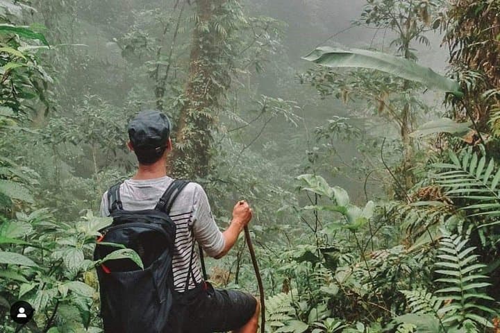
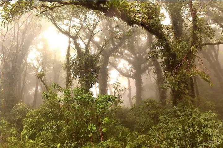
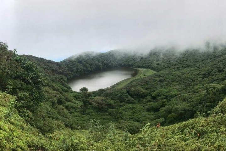
By the time the guide leads you onto the trailhead at the base of Volcán Maderas, the jungle is already awake: a damp, green corridor of ferns, strangler figs, and moss-slippery roots. The path climbs quickly, steeper than it looks from below, cutting through cloud forest that presses close, as if the trees themselves are testing your boots and breath. After several hours of switchbacks and wet volcanic soil, the forest opens and a small, glassy lagoon appears in the crater—an odd, calm pool perched like a secret at the heart of the mountain.
Maderas, the smaller of Ometepe’s two cones at roughly 1,394 meters, is a volcanic caldera shaped by eruptions and long erosion. The crater lagoon is a remnant of that violence turned quiet, an ecological pocket that supports orchids, bromeliads, and a surprising roster of birds. Ometepe itself sits in Lake Nicaragua; the island is the product of volcanic activity and pre-Columbian settlement—archaeological petroglyphs dot the lowlands and Indigenous folklore still colors daily life.
On the trail you'll pass stands of old coffee and cultivated patches where local campesinos bring crops down from the slopes, and you'll hear monkeys calling from the canopy—white-faced capuchins and howlers that treat the trail like a thoroughfare. Guides on this route are licensed and familiar with both the terrain and the local stories: they’ll point out medicinal plants, explain land use, and navigate the steepest sections safely.
Practical guide: expect a challenging day-hike of roughly 8–10 km round trip with about 600–800 meters of elevation gain, depending on the exact start point. Trail surfaces vary from packed volcanic ash to muddy root networks; rain can turn the entire route slick. The operator includes walking sticks, gloves, 3 liters of water per person, and a hearty lunch—arrangements often include hotel pickup in Moyogalpa.
Timing matters: start early to avoid afternoon rain and enjoy clearer crater views. Footwear with aggressive tread and gaiters will make the wet sections manageable; bring layered rain protection, insect repellent, and snacks to maintain energy on steep pitches. Acclimate to the low altitude of Lake Nicaragua but expect a steady cardiovascular effort—this hike is fitness-forward rather than technical.
Leave the crater as you found it: stick to the trail, pack out waste, and respect local agricultural areas on the descent. Done well, the hike delivers a compact cross-section of Nicaraguan geology, wildlife, and island culture—an honest, physical day that finishes with a view back across the lake toward Concepción, where the island you climbed becomes the horizon.
challenging.
7–10 hours.
Good aerobic fitness and steady uphill endurance; able to hike on steep, uneven trails for several hours
This is challenging for beginners: steep, muddy sections and lengthy climbs require moderate fitness. Go with a guide and move at a conservative pace.
The crater lagoon is scenic but swimming is often discouraged due to fragile ecology and variable water quality; check with your guide on conditions.
Yes—licensed guides provide walking sticks and gloves; the operator includes water and lunch as listed.
Rain is common; the trail becomes slippery. Wear a rain shell, protect electronics, and slow your pace—guides may alter timing for safety.
Yes—pickup is offered for guests in Moyogalpa; communicate your hotel location when booking.
Facilities are typically limited to the trailhead and sporadic basic stops; bring tissues and plan accordingly.
Ometepe’s two volcanoes shaped settlement patterns for centuries; the island is dotted with archaeological petroglyphs and small farming communities tied to traditional agriculture.
Trails cross sensitive cloud-forest habitat—stick to the path, avoid introducing soaps into water, and support guides who practice leave-no-trace principles.
Green Expeditions operates guided outdoor trips and adventures with an emphasis on safety, stewardship, and memorable experiences.
You begin before dawn on a narrow ferry road into Moyogalpa, the island's simple port town, where banana palms sway and the two volcanoes of Ometepe loom like sleeping giants.
You begin before dawn on a narrow ferry road into Moyogalpa, the island's simple port town, where banana palms sway and the two volcanoes of Ometepe loom like sleeping giants.
By the time the guide leads you onto the trailhead at the base of Volcán Maderas, the jungle is already awake: a damp, green corridor of ferns, strangler figs, and moss-slippery roots. The path climbs quickly, steeper than it looks from below, cutting through cloud forest that presses close, as if the trees themselves are testing your boots and breath. After several hours of switchbacks and wet volcanic soil, the forest opens and a small, glassy lagoon appears in the crater—an odd, calm pool perched like a secret at the heart of the mountain.
Maderas, the smaller of Ometepe’s two cones at roughly 1,394 meters, is a volcanic caldera shaped by eruptions and long erosion. The crater lagoon is a remnant of that violence turned quiet, an ecological pocket that supports orchids, bromeliads, and a surprising roster of birds. Ometepe itself sits in Lake Nicaragua; the island is the product of volcanic activity and pre-Columbian settlement—archaeological petroglyphs dot the lowlands and Indigenous folklore still colors daily life.
On the trail you'll pass stands of old coffee and cultivated patches where local campesinos bring crops down from the slopes, and you'll hear monkeys calling from the canopy—white-faced capuchins and howlers that treat the trail like a thoroughfare. Guides on this route are licensed and familiar with both the terrain and the local stories: they’ll point out medicinal plants, explain land use, and navigate the steepest sections safely.
Practical guide: expect a challenging day-hike of roughly 8–10 km round trip with about 600–800 meters of elevation gain, depending on the exact start point. Trail surfaces vary from packed volcanic ash to muddy root networks; rain can turn the entire route slick. The operator includes walking sticks, gloves, 3 liters of water per person, and a hearty lunch—arrangements often include hotel pickup in Moyogalpa.
Timing matters: start early to avoid afternoon rain and enjoy clearer crater views. Footwear with aggressive tread and gaiters will make the wet sections manageable; bring layered rain protection, insect repellent, and snacks to maintain energy on steep pitches. Acclimate to the low altitude of Lake Nicaragua but expect a steady cardiovascular effort—this hike is fitness-forward rather than technical.
Leave the crater as you found it: stick to the trail, pack out waste, and respect local agricultural areas on the descent. Done well, the hike delivers a compact cross-section of Nicaraguan geology, wildlife, and island culture—an honest, physical day that finishes with a view back across the lake toward Concepción, where the island you climbed becomes the horizon.