THE ADVENTURE COLLECTIVE® · Independent discovery and booking for outdoor travel

Tackle a 14 km out-and-back to Kirigalpotta, Sri Lanka’s second-highest public summit, across montane grasslands and cloud forest in Horton Plains. Expect six hours, quick weather shifts, and sweeping highland views.
Tackle a 14 km out-and-back to Kirigalpotta, Sri Lanka’s second-highest public summit, across montane grasslands and cloud forest in Horton Plains. Expect six hours, quick weather shifts, and sweeping highland views.
Morning mist slides across open patana as hikers step from the park gate and into a landscape that alternates between wind-swept grassland and small pockets of cloud forest. The trail threads across a high plateau before pitching up toward Kirigalpotta’s exposed ridge; at 2,388 m the summit rewards steady effort with broad views over tea-country and ragged mountain shoulders.
Verified experiences and guided adventures in the surrounding area.
Operated by Overa Tours · Nuwara Eliya, Central Province
Morning mist slides across open patana as hikers step from the park gate and into a landscape that alternates between wind-swept grassland and small pockets of cloud forest. The trail threads across a high plateau before pitching up toward Kirigalpotta’s exposed ridge; at 2,388 m the summit rewards steady effort with broad views over tea-country and ragged mountain shoulders.
Horton Plains preserves a remnant of Sri Lanka’s montane ecosystems: montane grasslands (patana) and evergreen cloud forest shaped by uplifted geology and persistent moisture. The area’s soils and microclimates support dozens of endemic plants and a bird list that excites naturalists; at dawn sambar deer often graze in small groups and the calls of endemic thrushes punctuate the air. Cultural links to nearby Nuwara Eliya and the colonial-era tea industry frame the human history visitors pass through en route to the mountain.
Expect a 14 km out-and-back with variable footing—packed earth, wet grasses, and rocky scramble close to the summit—and roughly six hours on the trail. Weather changes fast: wind, drizzle and bright sun can all arrive in a single outing. Practical preparation makes the difference: layered waterproof clothing, sturdy waterproof boots, plenty of water and a guide familiar with local trail conditions. Start early to avoid mid-day clouds, move deliberately on the steeper sections, and keep to the marked route to protect fragile patana. For those fit enough for a sustained uphill push, the summit offers a clean, alpine-like finish in one of Sri Lanka’s most dramatic highland landscapes.
challenging.
6 hours.
Requires good cardiovascular fitness and endurance for sustained uphill hiking at high elevation.
The route is a sustained 14 km round trip with steady elevation gain—suitable for hikers with moderate to good fitness; guides lead the way so no technical climbing skills are required.
Horton Plains National Park charges an entrance fee, which is typically included in guided tour packages; confirm with your operator before arrival.
Weather is unpredictable—temperatures are several degrees cooler than Nuwara Eliya, and wind, mist or rain can appear suddenly, so dress in layers and carry rain protection.
Yes—sambar deer and endemic birds are commonly seen, though sightings aren’t guaranteed; early mornings improve chances.
The Horton Plains plateau has been protected to conserve its unique montane grassland and cloud forest ecosystems and sits above Sri Lanka’s central highland tea country.
The patana habitat is fragile; staying on marked trails, avoiding single-use plastics, and following guide instructions helps reduce erosion and protect endemic species.
Overa Tours operates guided outdoor trips and adventures with an emphasis on safety, stewardship, and memorable experiences.
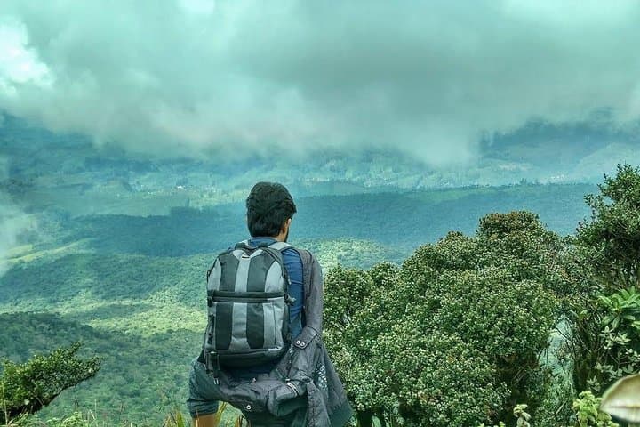
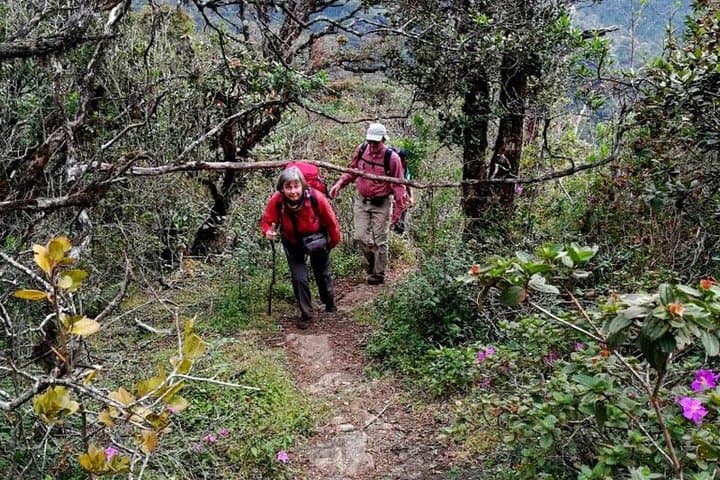
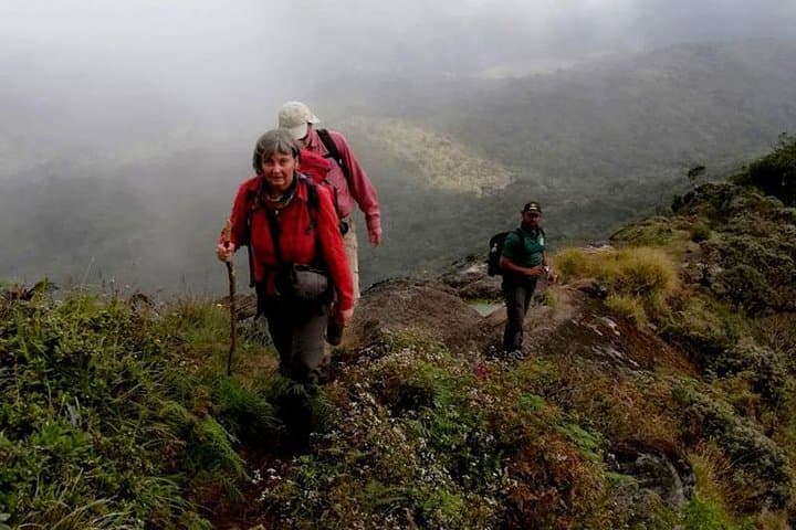
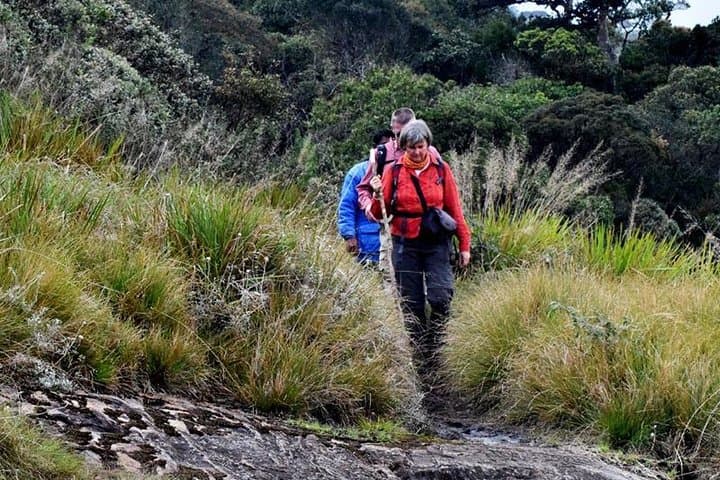
Morning mist slides across open patana as hikers step from the park gate and into a landscape that alternates between wind-swept grassland and small pockets of cloud forest. The trail threads across a high plateau before pitching up toward Kirigalpotta’s exposed ridge; at 2,388 m the summit rewards steady effort with broad views over tea-country and ragged mountain shoulders.
Morning mist slides across open patana as hikers step from the park gate and into a landscape that alternates between wind-swept grassland and small pockets of cloud forest. The trail threads across a high plateau before pitching up toward Kirigalpotta’s exposed ridge; at 2,388 m the summit rewards steady effort with broad views over tea-country and ragged mountain shoulders.
Horton Plains preserves a remnant of Sri Lanka’s montane ecosystems: montane grasslands (patana) and evergreen cloud forest shaped by uplifted geology and persistent moisture. The area’s soils and microclimates support dozens of endemic plants and a bird list that excites naturalists; at dawn sambar deer often graze in small groups and the calls of endemic thrushes punctuate the air. Cultural links to nearby Nuwara Eliya and the colonial-era tea industry frame the human history visitors pass through en route to the mountain.
Expect a 14 km out-and-back with variable footing—packed earth, wet grasses, and rocky scramble close to the summit—and roughly six hours on the trail. Weather changes fast: wind, drizzle and bright sun can all arrive in a single outing. Practical preparation makes the difference: layered waterproof clothing, sturdy waterproof boots, plenty of water and a guide familiar with local trail conditions. Start early to avoid mid-day clouds, move deliberately on the steeper sections, and keep to the marked route to protect fragile patana. For those fit enough for a sustained uphill push, the summit offers a clean, alpine-like finish in one of Sri Lanka’s most dramatic highland landscapes.