THE ADVENTURE COLLECTIVE® · Independent discovery and booking for outdoor travel

See freshly formed lava fields and craters from the air on a 35–45 minute helicopter tour of Reykjanes Peninsula. Expert commentary explains the recent Fagradalsfjall and Sundhnúkur eruptions while offering rare aerial perspectives of Iceland’s shifting geology.
See freshly formed lava fields and craters from the air on a 35–45 minute helicopter tour of Reykjanes Peninsula. Expert commentary explains the recent Fagradalsfjall and Sundhnúkur eruptions while offering rare aerial perspectives of Iceland’s shifting geology.
You lift off from the Reykjavík outskirts and the coastline peels away beneath the rotor wash — black lobes of cooled lava, pale steam rising from fissures, and the angular scars of recent craters spreading across Reykjanes Peninsula.
Verified experiences and guided adventures in the surrounding area.
Operated by Nordurflug Helicopter Tours · Reykjavík, Capital Region
You lift off from the Reykjavík outskirts and the coastline peels away beneath the rotor wash — black lobes of cooled lava, pale steam rising from fissures, and the angular scars of recent craters spreading across Reykjanes Peninsula.
The flight traces the Sundhnúkur and Fagradalsfjall eruption zones, places remade between 2021–2024 when molten rock rewrote the map. Geologically young basalt fields sit beside older tuff and pillow lavas that tell of shifting plates and deep geothermal plumbing. Culturally, the area has long been a working landscape for fishing villages like Grindavík; modern Icelanders treat new lava as both spectacle and resource, harnessing heat and tourism while respecting unstable ground.
From a helicopter you see context: how craters align with fault lines, how lava channels feed into lakes and the sea, and how steam vents continue to scent the wind. Expect expert commentary that explains what you’re seeing and why the peninsula keeps erupting — part of the Mid-Atlantic Ridge exposed above sea level.
Practical guidance: flights run 35–45 minutes and depart near Reykjavík; dress for wind and sudden chill, bring a secured camera, and plan for possible weather cancellations. Landings depend on restrictions, so confirm access if you want to step onto cooled fields. Bookings have strict weight/age policies and minimal fitness needs, but be prepared for brief exposed moments if the flight includes a landing.
This is a focused, high-altitude way to witness Earth reshaping itself — dramatic, fast, and unmistakably Icelandic.
easy.
35–45 minutes.
Minimal fitness required; able to sit for the duration and follow crew instructions
Typical flights last 35–45 minutes, including aerial passes and any short landing, depending on weather and permissions.
Some tours include landings when allowed, but access varies by site safety, recent activity, and operator permissions—confirm in advance.
Yes—operators collect age, height and weight for safety and balance; infants often must sit on laps and some tours have minimum/maximum limits.
Flights are commonly canceled for high winds, low visibility, or volcanic conditions; most operators offer full refunds if canceled within the stated policy window.
Reykjanes has been shaped by repeated eruptions over centuries, and nearby settlements like Grindavík grew around fishing and geothermal resources; recent eruptions are part of a long, active tectonic history.
New lava is fragile—flight landings are limited to protect cooling crust and vegetation; follow operator guidance and local signage to avoid trampling regrowth and disturbing habitats.
Nordurflug Helicopter Tours operates guided outdoor trips and adventures with an emphasis on safety, stewardship, and memorable experiences.
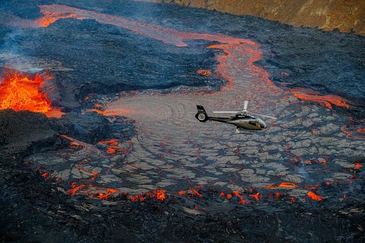
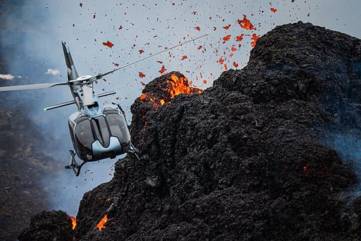
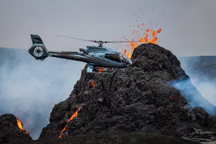

You lift off from the Reykjavík outskirts and the coastline peels away beneath the rotor wash — black lobes of cooled lava, pale steam rising from fissures, and the angular scars of recent craters spreading across Reykjanes Peninsula.
You lift off from the Reykjavík outskirts and the coastline peels away beneath the rotor wash — black lobes of cooled lava, pale steam rising from fissures, and the angular scars of recent craters spreading across Reykjanes Peninsula.
The flight traces the Sundhnúkur and Fagradalsfjall eruption zones, places remade between 2021–2024 when molten rock rewrote the map. Geologically young basalt fields sit beside older tuff and pillow lavas that tell of shifting plates and deep geothermal plumbing. Culturally, the area has long been a working landscape for fishing villages like Grindavík; modern Icelanders treat new lava as both spectacle and resource, harnessing heat and tourism while respecting unstable ground.
From a helicopter you see context: how craters align with fault lines, how lava channels feed into lakes and the sea, and how steam vents continue to scent the wind. Expect expert commentary that explains what you’re seeing and why the peninsula keeps erupting — part of the Mid-Atlantic Ridge exposed above sea level.
Practical guidance: flights run 35–45 minutes and depart near Reykjavík; dress for wind and sudden chill, bring a secured camera, and plan for possible weather cancellations. Landings depend on restrictions, so confirm access if you want to step onto cooled fields. Bookings have strict weight/age policies and minimal fitness needs, but be prepared for brief exposed moments if the flight includes a landing.
This is a focused, high-altitude way to witness Earth reshaping itself — dramatic, fast, and unmistakably Icelandic.