THE ADVENTURE COLLECTIVE® · Independent discovery and booking for outdoor travel

Lift off from Te Anau and see Doubtful Sound from an aerial vantage—waterfalls, alpine lakes, and the Tasman Sea converge in a dramatic one-hour helicopter tour. Ideal for photographers and anyone wanting a concentrated look at Fiordland’s raw topography.
Lift off from Te Anau and see Doubtful Sound from an aerial vantage—waterfalls, alpine lakes, and the Tasman Sea converge in a dramatic one-hour helicopter tour. Ideal for photographers and anyone wanting a concentrated look at Fiordland’s raw topography.
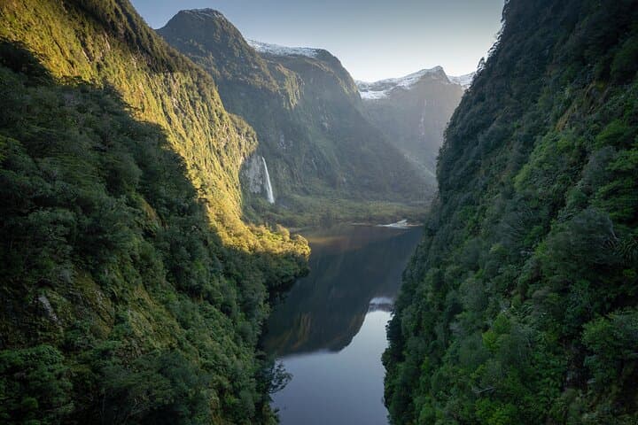
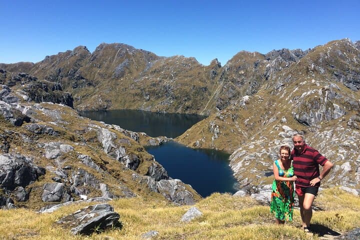
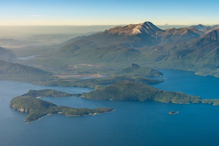
You lift off from Te Anau Airport and the world rearranges itself beneath the rotors: lake glass gives way to serrated granite, waterfalls cut white veins down dark cliff faces, and the Tasman Sea presses like a promise at the mouth of the fiord. The helicopter arcs over Lake Manapouri, then drops into the long, narrow throat of Doubtful Sound. From the air the fiord feels alive—waterfalls daring you, alpine tarns tucked like secrets, and mountains that wear snow as an accent rather than a coat.
Verified experiences and guided adventures in the surrounding area.
Operated by Te Anau Helicopter Services · Te Anau, Southland
You lift off from Te Anau Airport and the world rearranges itself beneath the rotors: lake glass gives way to serrated granite, waterfalls cut white veins down dark cliff faces, and the Tasman Sea presses like a promise at the mouth of the fiord. The helicopter arcs over Lake Manapouri, then drops into the long, narrow throat of Doubtful Sound. From the air the fiord feels alive—waterfalls daring you, alpine tarns tucked like secrets, and mountains that wear snow as an accent rather than a coat.
Doubtful Sound, or Patea in te reo Māori, sits within Fiordland National Park and the broader Te Wahipounamu World Heritage area. Carved by glaciers during the last ice age, the fiord’s steep walls—rising roughly 2,000 meters above sea level in places—tell a geological story of ice, pressure, and time. European explorers gave it an uneasy name; Māori history and place names map a deeper knowledge of the shoreline, fishing grounds, and seasonal movements through the sound.
From the air you see layers of landscape that are otherwise hard to read from sea level: ancient schist and granite, hanging valleys feeding thunderous falls, and the pale scars where glaciers once gripped. Wildlife threads into the view—fur seals loaf on rocky ledges, and birds ride the thermals along the cliffs. For locals, the fiord still carries cultural meaning and a quiet economy: conservation, guiding, and small-scale tourism that must balance access with protection.
Practicalities: the standard flight is about 60 minutes, with live commentary via headsets. Weather governs everything; operators will swap or cancel flights if conditions make a remote landing unsafe. Expect to meet at the Te Anau Helicopters office at the airport and travel light—carry-on only, with a single small bag per passenger. The flight is suitable for most fitness levels, but weight and balance checks are mandatory, and a non-private flight may be shared with other passengers.
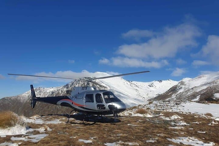
Photographers should aim for early or late in the day when light sculpts the cliffs; bring a fast lens and secure straps for shooting through open doors if a landing is included. Dress in layers—alpine winds bite even on sunny days—and pack a waterproof shell. If a remote landing is possible, it will be short and on uneven terrain; wear sturdy shoes.
This flight is an efficient, visceral way to read Fiordland’s topography in an hour. It’s not just a sightseeing hop; it’s an aerial introduction that gives context to future hikes, boat trips, or simply a longer stay to watch the fiord cycle through weather and light.
easy.
1 hour.
No special fitness required; must be able to board and briefed for short remote landings if included.
No; flights are typically shared with other passengers, though you will hear live commentary through provided headsets.
Yes; operators will cancel or reschedule flights for safety—book flexible plans and expect last-minute changes in Fiordland.
Yes; weight and balance checks are required for safety. The operator collects passenger weights during booking and at check-in.
If weather and conditions permit a remote landing, it will be brief and on uneven terrain—wear sturdy shoes and follow crew instructions.
Infants are allowed but must sit on an adult's lap; strollers are not suitable—check the operator policy for age-specific rules.
Each traveler is allowed one carry-on bag; larger luggage should remain at your accommodation or be left with the operator if arranged in advance.
Doubtful Sound, known in Māori as Patea, sits within Fiordland National Park and the Te Wahipounamu World Heritage area—land shaped by glaciers and long-standing Māori use of coastal resources.
Fiordland's ecosystems are fragile; operators follow strict landing and wildlife guidelines to minimize disturbance and support DOC conservation efforts.
Te Anau Helicopter Services operates guided outdoor trips and adventures with an emphasis on safety, stewardship, and memorable experiences.
You lift off from Te Anau Airport and the world rearranges itself beneath the rotors: lake glass gives way to serrated granite, waterfalls cut white veins down dark cliff faces, and the Tasman Sea presses like a promise at the mouth of the fiord. The helicopter arcs over Lake Manapouri, then drops into the long, narrow throat of Doubtful Sound. From the air the fiord feels alive—waterfalls daring you, alpine tarns tucked like secrets, and mountains that wear snow as an accent rather than a coat.
You lift off from Te Anau Airport and the world rearranges itself beneath the rotors: lake glass gives way to serrated granite, waterfalls cut white veins down dark cliff faces, and the Tasman Sea presses like a promise at the mouth of the fiord. The helicopter arcs over Lake Manapouri, then drops into the long, narrow throat of Doubtful Sound. From the air the fiord feels alive—waterfalls daring you, alpine tarns tucked like secrets, and mountains that wear snow as an accent rather than a coat.
Doubtful Sound, or Patea in te reo Māori, sits within Fiordland National Park and the broader Te Wahipounamu World Heritage area. Carved by glaciers during the last ice age, the fiord’s steep walls—rising roughly 2,000 meters above sea level in places—tell a geological story of ice, pressure, and time. European explorers gave it an uneasy name; Māori history and place names map a deeper knowledge of the shoreline, fishing grounds, and seasonal movements through the sound.
From the air you see layers of landscape that are otherwise hard to read from sea level: ancient schist and granite, hanging valleys feeding thunderous falls, and the pale scars where glaciers once gripped. Wildlife threads into the view—fur seals loaf on rocky ledges, and birds ride the thermals along the cliffs. For locals, the fiord still carries cultural meaning and a quiet economy: conservation, guiding, and small-scale tourism that must balance access with protection.
Practicalities: the standard flight is about 60 minutes, with live commentary via headsets. Weather governs everything; operators will swap or cancel flights if conditions make a remote landing unsafe. Expect to meet at the Te Anau Helicopters office at the airport and travel light—carry-on only, with a single small bag per passenger. The flight is suitable for most fitness levels, but weight and balance checks are mandatory, and a non-private flight may be shared with other passengers.
Photographers should aim for early or late in the day when light sculpts the cliffs; bring a fast lens and secure straps for shooting through open doors if a landing is included. Dress in layers—alpine winds bite even on sunny days—and pack a waterproof shell. If a remote landing is possible, it will be short and on uneven terrain; wear sturdy shoes.
This flight is an efficient, visceral way to read Fiordland’s topography in an hour. It’s not just a sightseeing hop; it’s an aerial introduction that gives context to future hikes, boat trips, or simply a longer stay to watch the fiord cycle through weather and light.