THE ADVENTURE COLLECTIVE® · Independent discovery and booking for outdoor travel

Walk three miles through Harpers Ferry with a GPS-triggered audio guide that brings John Brown’s raid, Storer College, and riverbound industry to life. Download the Drives & Detours app, enter access code RNH279, and start at the Lower Town Train Station for a flexible, two-hour exploration.
Walk three miles through Harpers Ferry with a GPS-triggered audio guide that brings John Brown’s raid, Storer College, and riverbound industry to life. Download the Drives & Detours app, enter access code RNH279, and start at the Lower Town Train Station for a flexible, two-hour exploration.
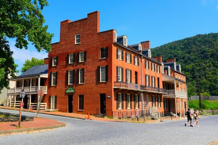
You step off Potomac Street into Lower Town and the air changes—river currents push around the riverbend, cliffs lean in, and a town shaped by industry and conflict opens like a storybook. The audio guide drops you into moments: a mill wheel grinding time, the hush above Jefferson Rock, the clack of trains at the old station.
Verified experiences and guided adventures in the surrounding area.
Operated by Drives & Detours · Harpers Ferry, West Virginia
You step off Potomac Street into Lower Town and the air changes—river currents push around the riverbend, cliffs lean in, and a town shaped by industry and conflict opens like a storybook. The audio guide drops you into moments: a mill wheel grinding time, the hush above Jefferson Rock, the clack of trains at the old station.
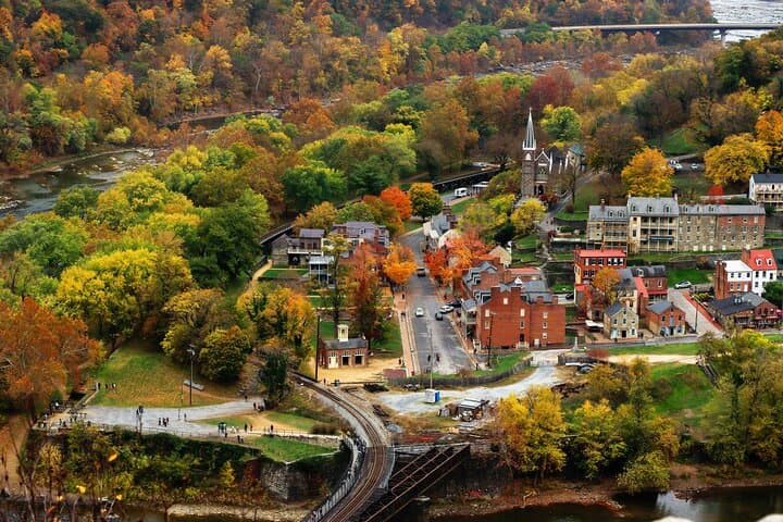
This self-guided, GPS-triggered walk covers roughly 3 miles and takes about two hours, threading streets, ruins on Virginius Island, the site of the old armory, and the stairway that links Lower Town to the Appalachian Trail. Harpers Ferry’s geology—steep slate and sandstone outcrops—made it a strategic crossroads where the Potomac and Shenandoah rivers meet, and where industry and military significance grew side-by-side. Cultural layers here include Indigenous paths, 18th- and 19th-century industry, the flashpoint of John Brown’s 1859 raid, and the later rise of Storer College as a center for Black education.
Practical side: download the Drives & Detours app and enter access code RNH279 before you arrive—cell service can be unreliable. Start at the Lower Town Train Station parking lot and allow time for viewpoints and museum stops; the tour is flexible and can be paused to linger. Footing varies from paved streets to uneven stone and steep steps—sturdy shoes matter. Carry water, a charged phone, and light layers; mornings bring cooler river air, afternoons sun on the ridges.
This is an immersive historical walk with the autonomy of self-guiding—expect narrative-rich stops, interpretive ruins, and river views that make the landscape an active character in the story.
moderate.
2 hours.
Suitable for people who can walk 3 miles with stairs and uneven surfaces; basic stamina needed for short climbs.
The audio tour covers about 3 miles and typically takes around two hours, depending on how long you stop at points of interest.
This is a self-guided GPS-triggered audio tour delivered through the Drives & Detours app—no live guide required.
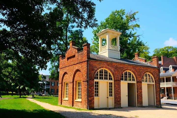
Begin at the Lower Town Train Station parking lot on Potomac Street, less than a quarter-mile from John Brown’s Fort; public transit options also serve Harpers Ferry.
Lower Town has some accessible sections, but historic streets, stone steps, and uneven trails make complete route accessibility limited—contact local park services for specific access information.
Harpers Ferry’s strategic confluence and armory made it central to industry and conflict—John Brown’s 1859 raid and Storer College’s post‑Civil War role are pivotal local chapters.
The park balances public access with preservation; stick to trails, avoid disturbing ruins, and pack out waste to protect historic structures and river habitats.
Drives & Detours operates guided outdoor trips and adventures with an emphasis on safety, stewardship, and memorable experiences.
You step off Potomac Street into Lower Town and the air changes—river currents push around the riverbend, cliffs lean in, and a town shaped by industry and conflict opens like a storybook. The audio guide drops you into moments: a mill wheel grinding time, the hush above Jefferson Rock, the clack of trains at the old station.
You step off Potomac Street into Lower Town and the air changes—river currents push around the riverbend, cliffs lean in, and a town shaped by industry and conflict opens like a storybook. The audio guide drops you into moments: a mill wheel grinding time, the hush above Jefferson Rock, the clack of trains at the old station.
This self-guided, GPS-triggered walk covers roughly 3 miles and takes about two hours, threading streets, ruins on Virginius Island, the site of the old armory, and the stairway that links Lower Town to the Appalachian Trail. Harpers Ferry’s geology—steep slate and sandstone outcrops—made it a strategic crossroads where the Potomac and Shenandoah rivers meet, and where industry and military significance grew side-by-side. Cultural layers here include Indigenous paths, 18th- and 19th-century industry, the flashpoint of John Brown’s 1859 raid, and the later rise of Storer College as a center for Black education.
Practical side: download the Drives & Detours app and enter access code RNH279 before you arrive—cell service can be unreliable. Start at the Lower Town Train Station parking lot and allow time for viewpoints and museum stops; the tour is flexible and can be paused to linger. Footing varies from paved streets to uneven stone and steep steps—sturdy shoes matter. Carry water, a charged phone, and light layers; mornings bring cooler river air, afternoons sun on the ridges.
This is an immersive historical walk with the autonomy of self-guiding—expect narrative-rich stops, interpretive ruins, and river views that make the landscape an active character in the story.