THE ADVENTURE COLLECTIVE® · Independent discovery and booking for outdoor travel

A brisk 6–8 hour guided hike from Kandy through tea estates and up the Hanthana ridgeline, with endemic birdwatching, ridge views and a stop at the Sri Lanka Tea Industry Museum. Expect steep sections, muddy footpaths after rain, and rewarding panoramas from Ura Kanda.
A brisk 6–8 hour guided hike from Kandy through tea estates and up the Hanthana ridgeline, with endemic birdwatching, ridge views and a stop at the Sri Lanka Tea Industry Museum. Expect steep sections, muddy footpaths after rain, and rewarding panoramas from Ura Kanda.
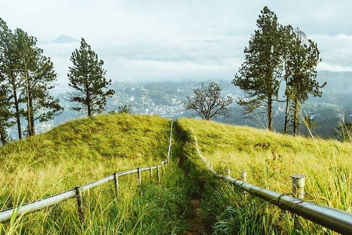
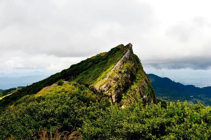
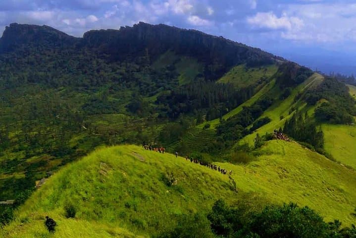
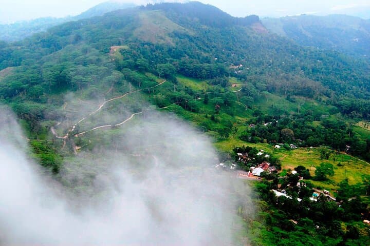
Mist clings to the slopes as you step off the vehicle and into the green hush of Hanthana. The path moves through clipped tea terraces of the Upper Lance, threads a footpath that once linked villages, and climbs toward seven rounded peaks whose ridgelines puncture the sky; the highest, Ura Kanda, reaches about 1,240 m. Birds call from the canopy—raptors wheel above and endemic species dart between bushes—as freshwater springs on the western end feed tributaries of the Mahaweli River, the island’s longest watercourse.
Verified experiences and guided adventures in the surrounding area.
Operated by Ceylon Travel Dream · Kandy, Central Province
Mist clings to the slopes as you step off the vehicle and into the green hush of Hanthana. The path moves through clipped tea terraces of the Upper Lance, threads a footpath that once linked villages, and climbs toward seven rounded peaks whose ridgelines puncture the sky; the highest, Ura Kanda, reaches about 1,240 m. Birds call from the canopy—raptors wheel above and endemic species dart between bushes—as freshwater springs on the western end feed tributaries of the Mahaweli River, the island’s longest watercourse.
Geology here is ancient highland rock shaped by erosion into stacked hills; cultural history is visible in the tea fields and the nearby Sri Lanka Tea Industry Museum, where the colonial-era transformation of Ceylon tea is explained in simple displays. Local villagers and songwriters have long used these hills for grazing, small-scale agriculture and quiet refuge from Kandy’s bustle.
Practically, this is a full-day, physically demanding hike of 6–8 hours with steep sections, uneven footpaths, and exposed ridge walking. Expect muddy stretches after rain and clear, far-reaching views on dry mornings. Carry layers, a filter or bottled water, sun protection and insect repellent; start early for cooler air and better bird activity. The route includes a museum stop and vehicle transfer back to Kandy, so it’s suitable as a guided day trip rather than a self-supported trek. Respect local trails, stick to marked paths, and leave no trace—these hills sustain both wildlife and smallholder tea farms.
challenging.
6–8 hours.
Best for hikers with strong cardiovascular fitness and experience on sustained uphill and uneven terrain
The route is challenging: 6–8 hours with steep sections and uneven terrain—good fitness and footwear are required.
Yes; the itinerary typically includes a stop at the museum for historical context before returning to Kandy.
Yes; Hanthana is known for birdwatching—raptors and several endemic species are commonly seen, along with small mammals and butterflies.
Layered clothing, waterproof jacket, sturdy shoes, sunscreen, insect repellent, snacks, and at least 1.5–2 L of water are recommended.
The Hanthana hills have supported smallholder tea cultivation since the colonial era; the region’s tea industry shaped local economies and landscape patterns seen today.
Stick to marked paths to protect fragile hill-country soils and tea-plot boundaries; avoid feeding wildlife and carry out all trash to reduce pressure on local ecosystems.
Ceylon Travel Dream operates guided outdoor trips and adventures with an emphasis on safety, stewardship, and memorable experiences.
Mist clings to the slopes as you step off the vehicle and into the green hush of Hanthana. The path moves through clipped tea terraces of the Upper Lance, threads a footpath that once linked villages, and climbs toward seven rounded peaks whose ridgelines puncture the sky; the highest, Ura Kanda, reaches about 1,240 m. Birds call from the canopy—raptors wheel above and endemic species dart between bushes—as freshwater springs on the western end feed tributaries of the Mahaweli River, the island’s longest watercourse.
Mist clings to the slopes as you step off the vehicle and into the green hush of Hanthana. The path moves through clipped tea terraces of the Upper Lance, threads a footpath that once linked villages, and climbs toward seven rounded peaks whose ridgelines puncture the sky; the highest, Ura Kanda, reaches about 1,240 m. Birds call from the canopy—raptors wheel above and endemic species dart between bushes—as freshwater springs on the western end feed tributaries of the Mahaweli River, the island’s longest watercourse.
Geology here is ancient highland rock shaped by erosion into stacked hills; cultural history is visible in the tea fields and the nearby Sri Lanka Tea Industry Museum, where the colonial-era transformation of Ceylon tea is explained in simple displays. Local villagers and songwriters have long used these hills for grazing, small-scale agriculture and quiet refuge from Kandy’s bustle.
Practically, this is a full-day, physically demanding hike of 6–8 hours with steep sections, uneven footpaths, and exposed ridge walking. Expect muddy stretches after rain and clear, far-reaching views on dry mornings. Carry layers, a filter or bottled water, sun protection and insect repellent; start early for cooler air and better bird activity. The route includes a museum stop and vehicle transfer back to Kandy, so it’s suitable as a guided day trip rather than a self-supported trek. Respect local trails, stick to marked paths, and leave no trace—these hills sustain both wildlife and smallholder tea farms.