THE ADVENTURE COLLECTIVE® · Independent discovery and booking for outdoor travel

A compact three-day trek from Hanoi to Sapa that blends village homestays, rice-terrace walks and cultural exchange in Ta Van. Walk traditional trails, join a home-cooking class, and sleep in local bungalows set beneath the Hoang Lien Son ridgeline.
A compact three-day trek from Hanoi to Sapa that blends village homestays, rice-terrace walks and cultural exchange in Ta Van. Walk traditional trails, join a home-cooking class, and sleep in local bungalows set beneath the Hoang Lien Son ridgeline.
The bus eases out of Hanoi predawn and by midday the road opens onto a highland bowl of clouds and terraces. In Muong Hoa Valley the rice fields step down the slope like ordered waves; a clear mountain stream threads the valley floor and pushes you toward narrow footpaths that lead to Ta Van's bungalows.
Verified experiences and guided adventures in the surrounding area.
Operated by Chill Tourist · Sapa, Lao Cai Province
The bus eases out of Hanoi predawn and by midday the road opens onto a highland bowl of clouds and terraces. In Muong Hoa Valley the rice fields step down the slope like ordered waves; a clear mountain stream threads the valley floor and pushes you toward narrow footpaths that lead to Ta Van's bungalows.
This three-day route follows traditional trails used by Black Hmong, Red Dzao and Giay (Dzay) communities. Geologically the Hoang Lien Son range—home to Fansipan, Indochina’s highest peak—creates steep, quickly eroding slopes where terraces were carved over generations to hold water and soil. Culturally, villages here remain living communities: you’ll meet artisans, try a family cooking lesson, and sleep in simple bungalows that reflect local building styles.
Expect about 19–20 km of walking over the trip: Day 1 roughly 9 km (≈3.5 hours) from Y Linh Ho through Lao Chai to Ta Van; Day 2 ~4 km (≈2 hours) through bamboo and Giang Ta Chai panoramas; Day 3 ~6 km (≈2+ hours) to Hang Cung before returning to Sapa and the evening bus to Hanoi. Trails are dirt and stone, often stepped and occasionally muddy after rain; elevation around 1,200–1,600 m brings cool mornings and variable weather.
Practical edge: pack layers, bring waterproof footwear, and carry snacks and 1–2 liters of water for trekking days. Respect homestay rules, ask before photographing people, and budget time for slow photos—the landscape rewards a steady pace.
moderate.
3 days.
Suitable for travelers with basic fitness who can walk several hours across uneven terrain; moderate stamina required for consecutive trekking days.
Expect about 6–7 hours each way including scheduled rest stops; the tour departs early morning and returns to Hanoi late evening on day three.
Accommodation is in bungalows/homestays run by local families; rooms are simple with shared facilities and local-style comforts rather than hotel amenities.
Yes—trail segments are short to moderate and the pace is relaxed, but participants should be comfortable walking on uneven ground for up to 4 hours in a day.
Yes—carry Vietnamese đồng for small purchases, souvenirs, and tips; ATMs are available in Sapa town but limited in villages.
The valley’s terraces reflect centuries of communal agriculture by ethnic minority groups; Sapa developed as a hill station in French colonial times, which shaped modern access routes.
Terrace agriculture is vulnerable to erosion and changing weather; stick to marked paths, avoid littering, and support local-led homestays that reinvest tourism revenue into the community.
Chill Tourist operates guided outdoor trips and adventures with an emphasis on safety, stewardship, and memorable experiences.
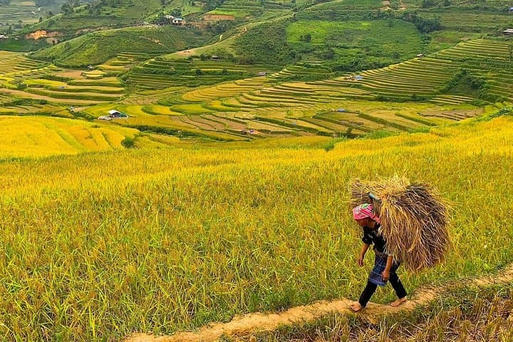
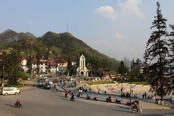
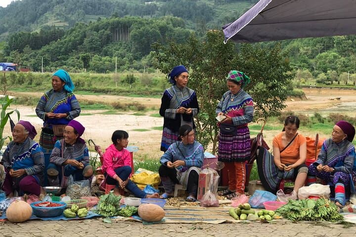
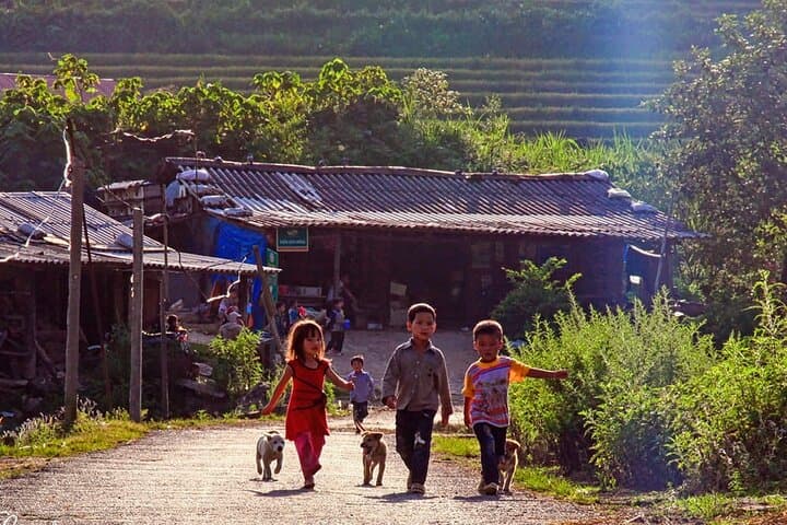
The bus eases out of Hanoi predawn and by midday the road opens onto a highland bowl of clouds and terraces. In Muong Hoa Valley the rice fields step down the slope like ordered waves; a clear mountain stream threads the valley floor and pushes you toward narrow footpaths that lead to Ta Van's bungalows.
The bus eases out of Hanoi predawn and by midday the road opens onto a highland bowl of clouds and terraces. In Muong Hoa Valley the rice fields step down the slope like ordered waves; a clear mountain stream threads the valley floor and pushes you toward narrow footpaths that lead to Ta Van's bungalows.
This three-day route follows traditional trails used by Black Hmong, Red Dzao and Giay (Dzay) communities. Geologically the Hoang Lien Son range—home to Fansipan, Indochina’s highest peak—creates steep, quickly eroding slopes where terraces were carved over generations to hold water and soil. Culturally, villages here remain living communities: you’ll meet artisans, try a family cooking lesson, and sleep in simple bungalows that reflect local building styles.
Expect about 19–20 km of walking over the trip: Day 1 roughly 9 km (≈3.5 hours) from Y Linh Ho through Lao Chai to Ta Van; Day 2 ~4 km (≈2 hours) through bamboo and Giang Ta Chai panoramas; Day 3 ~6 km (≈2+ hours) to Hang Cung before returning to Sapa and the evening bus to Hanoi. Trails are dirt and stone, often stepped and occasionally muddy after rain; elevation around 1,200–1,600 m brings cool mornings and variable weather.
Practical edge: pack layers, bring waterproof footwear, and carry snacks and 1–2 liters of water for trekking days. Respect homestay rules, ask before photographing people, and budget time for slow photos—the landscape rewards a steady pace.