THE ADVENTURE COLLECTIVE® · Independent discovery and booking for outdoor travel

Walk the Muong Hoa Valley from Y Linh Ho to Ta Van, passing terraced rice fields and Black H’mong villages. This guided trek blends accessible hiking with cultural insight and a local lunch in Ta Van.
Walk the Muong Hoa Valley from Y Linh Ho to Ta Van, passing terraced rice fields and Black H’mong villages. This guided trek blends accessible hiking with cultural insight and a local lunch in Ta Van.
Mist sits low in the Muong Hoa Valley as the trail threads out from Sapa town — terraces step down the slopes like a living staircase, and the stream dares you to follow its curve deeper into the mountains.
Verified experiences and guided adventures in the surrounding area.
Operated by Local Tours Ha Giang · Sapa, Lao Cai Province
Mist sits low in the Muong Hoa Valley as the trail threads out from Sapa town — terraces step down the slopes like a living staircase, and the stream dares you to follow its curve deeper into the mountains.
This trek moves through Y Linh Ho into Lao Chai and finishes in Ta Van, villages settled by Black H’mong and other ethnic minority groups. The terraces here are carved into the Hoang Lien Son foothills; many fields trace techniques used for generations, shaped by local irrigation and steep topography. Geologically, you walk on folded metamorphic ridges that feed quick-draining soils and sudden viewpoints across the valley.
Culturally, expect to see traditional dress, small homestays, and daily farming rhythms — rice planting in spring, golden harvests in late summer and fall. Local guides explain clan history and rice-cultivation methods while pointing out carved stones and the occasional riverside shrine.
Practically, the loop covers roughly 8–12 km on uneven dirt and stone paths with cumulative ascent under 400 m, making the route accessible for most hikers with steady footwear. The cadence of the day is steady walking punctuated by photo stops, village visits, and a family-style lunch in Ta Van before a return transfer to Sapa (total tour time ~7 hours). Bring layered rain protection, sturdy shoes, at least 1.5 L of water, and cash for small purchases. Early starts avoid afternoon cloud and give the best long-range views. Respect private yards and ask before photographing residents — the villages are living places, not sets.
moderate.
6–7 hours.
Able to walk 8–12 km over uneven terrain with short steep sections; basic cardio fitness recommended
The guided route runs about 6–7 hours covering roughly 8–12 km with rolling elevation up to ~400 m total gain — suitable for most walkers with moderate fitness.
Yes: a local English-speaking guide is included to lead the route, explain cultural points, and arrange pickup and return transport.
A traditional Vietnamese lunch in Ta Van is included; bring snacks and any dietary notes at booking time.
Pack layered clothing, a waterproof jacket, sturdy shoes, sun protection, and cash; mornings are coolest and afternoons can cloud over.
The terraces and villages reflect centuries of upland rice agriculture and the mixed ethnic heritage of Black H’mong, Red Dao and other groups in the Hoang Lien Son foothills.
Stick to marked paths to limit erosion, avoid single-use plastics, and favor local guides and homestays to support community-based tourism.
Local Tours Ha Giang operates guided outdoor trips and adventures with an emphasis on safety, stewardship, and memorable experiences.
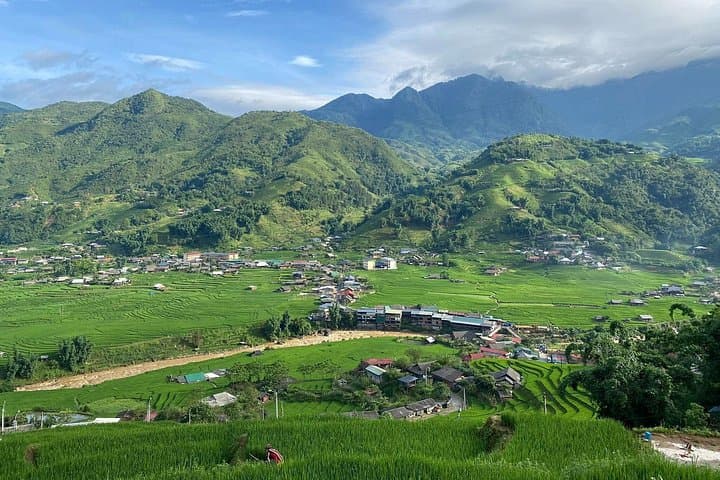
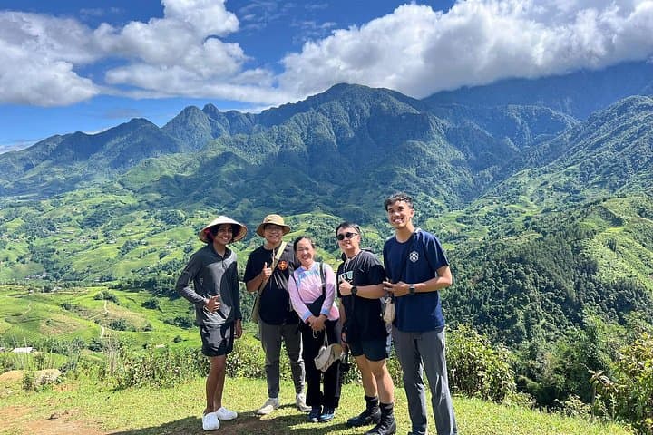

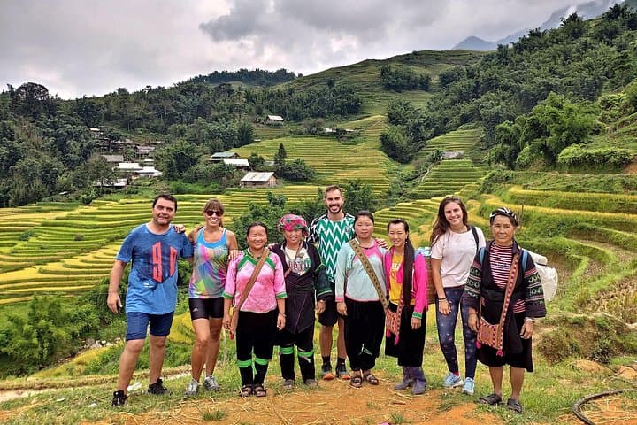
Mist sits low in the Muong Hoa Valley as the trail threads out from Sapa town — terraces step down the slopes like a living staircase, and the stream dares you to follow its curve deeper into the mountains.
Mist sits low in the Muong Hoa Valley as the trail threads out from Sapa town — terraces step down the slopes like a living staircase, and the stream dares you to follow its curve deeper into the mountains.
This trek moves through Y Linh Ho into Lao Chai and finishes in Ta Van, villages settled by Black H’mong and other ethnic minority groups. The terraces here are carved into the Hoang Lien Son foothills; many fields trace techniques used for generations, shaped by local irrigation and steep topography. Geologically, you walk on folded metamorphic ridges that feed quick-draining soils and sudden viewpoints across the valley.
Culturally, expect to see traditional dress, small homestays, and daily farming rhythms — rice planting in spring, golden harvests in late summer and fall. Local guides explain clan history and rice-cultivation methods while pointing out carved stones and the occasional riverside shrine.
Practically, the loop covers roughly 8–12 km on uneven dirt and stone paths with cumulative ascent under 400 m, making the route accessible for most hikers with steady footwear. The cadence of the day is steady walking punctuated by photo stops, village visits, and a family-style lunch in Ta Van before a return transfer to Sapa (total tour time ~7 hours). Bring layered rain protection, sturdy shoes, at least 1.5 L of water, and cash for small purchases. Early starts avoid afternoon cloud and give the best long-range views. Respect private yards and ask before photographing residents — the villages are living places, not sets.