THE ADVENTURE COLLECTIVE® · Independent discovery and booking for outdoor travel

A brisk half-day trek above Munnar threading tea plantations, shola patches and a grassy ridge with views of Anamudi and Idukki reservoir. Practical route details, terrain notes and packing tips for a compact mountain hike.
A brisk half-day trek above Munnar threading tea plantations, shola patches and a grassy ridge with views of Anamudi and Idukki reservoir. Practical route details, terrain notes and packing tips for a compact mountain hike.
You set off at dawn from a narrow dirt track, tea bushes on one shoulder and a rocky slope on the other. Cool air at 1,420 meters lifts the scent of wet earth and crushed cardamom; the ridge ahead cuts a clear line against the sky and dares you onward.
Verified experiences and guided adventures in the surrounding area.
Operated by Munnar Info · Munnar, Kerala
You set off at dawn from a narrow dirt track, tea bushes on one shoulder and a rocky slope on the other. Cool air at 1,420 meters lifts the scent of wet earth and crushed cardamom; the ridge ahead cuts a clear line against the sky and dares you onward.
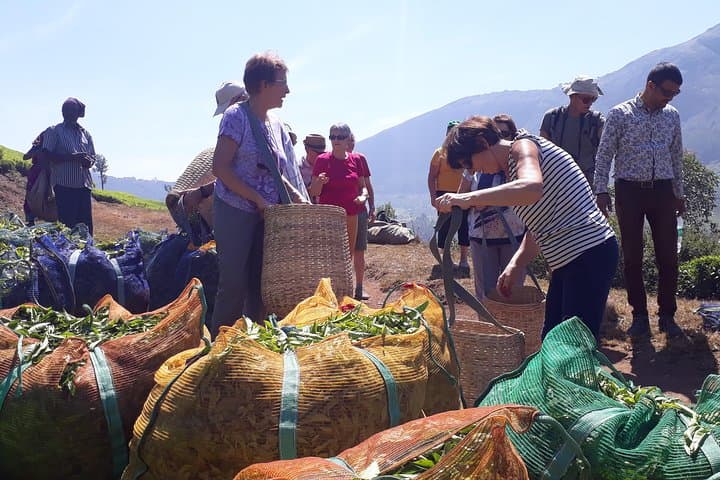
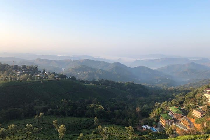
The route threads through working tea estates, fragments of shola forest and open grassland. These hills are part of the southern Western Ghats, a geological uplift of ancient gneiss and charnockite that supports a distinct montane ecosystem. British-era tea and spice plantations changed land use here in the 19th century, but pockets of native forest still shelter endemic plants and birds.
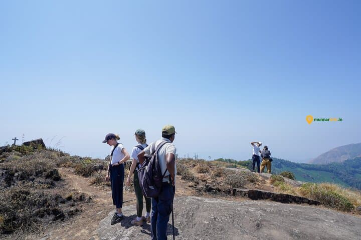
Expect alternating terrain: planted terraces, narrow dirt trails, grassy ridge walking and short rock steps. On clear days the dark profile of Anamudi—South India’s highest peak—and the Idukki reservoir arc into view. Local culture is agricultural; you'll pass small cardamom and coffee groves and may hear Malayalam spoken in nearby villages.
Practical guidance: the outing is roughly 3–4 hours with an ascent to about 1,950 m MSL—moderate effort with frequent photo stops. Wear steady hiking shoes with grip, carry 1–1.5 liters of water and a light rain shell; afternoon weather can shift quickly. Stick to your guide’s line through private estates, pack out wrappers, and plan for a picnic-style refreshment break on the ridge. Morning light offers the best visibility and cooler footing; afternoons often cloud in this region.
moderate.
3–4 hours.
Moderate fitness: able to manage repeated uphill walking and uneven terrain; suitable for most hikers comfortable with sustained walking.
The trip is about 3–4 hours total, starting near 1,420 m and reaching roughly 1,950 m—around 500–550 m of ascent spread over the route.
Yes—guides rate it accessible for most fitness levels, but expect uneven terrain and short steep sections; take breaks as needed.
On clear days you can see both Anamudi and the Idukki reservoir; visibility depends on morning clarity and monsoon cloud cover.
Local listings often offer pickup options; public transport exists to Munnar but confirm pickup details with the operator before booking.
Plantation agriculture introduced tea and spice cultivation during the colonial period; the Western Ghats’ montane landscapes supported both forest fragments and new estates.
The shola–grassland mosaic is fragile—stick to trails, avoid trampling grasslands and carry out any waste to reduce impact on native habitats.
Munnar Info operates guided outdoor trips and adventures with an emphasis on safety, stewardship, and memorable experiences.
You set off at dawn from a narrow dirt track, tea bushes on one shoulder and a rocky slope on the other. Cool air at 1,420 meters lifts the scent of wet earth and crushed cardamom; the ridge ahead cuts a clear line against the sky and dares you onward.
You set off at dawn from a narrow dirt track, tea bushes on one shoulder and a rocky slope on the other. Cool air at 1,420 meters lifts the scent of wet earth and crushed cardamom; the ridge ahead cuts a clear line against the sky and dares you onward.
The route threads through working tea estates, fragments of shola forest and open grassland. These hills are part of the southern Western Ghats, a geological uplift of ancient gneiss and charnockite that supports a distinct montane ecosystem. British-era tea and spice plantations changed land use here in the 19th century, but pockets of native forest still shelter endemic plants and birds.
Expect alternating terrain: planted terraces, narrow dirt trails, grassy ridge walking and short rock steps. On clear days the dark profile of Anamudi—South India’s highest peak—and the Idukki reservoir arc into view. Local culture is agricultural; you'll pass small cardamom and coffee groves and may hear Malayalam spoken in nearby villages.
Practical guidance: the outing is roughly 3–4 hours with an ascent to about 1,950 m MSL—moderate effort with frequent photo stops. Wear steady hiking shoes with grip, carry 1–1.5 liters of water and a light rain shell; afternoon weather can shift quickly. Stick to your guide’s line through private estates, pack out wrappers, and plan for a picnic-style refreshment break on the ridge. Morning light offers the best visibility and cooler footing; afternoons often cloud in this region.