THE ADVENTURE COLLECTIVE® · Independent discovery and booking for outdoor travel

A four-hour, community-led hike from Nagarkot that threads forest tracks, terraced farms, and small waterfalls—finishing with a home-cooked lunch. Expect mixed terrain, moderate climbs, and Himalayan views on clear days.
A four-hour, community-led hike from Nagarkot that threads forest tracks, terraced farms, and small waterfalls—finishing with a home-cooked lunch. Expect mixed terrain, moderate climbs, and Himalayan views on clear days.
You start on a cool ridge above the valley, the air thin with the scent of pine and wet earth, and the nearest peaks peeking through a gap in cloud. The trail slips away from the Nagarkot Community Homestay into forested tracks, cuts through terraces where farmers move like small, steady machines, and drops to clear, stony streams that form the small waterfalls that punctuate the route.
Verified experiences and guided adventures in the surrounding area.
Operated by Community Homestay Network · Nagarkot, Bagmati Province
You start on a cool ridge above the valley, the air thin with the scent of pine and wet earth, and the nearest peaks peeking through a gap in cloud. The trail slips away from the Nagarkot Community Homestay into forested tracks, cuts through terraces where farmers move like small, steady machines, and drops to clear, stony streams that form the small waterfalls that punctuate the route.
Geology here is young folded foothills of the Himalaya: steep slopes, fractured schist, and narrow gullies that channel winter runoff into year-round springs. Historically, Nagarkot served as a lookout for Kathmandu Valley and the villages along the trail reflect centuries of Newar and Tamang farming culture—stone walls, carved shrines, and stacked grain stores. Guides often share stories of local festivals and the seasons that shape planting rhythms.
The hike is straightforward but active: expect roughly 6 km of mixed dirt tracks and stone steps with an elevation change of about 200–350 m, moderate ascents and descents, and several short slick sections after rain. On a clear day the Himalayan skyline — Ganesh Himal to Everest range silhouettes — rewards the climbs.
Practical guidance: start mid-morning for the best visibility, wear grippy shoes for stone steps, carry at least 1–1.5 liters of water, and pack a light rain layer. The walk finishes back at the homestay with a warm, home-cooked lunch and a chance to meet hosts. This is an accessible half-day route that blends village life, waterfalls, and Himalayan outlooks without technical gear.
moderate.
4 hours.
Suitable for travelers with a moderate level of fitness who can handle steady uphill and downhill walking for several hours.
The activity lasts about 4 hours over roughly 6 km with moderate ascents and descents (approx. 200–350 m elevation change); it's suitable for walkers comfortable on uneven terrain.
It starts and ends at the Nagarkot Community Homestay—the loop passes through villages, terraced fields, and waterfalls before returning for lunch.
An English-speaking local guide is included, who can explain local culture, route features, and basic safety information.
The tour note advises it's not recommended for pregnant travelers; families with young children should consider fitness and trail conditions before booking.
Nagarkot has long been a strategic lookout for Kathmandu Valley; local villages reflect Newar and Tamang agricultural traditions shaped by terraced farming and seasonal festivals.
Stick to existing trails and avoid stepping on terraced crops—local conservation focuses on reducing erosion and preserving spring-fed streams that feed waterfalls.
Community Homestay Network operates guided outdoor trips and adventures with an emphasis on safety, stewardship, and memorable experiences.
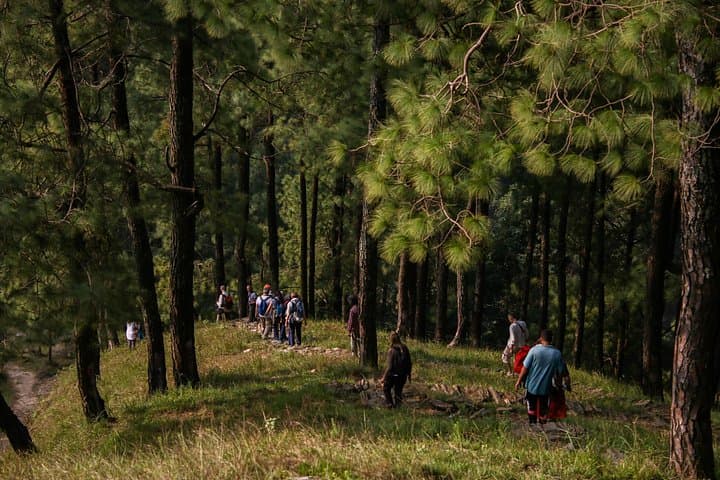
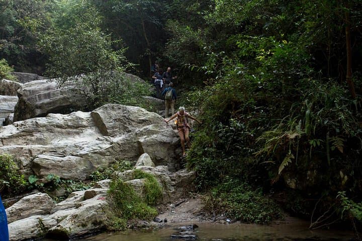
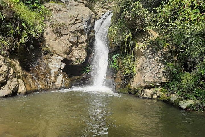
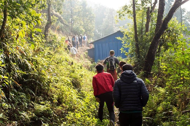
You start on a cool ridge above the valley, the air thin with the scent of pine and wet earth, and the nearest peaks peeking through a gap in cloud. The trail slips away from the Nagarkot Community Homestay into forested tracks, cuts through terraces where farmers move like small, steady machines, and drops to clear, stony streams that form the small waterfalls that punctuate the route.
You start on a cool ridge above the valley, the air thin with the scent of pine and wet earth, and the nearest peaks peeking through a gap in cloud. The trail slips away from the Nagarkot Community Homestay into forested tracks, cuts through terraces where farmers move like small, steady machines, and drops to clear, stony streams that form the small waterfalls that punctuate the route.
Geology here is young folded foothills of the Himalaya: steep slopes, fractured schist, and narrow gullies that channel winter runoff into year-round springs. Historically, Nagarkot served as a lookout for Kathmandu Valley and the villages along the trail reflect centuries of Newar and Tamang farming culture—stone walls, carved shrines, and stacked grain stores. Guides often share stories of local festivals and the seasons that shape planting rhythms.
The hike is straightforward but active: expect roughly 6 km of mixed dirt tracks and stone steps with an elevation change of about 200–350 m, moderate ascents and descents, and several short slick sections after rain. On a clear day the Himalayan skyline — Ganesh Himal to Everest range silhouettes — rewards the climbs.
Practical guidance: start mid-morning for the best visibility, wear grippy shoes for stone steps, carry at least 1–1.5 liters of water, and pack a light rain layer. The walk finishes back at the homestay with a warm, home-cooked lunch and a chance to meet hosts. This is an accessible half-day route that blends village life, waterfalls, and Himalayan outlooks without technical gear.