THE ADVENTURE COLLECTIVE® · Independent discovery and booking for outdoor travel

Walk 1.5 miles along Hadrian’s Wall at Cawfields with a professional guide. This two-hour tour combines archaeological insight, moorland views and hands-on history suitable for moderately fit visitors.
Walk 1.5 miles along Hadrian’s Wall at Cawfields with a professional guide. This two-hour tour combines archaeological insight, moorland views and hands-on history suitable for moderately fit visitors.
The wind carries history along the ridge above the Northumberland moor—stones warmed by an English sun, tufts of grass whispering where Roman sandals once scuffed. On this compact, guided walk you move from lane to ruin, tracing roughly 1.5 miles of path that follows the line of Hadrian’s Wall at Cawfields and the adjacent vallum.
Verified experiences and guided adventures in the surrounding area.
Operated by Ancient Britain · Hexham, Northumberland
The wind carries history along the ridge above the Northumberland moor—stones warmed by an English sun, tufts of grass whispering where Roman sandals once scuffed. On this compact, guided walk you move from lane to ruin, tracing roughly 1.5 miles of path that follows the line of Hadrian’s Wall at Cawfields and the adjacent vallum.
Built around AD 122 on orders from Emperor Hadrian, the wall marked Rome’s northern boundary and shaped lives on both sides. The geology is uncompromising: sandstone outcrops and peaty soils carved by glacial processes give the landscape its stripped, open character. Local lore layers on top—farm names, milecastle positions and the vernacular stories guides use to make soldiers and settlers feel present again.
Culture here is straightforward: a rural working landscape managed alongside protected archaeology. English Heritage and the national park prioritize footpath maintenance and interpretive signage, and guides keep the narrative tight—archaeology, strategy, and everyday soldier life—while you touch mortar that’s nearly two millennia old.
Practically, expect uneven stone and grass underfoot, exposed ridgeline wind and clear sightlines across moorland. The two-hour format makes this ideal for day visitors based in Hexham or Newcastle; groups are small and the pace steady but requires moderate fitness. Bring layered clothing, waterproofs and sturdy footwear; plan for variable weather and take water. With a knowledgeable guide, the walk reveals scale—milecastle placements, a well-preserved vallum ditch—and leaves you with a clearer sense of why a linear fortification could order an empire’s edge.
moderate.
2 hours (1.5 miles).
Moderate—able to walk over uneven ground for up to two hours with short inclines
Meeting details are provided at booking; typical pickup is at a designated roadside point near the Cawfields/Steel Rigg area—confirm exact coordinates with the operator before arrival.
The route is about 1.5 miles over uneven terrain with short slopes; it is rated moderate and requires a reasonable level of mobility and balance.
Children can attend but must be accompanied by an adult; check the operator’s child-rate policy and ensure younger walkers are comfortable with exposed sections.
Service animals are permitted, but other pets are generally discouraged due to livestock and sensitive archaeological areas—verify with the guide in advance.
Hadrian’s Wall was ordered by Emperor Hadrian around AD 122 and served as a fortified frontier and administrative boundary for Roman Britain, marked by forts, milecastles and a protective vallum to the south.
The route crosses protected archaeology and moorland; stick to paths, avoid removing stones and follow guidance from English Heritage and Northumberland National Park to limit erosion.
Ancient Britain operates guided outdoor trips and adventures with an emphasis on safety, stewardship, and memorable experiences.

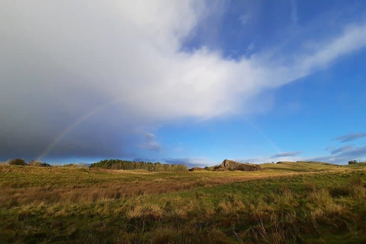
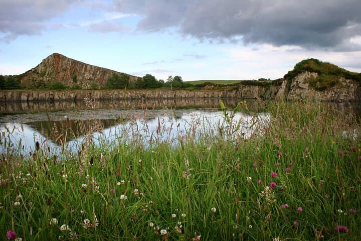
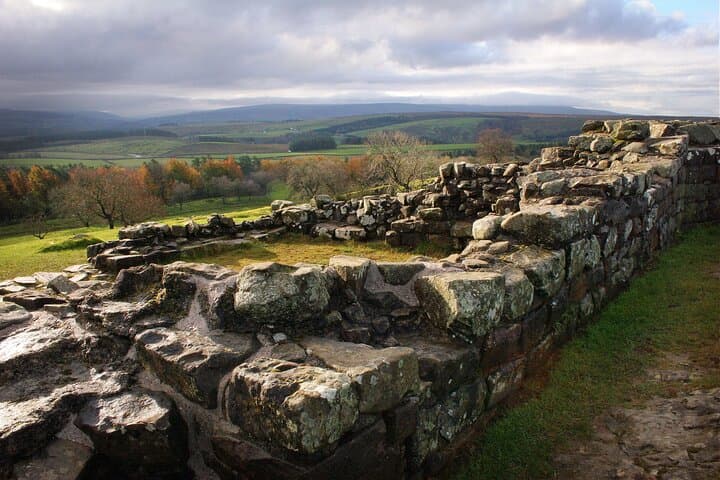
The wind carries history along the ridge above the Northumberland moor—stones warmed by an English sun, tufts of grass whispering where Roman sandals once scuffed. On this compact, guided walk you move from lane to ruin, tracing roughly 1.5 miles of path that follows the line of Hadrian’s Wall at Cawfields and the adjacent vallum.
The wind carries history along the ridge above the Northumberland moor—stones warmed by an English sun, tufts of grass whispering where Roman sandals once scuffed. On this compact, guided walk you move from lane to ruin, tracing roughly 1.5 miles of path that follows the line of Hadrian’s Wall at Cawfields and the adjacent vallum.
Built around AD 122 on orders from Emperor Hadrian, the wall marked Rome’s northern boundary and shaped lives on both sides. The geology is uncompromising: sandstone outcrops and peaty soils carved by glacial processes give the landscape its stripped, open character. Local lore layers on top—farm names, milecastle positions and the vernacular stories guides use to make soldiers and settlers feel present again.
Culture here is straightforward: a rural working landscape managed alongside protected archaeology. English Heritage and the national park prioritize footpath maintenance and interpretive signage, and guides keep the narrative tight—archaeology, strategy, and everyday soldier life—while you touch mortar that’s nearly two millennia old.
Practically, expect uneven stone and grass underfoot, exposed ridgeline wind and clear sightlines across moorland. The two-hour format makes this ideal for day visitors based in Hexham or Newcastle; groups are small and the pace steady but requires moderate fitness. Bring layered clothing, waterproofs and sturdy footwear; plan for variable weather and take water. With a knowledgeable guide, the walk reveals scale—milecastle placements, a well-preserved vallum ditch—and leaves you with a clearer sense of why a linear fortification could order an empire’s edge.