
Ha Giang Trekker 2D2N: Two-Day Homestay Trek Through Tay & Dao Villages
Two days of village trails, rice terraces and a Tay homestay in Ha Giang province. Expect 16 km days through mixed terrain, cultural exchange with hill-tribe families, and an overnight that supports local life.
An Adventure In Ha Giang.
Two days of village trails, rice terraces and a Tay homestay in Ha Giang province. Expect 16 km days through mixed terrain, cultural exchange with hill-tribe families, and an overnight that supports local life.
Read the full experience
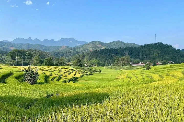
Morning mist lifts off terraced rice paddies as you step out of a stilted Tay house and into a narrow footpath cut through green. The first day unfolds across roughly 16 km of farmland and forest, meeting villagers, crossing streams and pausing at Na Mau to share a picnic or a Dao family meal. By afternoon the trail drops to Ha Thanh waterfall—a cool rush that punctuates the loop back to your homestay.
Morning mist lifts off terraced rice paddies as you step out of a stilted Tay house and into a narrow footpath cut through green. The first day unfolds across roughly 16 km of farmland and forest, meeting villagers, crossing streams and pausing at Na Mau to share a picnic or a Dao family meal. By afternoon the trail drops to Ha Thanh waterfall—a cool rush that punctuates the loop back to your homestay.
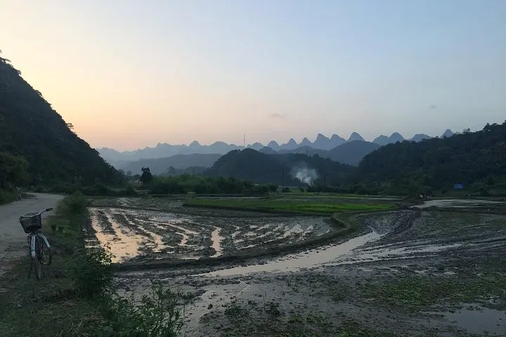
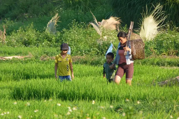
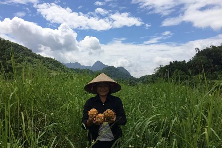
Ha Giang’s landscape is young mountains and folded limestone carved by rivers; the province has long been home to Tay, Dao and other hill-tribe communities whose cultures shape trail-side life. Khuoi My sits near the region’s higher peaks, and local stories, textiles and Ao Dai costumes are woven into daily routines. The homestay model here supports village economies while giving travelers direct cultural exchange.
Expect steady, undulating terrain: each day is about 16 km with several steep sections and short climbs—plan for 300–600 m of cumulative elevation gain per day. Trails are dirt and stone, sometimes muddy after rain. Practical planning: bring waterproof layers, sturdy boots, at least 2–3 liters of water, and cash for small village purchases. Night two ends with a night bus option back to Hanoi, so pack lightweight and secure wet clothes to dry if needed.
This route balances culture and movement—walks that slow you down enough to notice terraced detail, local rituals and a waterfall’s thunder—while remaining accessible to hikers with moderate fitness and curiosity.
Frequently asked questions
Each day covers about 16 km of mixed terrain, typically 5–7 hours depending on pace and breaks.
Tay homestays are stilted houses with thatched roofs and outside bathroom facilities; bedding is provided but basic.
Travelers should have moderate fitness; children and older adults should consult with the operator if mobility issues exist.
No special permits are required for this local trek; ensure routine vaccinations are up to date and carry travel insurance.
About This Experience
YESD Responsible Tours operates guided outdoor trips and adventures with an emphasis on safety, stewardship, and memorable experiences.
Adventure tips
Recommended gear
- Sturdy hiking boots: Protect ankles and provide grip on rocky, muddy trails.
- Light waterproof jacket: Showers can be frequent; a breathable shell keeps you dry and warm.
- 2–3L hydration system: Keeps water accessible on long sections between villages.
- Headlamp with spare batteries: Useful in homestays with limited lighting and for early starts or night-bus packing.
Photos of the experience
Related adventures & guides
Read the full experience
Morning mist lifts off terraced rice paddies as you step out of a stilted Tay house and into a narrow footpath cut through green. The first day unfolds across roughly 16 km of farmland and forest, meeting villagers, crossing streams and pausing at Na Mau to share a picnic or a Dao family meal. By afternoon the trail drops to Ha Thanh waterfall—a cool rush that punctuates the loop back to your homestay.
Morning mist lifts off terraced rice paddies as you step out of a stilted Tay house and into a narrow footpath cut through green. The first day unfolds across roughly 16 km of farmland and forest, meeting villagers, crossing streams and pausing at Na Mau to share a picnic or a Dao family meal. By afternoon the trail drops to Ha Thanh waterfall—a cool rush that punctuates the loop back to your homestay.
Ha Giang’s landscape is young mountains and folded limestone carved by rivers; the province has long been home to Tay, Dao and other hill-tribe communities whose cultures shape trail-side life. Khuoi My sits near the region’s higher peaks, and local stories, textiles and Ao Dai costumes are woven into daily routines. The homestay model here supports village economies while giving travelers direct cultural exchange.
Expect steady, undulating terrain: each day is about 16 km with several steep sections and short climbs—plan for 300–600 m of cumulative elevation gain per day. Trails are dirt and stone, sometimes muddy after rain. Practical planning: bring waterproof layers, sturdy boots, at least 2–3 liters of water, and cash for small village purchases. Night two ends with a night bus option back to Hanoi, so pack lightweight and secure wet clothes to dry if needed.
This route balances culture and movement—walks that slow you down enough to notice terraced detail, local rituals and a waterfall’s thunder—while remaining accessible to hikers with moderate fitness and curiosity.
Make a day of it nearby.
Verified experiences and guided adventures in the surrounding area.