THE ADVENTURE COLLECTIVE® · Independent discovery and booking for outdoor travel

A three-day loop from Ha Noi that threads the Dong Van Karst Plateau by motorbike, including Ma Pi Leng Pass, Nho Que River and colorful ethnic villages. Expect steep passes, dramatic karst scenery and an immersive rural experience.
A three-day loop from Ha Noi that threads the Dong Van Karst Plateau by motorbike, including Ma Pi Leng Pass, Nho Que River and colorful ethnic villages. Expect steep passes, dramatic karst scenery and an immersive rural experience.
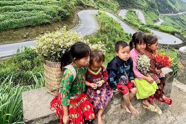
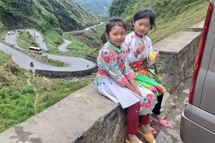
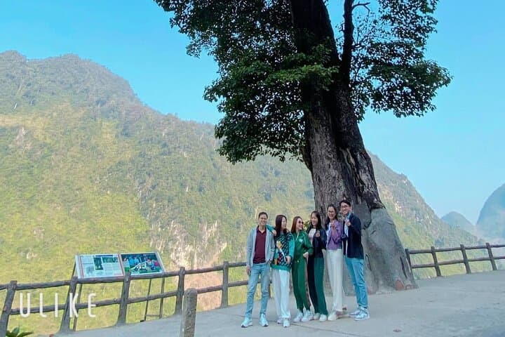
The road peels away from Ha Giang city and immediately begins to climb — hairpins carved into limestone, rice terraces folding into valleys, and occasional roadside vendors selling sweet corn and steaming tea. On day one riders feel the loop open beneath their wheels: Quan Ba’s Heaven Gate lifts the horizon, and by dusk the karst plateau throws a low, blue shadow across Dong Van.
Verified experiences and guided adventures in the surrounding area.
Operated by Local Tours ASIA · Ha Giang, Ha Giang Province
The road peels away from Ha Giang city and immediately begins to climb — hairpins carved into limestone, rice terraces folding into valleys, and occasional roadside vendors selling sweet corn and steaming tea. On day one riders feel the loop open beneath their wheels: Quan Ba’s Heaven Gate lifts the horizon, and by dusk the karst plateau throws a low, blue shadow across Dong Van.
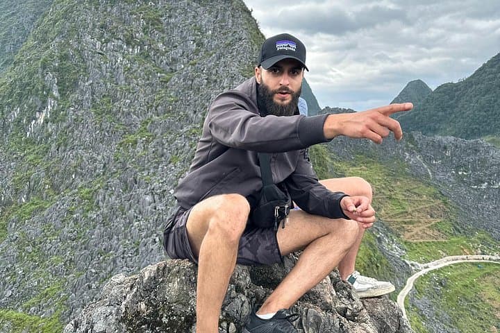
This route runs through the Dong Van Karst Plateau, a UNESCO-recognized geopark shaped by ancient marine limestone and recent uplift; rock outcrops and sheer cliffs testify to tectonic drama millions of years old. The region is also home to Hmong, Tay and Dao communities whose traditional houses, textiles and markets punctuate the route — Lung Cam’s century-old Hmong house is a standout stop.
Practically, the loop is a motorcyclist’s circuit: steep passes like Ma Pi Leng (around 2,000 m at its peak), narrow cliffside roads and long runs between service points. Expect mixed surfaces — paved with occasional gravel patches — and strong winds in exposed sections. The Nho Que River cuts a green ribbon through Tu San canyon, offering a boat option and a chance to rest.
Travelers should plan daylight riding for the best visibility, bring layered weather protection, and allow extra time for photo stops and village markets. If you’re not confident riding, book an Easy Rider guide and focus on the scenery. Hydration, respectful engagement with local communities, and careful speed control on narrow descents make the difference between a good trip and an unsafe one.
moderate.
3 days.
You should be comfortable on a motorcycle for several hours a day and able to handle stairs and short hikes at viewpoints.
No — the tour offers Easy Rider guides and can provide a high-quality motorbike with an experienced driver if you prefer not to ride solo.
The roads include narrow sections and steep drops; beginners should take the Easy Rider option or travel by car for safety and comfort.
Card payments are rare in remote towns; bring Vietnamese dong for homestays, markets and local services.
Accommodations range from basic homestays to private hotel rooms in Ha Giang city, depending on the itinerary and options chosen.
The Dong Van Karst Plateau has been shaped by millions of years of limestone uplift and erosion and contains cultural layers of Hmong, Dao and Tay communities who have farmed these slopes for generations.
The karst plateau is ecologically fragile; stick to roads and village tracks, avoid disturbing farmland, and pack out all trash to reduce impact on the geopark.
Local Tours ASIA operates guided outdoor trips and adventures with an emphasis on safety, stewardship, and memorable experiences.
The road peels away from Ha Giang city and immediately begins to climb — hairpins carved into limestone, rice terraces folding into valleys, and occasional roadside vendors selling sweet corn and steaming tea. On day one riders feel the loop open beneath their wheels: Quan Ba’s Heaven Gate lifts the horizon, and by dusk the karst plateau throws a low, blue shadow across Dong Van.
The road peels away from Ha Giang city and immediately begins to climb — hairpins carved into limestone, rice terraces folding into valleys, and occasional roadside vendors selling sweet corn and steaming tea. On day one riders feel the loop open beneath their wheels: Quan Ba’s Heaven Gate lifts the horizon, and by dusk the karst plateau throws a low, blue shadow across Dong Van.
This route runs through the Dong Van Karst Plateau, a UNESCO-recognized geopark shaped by ancient marine limestone and recent uplift; rock outcrops and sheer cliffs testify to tectonic drama millions of years old. The region is also home to Hmong, Tay and Dao communities whose traditional houses, textiles and markets punctuate the route — Lung Cam’s century-old Hmong house is a standout stop.
Practically, the loop is a motorcyclist’s circuit: steep passes like Ma Pi Leng (around 2,000 m at its peak), narrow cliffside roads and long runs between service points. Expect mixed surfaces — paved with occasional gravel patches — and strong winds in exposed sections. The Nho Que River cuts a green ribbon through Tu San canyon, offering a boat option and a chance to rest.
Travelers should plan daylight riding for the best visibility, bring layered weather protection, and allow extra time for photo stops and village markets. If you’re not confident riding, book an Easy Rider guide and focus on the scenery. Hydration, respectful engagement with local communities, and careful speed control on narrow descents make the difference between a good trip and an unsafe one.