THE ADVENTURE COLLECTIVE® · Independent discovery and booking for outdoor travel

A four-day Easy Rider motorbike loop that threads Ha Giang’s highest passes, UNESCO-listed karst plateaus and remote ethnic villages. Expect long riding days, dramatic viewpoints like Ma Pi Leng and hands-on homestays with Hmong and Dao families.
A four-day Easy Rider motorbike loop that threads Ha Giang’s highest passes, UNESCO-listed karst plateaus and remote ethnic villages. Expect long riding days, dramatic viewpoints like Ma Pi Leng and hands-on homestays with Hmong and Dao families.
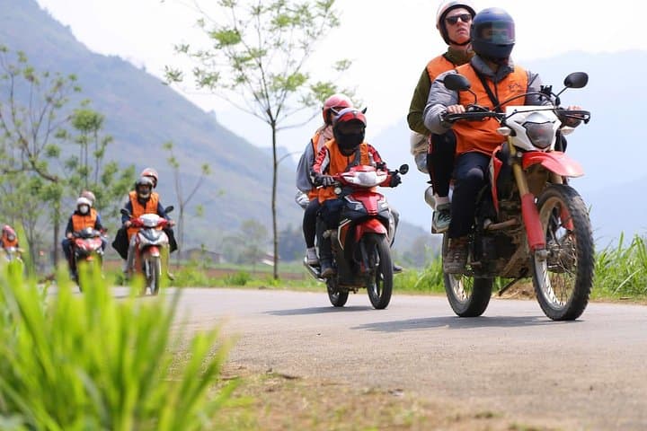
Riders peel away from Ha Giang town at dawn, engines low, and the limestone spines of the Dong Van Karst Plateau roll into view. The loop climbs through Pac Sum and Quan Ba Heaven Gate (about 1,500 m), threads Tham Ma’s nine-step ribbon and crests Ma Pi Leng—near 2,000 m—where the Nho Que River cuts the deepest valley.
Verified experiences and guided adventures in the surrounding area.
Operated by Ha Giang Peak Riders · Ha Giang, Ha Giang Province
Riders peel away from Ha Giang town at dawn, engines low, and the limestone spines of the Dong Van Karst Plateau roll into view. The loop climbs through Pac Sum and Quan Ba Heaven Gate (about 1,500 m), threads Tham Ma’s nine-step ribbon and crests Ma Pi Leng—near 2,000 m—where the Nho Que River cuts the deepest valley.
This four-day Easy Rider route follows mixed sealed and rough backroads across northern Vietnam’s geology: ancient karst plateaus, steep schist slopes and cloud-topped ridgelines. Dong Van is part of the Dong Van Karst Plateau Global Geopark, a landscape shaped by uplift and erosion over millions of years. Cultural history is immediate; Hmong, Dao and Lo Lo communities keep traditional dress, stilt-house architecture and terrace agriculture that visitors encounter in villages such as Nam Dam, Lung Tam and Du Gia.
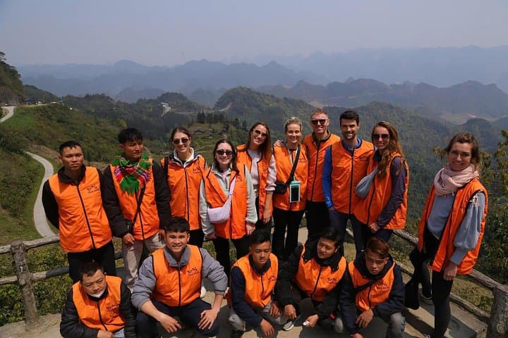
Expect long riding days and frequent photo stops—panoramas, cliffside corn drying racks, and small market towns. Guides often double as cultural interpreters and will arrange homestays and local meals; many nights are spent in simple guesthouses or family homes.
Practical essentials: plan for altitude swings and rapidly changing weather—pack a windproof layer, waterproofs, sturdy shoes and a small medical kit. Hydrate, secure luggage on the bike, and carry cash for remote facilities. Morning light is best for Ma Pi Leng and Pac Sum photos; avoid tight schedules and allow extra time for unpaved stretches. Respect local customs, travel with a guide, and leave no trace on fragile karst slopes. Stay flexible and curious.
moderate.
4 days.
Moderate: passengers need stamina for several long riding days and brief hill walks at viewpoints; not strenuous but expect altitude and early starts.
No—this Easy Rider product provides experienced riders to drive; travelers typically ride as passengers unless a private arrangement is made.
Accommodations mix simple guesthouses, traditional homestays and basic hotels in towns like Yen Minh, Dong Van and Meo Vac; expect authentic, modest facilities.
Not recommended for pregnant travelers or infants due to long rides and rough roads; children should be able to tolerate extended sitting and altitude changes.
Bring a basic first-aid kit, any prescription medicines, and travel insurance that covers evacuation; mobile signal is intermittent on remote stretches.
The Dong Van Karst Plateau is a UNESCO Global Geopark and the region has long been home to Hmong, Dao and Lo Lo ethnic groups whose traditions and stilt houses remain visible along the loop.
The karst landscape is fragile; stick to trails, avoid removing plants or stones, and support local homestays to keep economic benefits in villages.
Ha Giang Peak Riders operates guided outdoor trips and adventures with an emphasis on safety, stewardship, and memorable experiences.

Riders peel away from Ha Giang town at dawn, engines low, and the limestone spines of the Dong Van Karst Plateau roll into view. The loop climbs through Pac Sum and Quan Ba Heaven Gate (about 1,500 m), threads Tham Ma’s nine-step ribbon and crests Ma Pi Leng—near 2,000 m—where the Nho Que River cuts the deepest valley.
Riders peel away from Ha Giang town at dawn, engines low, and the limestone spines of the Dong Van Karst Plateau roll into view. The loop climbs through Pac Sum and Quan Ba Heaven Gate (about 1,500 m), threads Tham Ma’s nine-step ribbon and crests Ma Pi Leng—near 2,000 m—where the Nho Que River cuts the deepest valley.
This four-day Easy Rider route follows mixed sealed and rough backroads across northern Vietnam’s geology: ancient karst plateaus, steep schist slopes and cloud-topped ridgelines. Dong Van is part of the Dong Van Karst Plateau Global Geopark, a landscape shaped by uplift and erosion over millions of years. Cultural history is immediate; Hmong, Dao and Lo Lo communities keep traditional dress, stilt-house architecture and terrace agriculture that visitors encounter in villages such as Nam Dam, Lung Tam and Du Gia.
Expect long riding days and frequent photo stops—panoramas, cliffside corn drying racks, and small market towns. Guides often double as cultural interpreters and will arrange homestays and local meals; many nights are spent in simple guesthouses or family homes.
Practical essentials: plan for altitude swings and rapidly changing weather—pack a windproof layer, waterproofs, sturdy shoes and a small medical kit. Hydrate, secure luggage on the bike, and carry cash for remote facilities. Morning light is best for Ma Pi Leng and Pac Sum photos; avoid tight schedules and allow extra time for unpaved stretches. Respect local customs, travel with a guide, and leave no trace on fragile karst slopes. Stay flexible and curious.