THE ADVENTURE COLLECTIVE® · Independent discovery and booking for outdoor travel

Ride the Ha Giang Loop over four days to encounter Vietnam’s raw karst highlands, steep passes and living ethnic cultures. This route blends dramatic viewpoints like Ma Pi Leng with homestays, markets and the Lung Cu flag tower.
Ride the Ha Giang Loop over four days to encounter Vietnam’s raw karst highlands, steep passes and living ethnic cultures. This route blends dramatic viewpoints like Ma Pi Leng with homestays, markets and the Lung Cu flag tower.
You pull away from MaiSon Tea House as dawn lifts off rice terraces and the road tightens into ribs of limestone and shale. Wind and dust play at your visor; villages appear like low clusters of tile roofs, Dao and Hmong women bent over hemp looms, children waving from stone walls. Over four days the loop climbs and drops across the Dong Van Karst Plateau, threading Ma Pi Leng Pass, skirting the Nho Que River canyon and ending beneath the Lung Cu flag tower at Vietnam’s northern edge.
Verified experiences and guided adventures in the surrounding area.
Operated by Ha Giang Loop Tour Guide · Ha Giang, Ha Giang Province
You pull away from MaiSon Tea House as dawn lifts off rice terraces and the road tightens into ribs of limestone and shale. Wind and dust play at your visor; villages appear like low clusters of tile roofs, Dao and Hmong women bent over hemp looms, children waving from stone walls. Over four days the loop climbs and drops across the Dong Van Karst Plateau, threading Ma Pi Leng Pass, skirting the Nho Que River canyon and ending beneath the Lung Cu flag tower at Vietnam’s northern edge.
The landscape is geological history laid bare: folded Ordovician–Devonian limestones sculpted into sharp pinnacles and wide, fluted valleys that became part of the UNESCO-recognized Dong Van Karst Plateau Geopark. Culture is equally prominent — the Vuong royal palace at Sa Phin recalls early 20th-century local power, while markets and homestays preserve Tay, Hmong and Red Dao traditions and hemp-weaving techniques.
Expect a mix of paved switchbacks and rough shoulder sections, daily riding of roughly 80–150 km and variable elevations often around 1,000–1,500 m. Stops include viewpoint overlooks, Lung Khuy Cave, Ma Pi Leng, Du Gia waterfall, and market towns; homestays provide home-cooked meals and a chance to learn local customs.
Practical notes: carry local cash, a reliable rain shell, and a layered base for rapid temperature change. Road surfaces can be narrow and occasionally gravelly — defensive riding and a host-guide are advised. Leave no trace, move respectfully through villages, and plan daylight hours for the most scenic stretches.
moderate.
4 days (approx. 300 km total; daily rides 80–150 km).
Good baseline fitness for long days on a motorbike and short hikes to viewpoints; comfortable for travelers who can mount/dismount bikes several times per day.
Yes — basic motorbike handling and confidence on twisty, narrow mountain roads are strongly recommended; many tours offer easy-rider options with guides who handle the bike.
Homestays are simple but welcoming, offering private or shared rooms, local meals and the chance to experience ethnic hospitality; expect basic amenities and communal bathrooms in some villages.
Bring enough Vietnamese dong for meals, market purchases, tips and small fees — ATMs are limited outside Ha Giang and Dong Van, so plan for several days of expenses in cash.
Elevations on the loop commonly range from about 800–1,500 m; temperatures can swing 10–20°C between day and night, and weather can change rapidly at higher passes.
The Dong Van area was home to powerful local families like the Vuong dynasty; the region’s strategic border location has shaped a unique mix of ethnic cultures and architecture.
The karst plateau is ecologically sensitive; stick to marked paths, avoid disturbing farmland, and reduce single-use plastics to limit local impacts.
Ha Giang Loop Tour Guide operates guided outdoor trips and adventures with an emphasis on safety, stewardship, and memorable experiences.
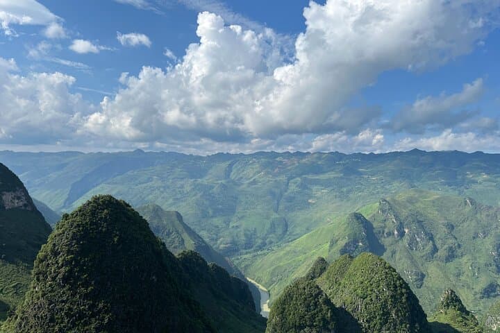

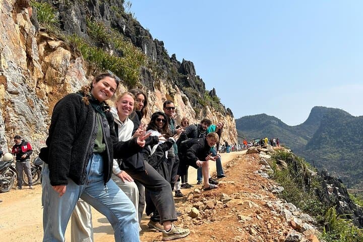
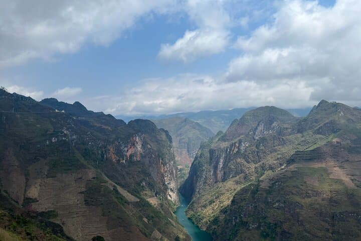
You pull away from MaiSon Tea House as dawn lifts off rice terraces and the road tightens into ribs of limestone and shale. Wind and dust play at your visor; villages appear like low clusters of tile roofs, Dao and Hmong women bent over hemp looms, children waving from stone walls. Over four days the loop climbs and drops across the Dong Van Karst Plateau, threading Ma Pi Leng Pass, skirting the Nho Que River canyon and ending beneath the Lung Cu flag tower at Vietnam’s northern edge.
You pull away from MaiSon Tea House as dawn lifts off rice terraces and the road tightens into ribs of limestone and shale. Wind and dust play at your visor; villages appear like low clusters of tile roofs, Dao and Hmong women bent over hemp looms, children waving from stone walls. Over four days the loop climbs and drops across the Dong Van Karst Plateau, threading Ma Pi Leng Pass, skirting the Nho Que River canyon and ending beneath the Lung Cu flag tower at Vietnam’s northern edge.
The landscape is geological history laid bare: folded Ordovician–Devonian limestones sculpted into sharp pinnacles and wide, fluted valleys that became part of the UNESCO-recognized Dong Van Karst Plateau Geopark. Culture is equally prominent — the Vuong royal palace at Sa Phin recalls early 20th-century local power, while markets and homestays preserve Tay, Hmong and Red Dao traditions and hemp-weaving techniques.
Expect a mix of paved switchbacks and rough shoulder sections, daily riding of roughly 80–150 km and variable elevations often around 1,000–1,500 m. Stops include viewpoint overlooks, Lung Khuy Cave, Ma Pi Leng, Du Gia waterfall, and market towns; homestays provide home-cooked meals and a chance to learn local customs.
Practical notes: carry local cash, a reliable rain shell, and a layered base for rapid temperature change. Road surfaces can be narrow and occasionally gravelly — defensive riding and a host-guide are advised. Leave no trace, move respectfully through villages, and plan daylight hours for the most scenic stretches.