THE ADVENTURE COLLECTIVE® · Independent discovery and booking for outdoor travel

Ride the Ha Giang Loop across the Dong Van karst plateau, Ma Pi Leng Pass and ethnic minority villages over four days. Expect dramatic mountain roads, homestays, frontier-area permits and big photographic payoffs.
Ride the Ha Giang Loop across the Dong Van karst plateau, Ma Pi Leng Pass and ethnic minority villages over four days. Expect dramatic mountain roads, homestays, frontier-area permits and big photographic payoffs.
You wake before dawn on a sleeper bus and step out into a thin, high-air morning where mountains cut the horizon into jagged teeth.
Verified experiences and guided adventures in the surrounding area.
Operated by AMAZING VIET NAM · Ha Giang, Ha Giang Province
You wake before dawn on a sleeper bus and step out into a thin, high-air morning where mountains cut the horizon into jagged teeth.
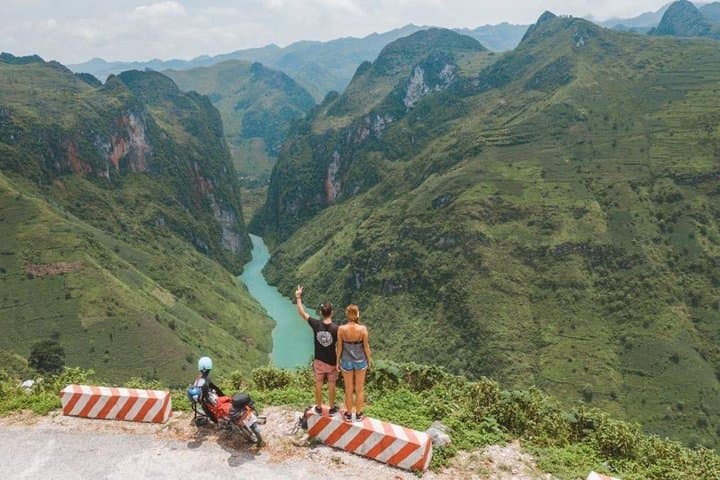
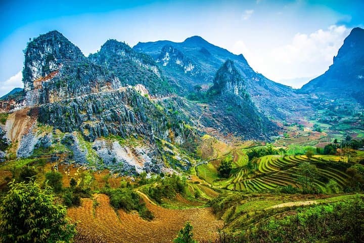
The Ha Giang Loop is not a leisurely coastal drive — it’s a compressed taste of northern Vietnam’s karst plateau, cliff-edged passes and mosaic of terrace fields. Over four days you'll track the ribbon of road from Ha Giang town through Quản Bạ, Yen Minh, Dong Van and the Ma Pi Leng Pass, watching light shift across limestone towers that were once seabed and are now carved by tectonic lift.
This region is shaped by geology and people: Dong Van’s stone plateau is a UNESCO-recognized karst landscape, and the area is home to H’Mong, Dao and LoLo communities whose markets, textiles and hemp-weaving traditions remain central to daily life. The “Palace of the H’Mong King” in Sa Phin and the flag-topped Lung Cu marker are local highlights.
Practicalities dominate too. The trip relies on long road stints and narrow passes — expect days of riding or sitting on a motorbike with frequent photo and village stops. Permits and frontier-area fees are standard; guides handle logistics but dress in layers for large temperature swings, carry at least 1.5–2L water, and bring cash for remote villages. Roads can be rough after rain; travel light, keep camera gear secure and allow time for markets and homestays. For photographers and cultural travelers this loop delivers dramatic viewpoints, intimate village encounters and a compact itinerary that balances motion with moments to step off the saddle and listen to the wind argue with the peaks.
moderate.
4 days.
Moderate — you’ll spend long periods on a motorbike but only light walking; be comfortable mounting/dismounting and doing short village hikes.
No — most group departures provide a local driver; self-riding options exist but require prior experience and confidence on mountain roads.
Yes — frontier-area permission and local entrance/security fees are typically included but carry ID and expect checkpoints in some districts.
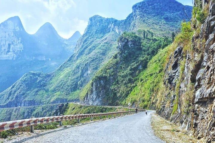
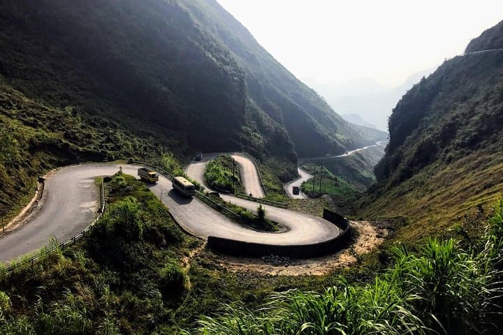
Roads vary from paved to narrow, patched mountain routes; they can be slippery after rain and have steep drop-offs, so expect cautious driving and occasional slow sections.
Elevations reach over 1,500–2,000 m on the plateau; most travelers acclimate quickly but bring warm layers and avoid strenuous exertion on arrival day.
The Dong Van Plateau formed from marine limestone uplifted by tectonic forces; local H’Mong and Dao communities settled these high valleys centuries ago, maintaining distinct dress and craft traditions.
The karst plateau is sensitive to erosion and overdevelopment; choose operators that limit waste, avoid single-use plastics and support homestays that respect local land use.
AMAZING VIET NAM operates guided outdoor trips and adventures with an emphasis on safety, stewardship, and memorable experiences.
You wake before dawn on a sleeper bus and step out into a thin, high-air morning where mountains cut the horizon into jagged teeth.
You wake before dawn on a sleeper bus and step out into a thin, high-air morning where mountains cut the horizon into jagged teeth.
The Ha Giang Loop is not a leisurely coastal drive — it’s a compressed taste of northern Vietnam’s karst plateau, cliff-edged passes and mosaic of terrace fields. Over four days you'll track the ribbon of road from Ha Giang town through Quản Bạ, Yen Minh, Dong Van and the Ma Pi Leng Pass, watching light shift across limestone towers that were once seabed and are now carved by tectonic lift.
This region is shaped by geology and people: Dong Van’s stone plateau is a UNESCO-recognized karst landscape, and the area is home to H’Mong, Dao and LoLo communities whose markets, textiles and hemp-weaving traditions remain central to daily life. The “Palace of the H’Mong King” in Sa Phin and the flag-topped Lung Cu marker are local highlights.
Practicalities dominate too. The trip relies on long road stints and narrow passes — expect days of riding or sitting on a motorbike with frequent photo and village stops. Permits and frontier-area fees are standard; guides handle logistics but dress in layers for large temperature swings, carry at least 1.5–2L water, and bring cash for remote villages. Roads can be rough after rain; travel light, keep camera gear secure and allow time for markets and homestays. For photographers and cultural travelers this loop delivers dramatic viewpoints, intimate village encounters and a compact itinerary that balances motion with moments to step off the saddle and listen to the wind argue with the peaks.