
Ha Giang Loop 4-Day Motorbike Adventure from Hanoi: Ma Pi Leng, Dong Van & Du Gia
Ride the Ha Giang Loop over four days to reach Ma Pi Leng’s cliffs, Dong Van’s ancient quarter, and the remote Du Gia valley. This motorbike tour blends dramatic mountain passes with village homestays and cultural stops.
An Adventure In Ha Giang.
Ride the Ha Giang Loop over four days to reach Ma Pi Leng’s cliffs, Dong Van’s ancient quarter, and the remote Du Gia valley. This motorbike tour blends dramatic mountain passes with village homestays and cultural stops.
Read the full experience
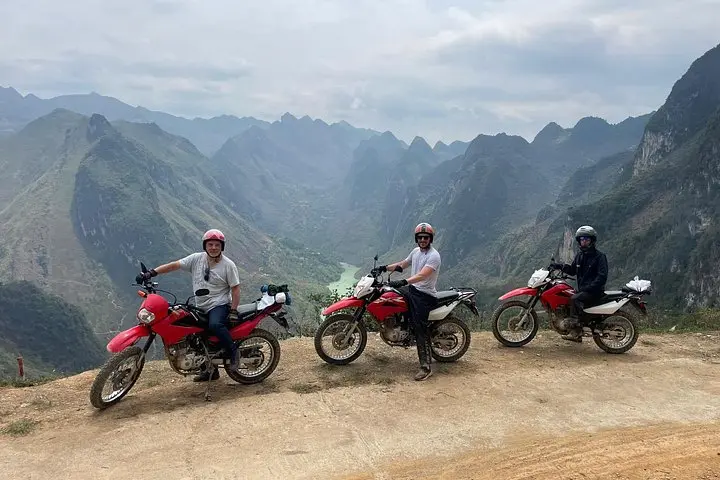
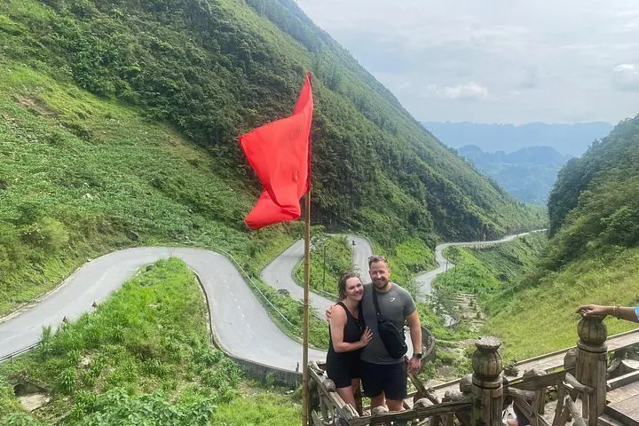
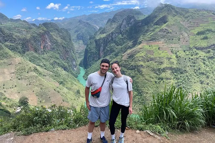
You crest a pass and the road unspools below—hairpin after hairpin, limestone ribs of the plateau opening to valleys where the river dares you to look down. Morning light catches terraces and the colorful headscarves of Hmong women; the air is thin and clear, and every bend promises a new viewpoint.
You crest a pass and the road unspools below—hairpin after hairpin, limestone ribs of the plateau opening to valleys where the river dares you to look down. Morning light catches terraces and the colorful headscarves of Hmong women; the air is thin and clear, and every bend promises a new viewpoint.
The Ha Giang Loop threads through northern Vietnam’s rugged karst highlands. The route hits Quan Ba’s Heaven Gate, climbs the old Tham Ma and Ma Pi Leng passes, and brushes the Lung Cu flag tower near the Chinese border. Geologically the region is limestone terrain carved into cliffs and deep canyons—Tu San Canyon drops sharply beside Ma Pi Leng Road. Culturally the loop is a living mosaic: Hmong, Dao, Tay and Lo Lo communities maintain weaving, silverwork and hill-slope rice farming; homestays are the primary accommodation and a direct way to support local economies.
Practical guide: the full loop is roughly 250–350 km depending on side trips, with daily riding of 4–8 hours across roads that vary from smooth asphalt to rough, steep switchbacks. Expect elevations up to ~1,500–1,700 m and rapidly changing weather—dry, cool mornings can turn to sudden rain. Ride conservatively on wet or gravel sections, keep fuel topped up in small towns, and carry a basic repair kit. Best times are the dry months (October–April) for clearer roads and views; summer monsoon brings landslides and washouts.
Stay hydrated, layer for temperature swings, respect local customs when visiting villages, and leave only footprints—these mountain roads reward patience and attention with some of Vietnam’s most dramatic scenery.
Frequently asked questions
Yes—participants should have prior motorbike experience and confidence on twisty mountain roads; each rider is paired with a local easy rider but basic control and stamina are expected.
This itinerary lists private rooms at homestays or local guesthouses; expect simple, clean rooms with shared bathroom facilities in some villages.
Daily legs range from moderate to long (4–8 hours) with steep climbs and many switchbacks; physical fitness and ability to sit/stand on a bike for extended periods help.
Yes—this tour advertises free bus transfer from Hanoi to Ha Giang as part of the package; confirm pickup point and timing when booking.
About This Experience
Ha Giang Motorbike Tour operates guided outdoor trips and adventures with an emphasis on safety, stewardship, and memorable experiences.
Adventure tips
Recommended gear
- Full-face or modular helmet: Protects against wind, debris and provides better warmth at altitude.
- Waterproof riding jacket and pants: Keeps you dry during sudden monsoon showers common in summer.
- Layered midweight clothing: Mornings are cool at elevation; layers let you adapt to temperature swings.
- Small repair kit & spare tube: Useful for punctures and minor roadside fixes where services are limited.
Photos of the experience

Related adventures & guides
Read the full experience
You crest a pass and the road unspools below—hairpin after hairpin, limestone ribs of the plateau opening to valleys where the river dares you to look down. Morning light catches terraces and the colorful headscarves of Hmong women; the air is thin and clear, and every bend promises a new viewpoint.
You crest a pass and the road unspools below—hairpin after hairpin, limestone ribs of the plateau opening to valleys where the river dares you to look down. Morning light catches terraces and the colorful headscarves of Hmong women; the air is thin and clear, and every bend promises a new viewpoint.
The Ha Giang Loop threads through northern Vietnam’s rugged karst highlands. The route hits Quan Ba’s Heaven Gate, climbs the old Tham Ma and Ma Pi Leng passes, and brushes the Lung Cu flag tower near the Chinese border. Geologically the region is limestone terrain carved into cliffs and deep canyons—Tu San Canyon drops sharply beside Ma Pi Leng Road. Culturally the loop is a living mosaic: Hmong, Dao, Tay and Lo Lo communities maintain weaving, silverwork and hill-slope rice farming; homestays are the primary accommodation and a direct way to support local economies.
Practical guide: the full loop is roughly 250–350 km depending on side trips, with daily riding of 4–8 hours across roads that vary from smooth asphalt to rough, steep switchbacks. Expect elevations up to ~1,500–1,700 m and rapidly changing weather—dry, cool mornings can turn to sudden rain. Ride conservatively on wet or gravel sections, keep fuel topped up in small towns, and carry a basic repair kit. Best times are the dry months (October–April) for clearer roads and views; summer monsoon brings landslides and washouts.
Stay hydrated, layer for temperature swings, respect local customs when visiting villages, and leave only footprints—these mountain roads reward patience and attention with some of Vietnam’s most dramatic scenery.
Make a day of it nearby.
Verified experiences and guided adventures in the surrounding area.