THE ADVENTURE COLLECTIVE® · Independent discovery and booking for outdoor travel

Drive the Ha Giang Loop counter-clockwise over four days for dramatic passes, limestone plateaus, cave walks and homestays with Dao and Hmong families. Expect rough roads, steep viewpoints and immersive northern Vietnamese culture.
Drive the Ha Giang Loop counter-clockwise over four days for dramatic passes, limestone plateaus, cave walks and homestays with Dao and Hmong families. Expect rough roads, steep viewpoints and immersive northern Vietnamese culture.
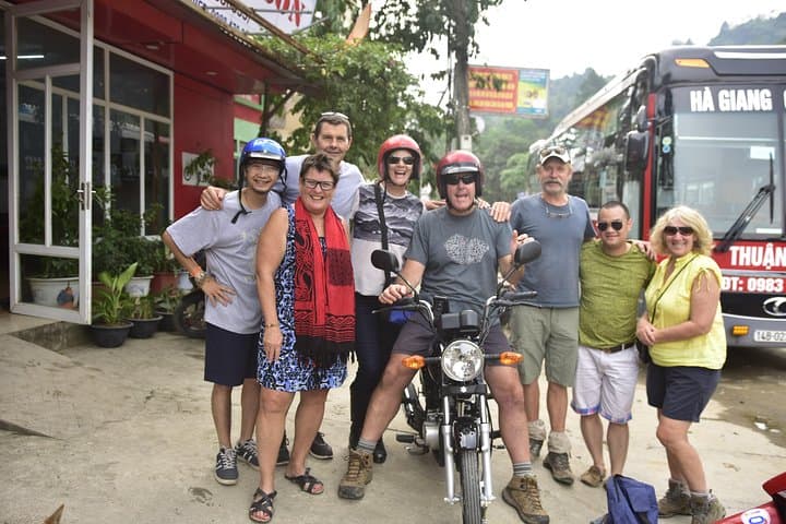
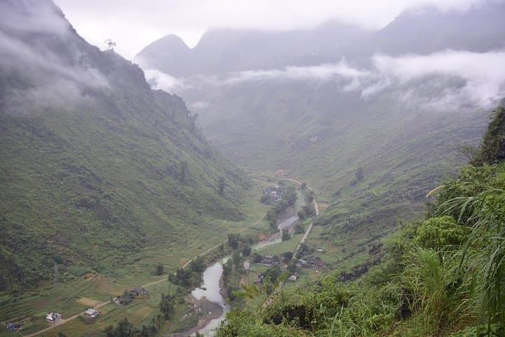
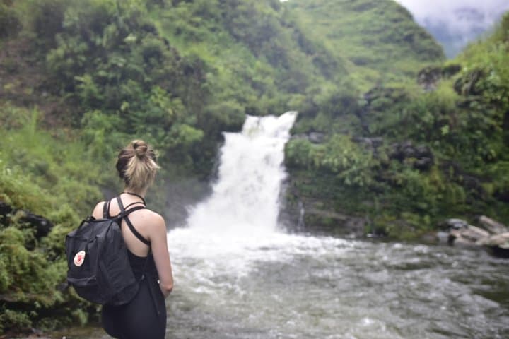
A narrow road peels away from Ha Giang City and climbs into a quilt of folded limestone ridges and cultivated terraces. Wind scours the exposed passes, and the river valleys below glint like a dare; villages perch on slopes, smoke from kitchen fires drifting across cornfields. Over four days you’ll move through that landscape by car and on foot—stopping for a cave, a cold plunge beneath a waterfall, and nights in family-run homestays.
Verified experiences and guided adventures in the surrounding area.
Operated by Duc Nguyen · Ha Giang, Ha Giang
A narrow road peels away from Ha Giang City and climbs into a quilt of folded limestone ridges and cultivated terraces. Wind scours the exposed passes, and the river valleys below glint like a dare; villages perch on slopes, smoke from kitchen fires drifting across cornfields. Over four days you’ll move through that landscape by car and on foot—stopping for a cave, a cold plunge beneath a waterfall, and nights in family-run homestays.
This route threads the Dong Van Karst Plateau, part of a UNESCO Global Geopark defined by weathered limestone towers and steep gorges carved over millennia. The Lung Cu flag tower marks Vietnam’s northernmost border; nearby Hmong and Dao communities preserve distinct dress, markets, and rice-wine hospitality. Ma Pi Leng Pass slices through cliffs—expect hairpin turns and dramatic viewpoints that have shaped travel and trade in these highlands for generations.
Practically, the loop is a mix of paved and rough provincial road; drivers experienced with mountain roads are essential. Day hikes—such as the approach to Lung Khuy Cave—are short but can be steep and slippery after rain. Homestays offer simple meals (local pho, rice dishes, and fresh fruit shakes) and a chance to learn about weaving and local markets like Lung Tam.
Bring layered clothing for cold nights, sturdy shoes for gravel tracks, and a refillable water bottle; carry cash for remote stops. Start early for clearer light and calmer winds on the passes, and allow flexibility: weather or road conditions commonly change plans. The reward is raw highland scenery and direct encounters with northern Vietnam’s living culture.
moderate.
4 days.
Moderate fitness for short steep hikes and long periods in a vehicle; comfortable walking on uneven surfaces required.
This tour runs four days (approximately 96 hours) covering key points: Du Gia, Dong Van, Lung Cu, Ma Pi Leng and return to Ha Giang.
Yes with experienced local drivers; however expect narrow, winding and sometimes rough sections—drive carefully and allow extra time.
Homestays are simple and welcoming: private or shared rooms, home-cooked meals, basic facilities, and an authentic cultural experience.
No special permits are required for the loop, but ensure routine vaccinations are up to date and carry identification for border-area sites like Lung Cu.
The Dong Van plateau hosts a karst landscape shaped over millions of years and a cross-border history reflected in Lung Cu tower and local Hmong and Dao settlements.
The area is part of the Dong Van Karst Plateau Geopark—travelers should stick to trails, avoid single-use plastic, and support local homestays to keep tourism benefits local.
Duc Nguyen operates guided outdoor trips and adventures with an emphasis on safety, stewardship, and memorable experiences.

A narrow road peels away from Ha Giang City and climbs into a quilt of folded limestone ridges and cultivated terraces. Wind scours the exposed passes, and the river valleys below glint like a dare; villages perch on slopes, smoke from kitchen fires drifting across cornfields. Over four days you’ll move through that landscape by car and on foot—stopping for a cave, a cold plunge beneath a waterfall, and nights in family-run homestays.
A narrow road peels away from Ha Giang City and climbs into a quilt of folded limestone ridges and cultivated terraces. Wind scours the exposed passes, and the river valleys below glint like a dare; villages perch on slopes, smoke from kitchen fires drifting across cornfields. Over four days you’ll move through that landscape by car and on foot—stopping for a cave, a cold plunge beneath a waterfall, and nights in family-run homestays.
This route threads the Dong Van Karst Plateau, part of a UNESCO Global Geopark defined by weathered limestone towers and steep gorges carved over millennia. The Lung Cu flag tower marks Vietnam’s northernmost border; nearby Hmong and Dao communities preserve distinct dress, markets, and rice-wine hospitality. Ma Pi Leng Pass slices through cliffs—expect hairpin turns and dramatic viewpoints that have shaped travel and trade in these highlands for generations.
Practically, the loop is a mix of paved and rough provincial road; drivers experienced with mountain roads are essential. Day hikes—such as the approach to Lung Khuy Cave—are short but can be steep and slippery after rain. Homestays offer simple meals (local pho, rice dishes, and fresh fruit shakes) and a chance to learn about weaving and local markets like Lung Tam.
Bring layered clothing for cold nights, sturdy shoes for gravel tracks, and a refillable water bottle; carry cash for remote stops. Start early for clearer light and calmer winds on the passes, and allow flexibility: weather or road conditions commonly change plans. The reward is raw highland scenery and direct encounters with northern Vietnam’s living culture.