THE ADVENTURE COLLECTIVE® · Independent discovery and booking for outdoor travel

Drive narrow mountain passes, float the turquoise Nho Que river and sleep in family-run homestays on this 4-day Ha Giang Loop. Expect dramatic canyons, ethnic villages and guided easy-rider support for a safe, immersive trip.
Drive narrow mountain passes, float the turquoise Nho Que river and sleep in family-run homestays on this 4-day Ha Giang Loop. Expect dramatic canyons, ethnic villages and guided easy-rider support for a safe, immersive trip.
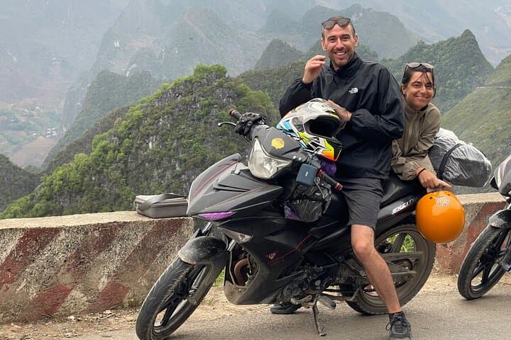
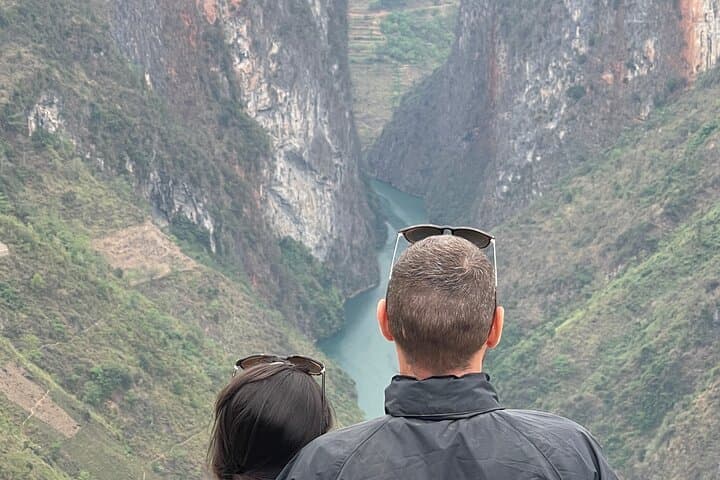
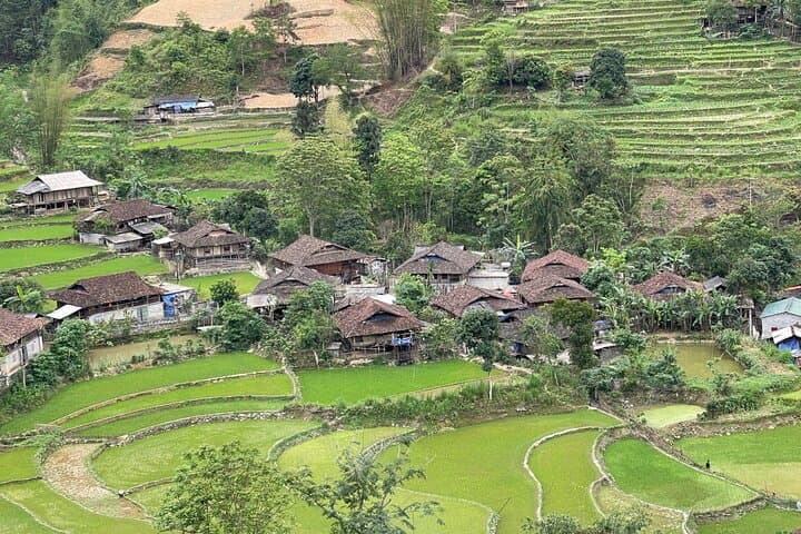
You crest a high switchback and the road falls away — a ribbon of asphalt carved into limestone, the Nho Que river glinting far below like a thin turquoise vein. Wind pushes at your jacket; distant terraces step down the mountainsides and a Hmong woman tends a small herd on a ledge. This is the Ha Giang Loop: raw northern Vietnam where roads connect remote border peaks, canyon rims and villages that keep old rhythms.
Verified experiences and guided adventures in the surrounding area.
Operated by Friendly Ha Giang loop tour · Ha Giang, Ha Giang Province
You crest a high switchback and the road falls away — a ribbon of asphalt carved into limestone, the Nho Que river glinting far below like a thin turquoise vein. Wind pushes at your jacket; distant terraces step down the mountainsides and a Hmong woman tends a small herd on a ledge. This is the Ha Giang Loop: raw northern Vietnam where roads connect remote border peaks, canyon rims and villages that keep old rhythms.
Over four days you move from Ha Giang city through Quan Ba’s Heaven Gate (about 1,700 m on clear days), past the H’Mong King’s Palace (built 1898) and up the 23 km Ma Pi Leng stretch that links Dong Van with Meo Vac. Geology here is dramatic—pocketed limestone, deep U-shaped canyons cut by the Nho Que (Tu San) river, with sections dropping 700–1,000 m. Local culture is front-and-center: Hmong, Dao and Tay communities still farm steep terraces, house styles reflect Chinese and French influences, and homestays offer a direct window into daily life.
Practically, expect long driving segments on narrow mountain roads with frequent hairpins and occasional gravel shoulders. Accommodations are simple homestays; meals focus on local rice, noodles and hotpots. Plan for sudden weather shifts—mornings can be frosty above 1,500 m, afternoons warm and sunlit. Bring layered clothing, a sturdy pair of shoes for short walks, and a sense of patience for travel pacing: the loop rewards those who slow down.
If you want views without motorbike fatigue, guided vans/"easy riders" provide both safety and local knowledge—ideal for first-time visitors to this rugged, culturally rich frontier.
moderate.
4 days (approx. 72–96 hours).
Suitable for travelers with average fitness; mostly vehicle-based with short walks and occasional stair or cliffside viewpoints.
The itinerary is vehicle-based with short walks—most travelers with average fitness find it manageable; there are some stairs and uneven surfaces at viewpoints.
Bring a valid passport for border-area entry and any required Vietnam visa documentation; passport details are collected at booking.
Yes—homestays offer private rooms with simple amenities, local meals and shared bathrooms in some places; they emphasize cultural experience over luxury.
Elevations can reach around 1,500–1,700 m; most travelers adapt fine but stay hydrated and rest if you feel lightheaded.
The route winds through regions long inhabited by Hmong, Dao and Tay people; H’Mong King’s Palace in Sa Phin (built 1898) reflects local elite history with Chinese and French architectural touches.
Tourism is growing—support local homestays, avoid single-use plastics, and stick to marked paths to limit erosion and disturbance.
Friendly Ha Giang loop tour operates guided outdoor trips and adventures with an emphasis on safety, stewardship, and memorable experiences.

You crest a high switchback and the road falls away — a ribbon of asphalt carved into limestone, the Nho Que river glinting far below like a thin turquoise vein. Wind pushes at your jacket; distant terraces step down the mountainsides and a Hmong woman tends a small herd on a ledge. This is the Ha Giang Loop: raw northern Vietnam where roads connect remote border peaks, canyon rims and villages that keep old rhythms.
You crest a high switchback and the road falls away — a ribbon of asphalt carved into limestone, the Nho Que river glinting far below like a thin turquoise vein. Wind pushes at your jacket; distant terraces step down the mountainsides and a Hmong woman tends a small herd on a ledge. This is the Ha Giang Loop: raw northern Vietnam where roads connect remote border peaks, canyon rims and villages that keep old rhythms.
Over four days you move from Ha Giang city through Quan Ba’s Heaven Gate (about 1,700 m on clear days), past the H’Mong King’s Palace (built 1898) and up the 23 km Ma Pi Leng stretch that links Dong Van with Meo Vac. Geology here is dramatic—pocketed limestone, deep U-shaped canyons cut by the Nho Que (Tu San) river, with sections dropping 700–1,000 m. Local culture is front-and-center: Hmong, Dao and Tay communities still farm steep terraces, house styles reflect Chinese and French influences, and homestays offer a direct window into daily life.
Practically, expect long driving segments on narrow mountain roads with frequent hairpins and occasional gravel shoulders. Accommodations are simple homestays; meals focus on local rice, noodles and hotpots. Plan for sudden weather shifts—mornings can be frosty above 1,500 m, afternoons warm and sunlit. Bring layered clothing, a sturdy pair of shoes for short walks, and a sense of patience for travel pacing: the loop rewards those who slow down.
If you want views without motorbike fatigue, guided vans/"easy riders" provide both safety and local knowledge—ideal for first-time visitors to this rugged, culturally rich frontier.