THE ADVENTURE COLLECTIVE® · Independent discovery and booking for outdoor travel

Drive the Ha Giang Loop over three days to see Ma Pi Leng Pass, the Nho Que River gorge and living Hmong and Dao villages. This private car tour pairs dramatic karst scenery with homestay culture and manageable walks.
Drive the Ha Giang Loop over three days to see Ma Pi Leng Pass, the Nho Que River gorge and living Hmong and Dao villages. This private car tour pairs dramatic karst scenery with homestay culture and manageable walks.
You start before dawn on Highway 4C, tires whispering on mountain asphalt as morning mist peels off limestone fingers. The road climbs and folds; the Ma Pi Leng ridge slices the sky and the Nho Que River dares you to look over the railing. Villages appear like sudden breaths of color—Hmong brocade drying on lines, Dao houses sitting low to the valley.
Verified experiences and guided adventures in the surrounding area.
Operated by SAIGONESE TREKKING HOUSE · Ha Giang, Ha Giang Province
You start before dawn on Highway 4C, tires whispering on mountain asphalt as morning mist peels off limestone fingers. The road climbs and folds; the Ma Pi Leng ridge slices the sky and the Nho Que River dares you to look over the railing. Villages appear like sudden breaths of color—Hmong brocade drying on lines, Dao houses sitting low to the valley.
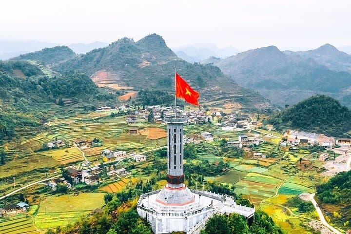
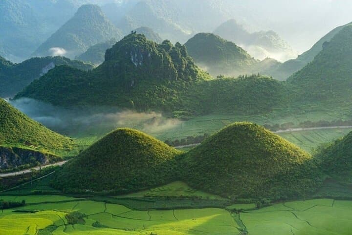
This region sits on the Dong Van Karst Plateau Geopark, a UNESCO-recognized landscape carved from ancient seabed limestones more than 400 million years old. Geological scars—dolines, limestone towers and travertine terraces—frame the human story: centuries of ethnic exchange, trade routes and the unique architecture of the Hmong Kings’ Palace and Lung Cu flag complex.
Culture is tactile here: weaving with flax in Lung Tam, oral histories told over bowls of noodle soup in homestays, and quiet ceremonial rhythms in small hamlets. The Nho Que River winds like a living line, pulling clouds and light into photographic drama.
Practical notes: this private car tour covers roughly 3 days of mixed driving and short walks; road surfaces vary from smooth asphalt to patched passes. Bring layered clothing for early mornings and sudden winds at 1,200–1,500 m elevation, sturdy shoes for village paths, and a daypack for camera gear and water. Expect basic homestay accommodation, entrance fees included, and a moderate level of mobility for short hikes and uneven village terrain. Time your visit outside the monsoon months for the clearest views.
moderate.
3 days.
Suitable for travelers with moderate fitness who can handle short hikes on uneven paths and extended time in a vehicle.
Most walks are short (15–60 minutes) over uneven village paths and viewpoints; no technical hiking is required but steady balance is helpful.
Accommodation is primarily family-run homestays and simple guesthouses—clean and local, but amenities are basic compared with city hotels.
Yes for shorter transfers, but long drives and winding mountain roads can be tiring; check mobility and consult the operator about seatbelts and frequent stops.
Autumn (September–November) and spring (March–May) offer clearer skies and cool temperatures; avoid heavy monsoon months (July–August) for safety and road conditions.
The Dong Van Karst Plateau has long been a cultural crossroads for Hmong, Dao and other ethnic groups; Dong Van Old Town served as a regional trading hub for centuries.
The geopark status protects karst formations and local biodiversity, but increasing tourism brings pressure—stick to trails, avoid single-use plastics, and support local homestays.
SAIGONESE TREKKING HOUSE operates guided outdoor trips and adventures with an emphasis on safety, stewardship, and memorable experiences.
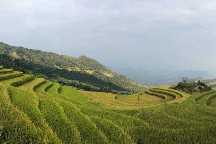
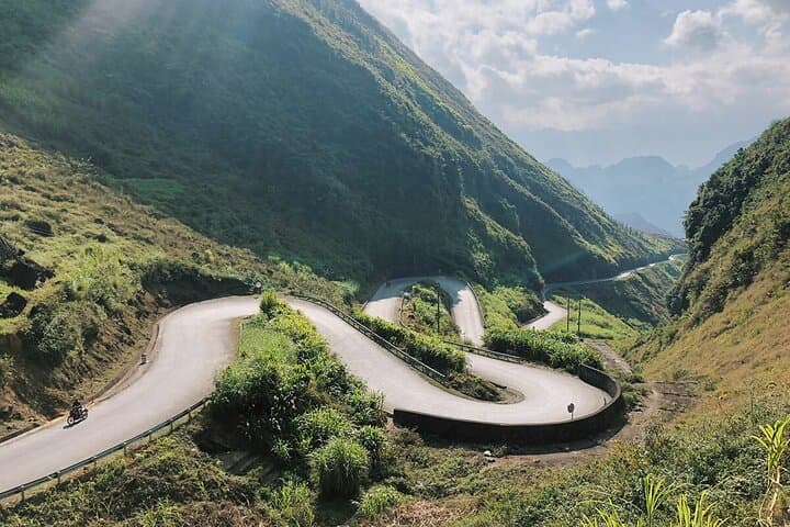
You start before dawn on Highway 4C, tires whispering on mountain asphalt as morning mist peels off limestone fingers. The road climbs and folds; the Ma Pi Leng ridge slices the sky and the Nho Que River dares you to look over the railing. Villages appear like sudden breaths of color—Hmong brocade drying on lines, Dao houses sitting low to the valley.
You start before dawn on Highway 4C, tires whispering on mountain asphalt as morning mist peels off limestone fingers. The road climbs and folds; the Ma Pi Leng ridge slices the sky and the Nho Que River dares you to look over the railing. Villages appear like sudden breaths of color—Hmong brocade drying on lines, Dao houses sitting low to the valley.
This region sits on the Dong Van Karst Plateau Geopark, a UNESCO-recognized landscape carved from ancient seabed limestones more than 400 million years old. Geological scars—dolines, limestone towers and travertine terraces—frame the human story: centuries of ethnic exchange, trade routes and the unique architecture of the Hmong Kings’ Palace and Lung Cu flag complex.
Culture is tactile here: weaving with flax in Lung Tam, oral histories told over bowls of noodle soup in homestays, and quiet ceremonial rhythms in small hamlets. The Nho Que River winds like a living line, pulling clouds and light into photographic drama.
Practical notes: this private car tour covers roughly 3 days of mixed driving and short walks; road surfaces vary from smooth asphalt to patched passes. Bring layered clothing for early mornings and sudden winds at 1,200–1,500 m elevation, sturdy shoes for village paths, and a daypack for camera gear and water. Expect basic homestay accommodation, entrance fees included, and a moderate level of mobility for short hikes and uneven village terrain. Time your visit outside the monsoon months for the clearest views.