THE ADVENTURE COLLECTIVE® · Independent discovery and booking for outdoor travel

Three days on the Ha Giang Loop take you over Ma Pi Leng Pass, alongside the Nho Que River and into remote hill-tribe homestays. Expect long riding days, rough mountain roads, and authentic village hospitality.
Three days on the Ha Giang Loop take you over Ma Pi Leng Pass, alongside the Nho Que River and into remote hill-tribe homestays. Expect long riding days, rough mountain roads, and authentic village hospitality.
The engine thumps to life as the road peels away from Ha Giang city and the valley opens into a sequence of folded limestone ridges. Dust rises, wind pushes at your jacket, and every bend reveals a new viewpoint: twin peaks, a lone tree on a slope, the ribbon of the Nho Que River far below daring you toward the next pass.
Verified experiences and guided adventures in the surrounding area.
Operated by Authentic HA GIANG · Ha Giang, Ha Giang Province
The engine thumps to life as the road peels away from Ha Giang city and the valley opens into a sequence of folded limestone ridges. Dust rises, wind pushes at your jacket, and every bend reveals a new viewpoint: twin peaks, a lone tree on a slope, the ribbon of the Nho Que River far below daring you toward the next pass.
This three-day loop traces routes used for generations by Hmong, Tay and Dao communities, a borderland long shaped by cross-border trade and subsistence agriculture. Geologically the region is rugged karst and stepped limestone, carved by rivers into deep canyons—Ma Pi Leng is a standout, a narrow spine of road perched above one of Southeast Asia’s deepest river canyons.
Culture threads through the trip: homestays in Du Gia and Dong Van offer Tay and Hmong hospitality and local dishes like corn wine and mountain greens. You’ll pass weaving villages where traditional looms still produce indigo textiles and terraces that mark centuries of upland farming.
Practical guidance: the route mixes paved and rough mountain roads; riders should be comfortable with long hours and tight switchbacks. Expect full days of riding with frequent short stops for photos and river boat options on the Nho Que. Bring layered clothing for morning chill and strong sun by afternoon, a reliable helmet, and a small toolkit if you’re self-riding. If you prefer to sit back, the tour offers a bus option with local drivers experienced on these mountain roads.
Plan for variable weather, limited cell service in sections, and evenings spent in simple homestays—this is about landscape, local life, and the steady rhythm of the Ha Giang loop.
moderate.
3 days.
Moderate endurance for several long riding days; able to mount/dismount a motorbike and walk short village trails.
If you book the motorbike option you should be comfortable riding on steep, winding mountain roads; a bus option is available for passengers who prefer not to ride.
Accommodations are local homestays or simple guesthouses—clean and basic, focused on authentic village hospitality rather than luxury.
The roads can be narrow and challenging; novice riders should opt for a slower pace, choose the bus option, or ride with an experienced local guide (easy rider).
Cell coverage is intermittent in remote sections, so download maps offline and notify your operator of special needs in advance.
Ha Giang is home to multiple ethnic minorities and historically sat along cross-border trade routes; the loop connects markets, weaving villages and ancestral lands.
The karst and terrace landscapes are ecologically fragile—stick to trails, avoid single-use plastics, and support local homestays to keep tourism benefits in the community.
Authentic HA GIANG operates guided outdoor trips and adventures with an emphasis on safety, stewardship, and memorable experiences.
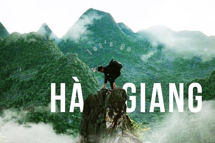


The engine thumps to life as the road peels away from Ha Giang city and the valley opens into a sequence of folded limestone ridges. Dust rises, wind pushes at your jacket, and every bend reveals a new viewpoint: twin peaks, a lone tree on a slope, the ribbon of the Nho Que River far below daring you toward the next pass.
The engine thumps to life as the road peels away from Ha Giang city and the valley opens into a sequence of folded limestone ridges. Dust rises, wind pushes at your jacket, and every bend reveals a new viewpoint: twin peaks, a lone tree on a slope, the ribbon of the Nho Que River far below daring you toward the next pass.
This three-day loop traces routes used for generations by Hmong, Tay and Dao communities, a borderland long shaped by cross-border trade and subsistence agriculture. Geologically the region is rugged karst and stepped limestone, carved by rivers into deep canyons—Ma Pi Leng is a standout, a narrow spine of road perched above one of Southeast Asia’s deepest river canyons.
Culture threads through the trip: homestays in Du Gia and Dong Van offer Tay and Hmong hospitality and local dishes like corn wine and mountain greens. You’ll pass weaving villages where traditional looms still produce indigo textiles and terraces that mark centuries of upland farming.
Practical guidance: the route mixes paved and rough mountain roads; riders should be comfortable with long hours and tight switchbacks. Expect full days of riding with frequent short stops for photos and river boat options on the Nho Que. Bring layered clothing for morning chill and strong sun by afternoon, a reliable helmet, and a small toolkit if you’re self-riding. If you prefer to sit back, the tour offers a bus option with local drivers experienced on these mountain roads.
Plan for variable weather, limited cell service in sections, and evenings spent in simple homestays—this is about landscape, local life, and the steady rhythm of the Ha Giang loop.