THE ADVENTURE COLLECTIVE® · Independent discovery and booking for outdoor travel

Ride narrow mountain roads, cross the Dong Van Karst Plateau, and descend to the Nho Que River on this three-day motorbike loop from Sapa. Expect dramatic passes, ethnic highland villages, and long riding days—pack layers and plan for changing weather.
Ride narrow mountain roads, cross the Dong Van Karst Plateau, and descend to the Nho Que River on this three-day motorbike loop from Sapa. Expect dramatic passes, ethnic highland villages, and long riding days—pack layers and plan for changing weather.
The road unfurls like a ribbon of slate and dust as the sleeping bus drops you into Ha Giang’s cool morning—mountains crowding the horizon, wind already testing your layers. On this three-day loop you ride carved switchbacks, feel the pass incline beneath you and watch the Nho Que River dare the canyon to hold it back.
Verified experiences and guided adventures in the surrounding area.
Operated by Local Tours ASIA · Ha Giang, Ha Giang Province
The road unfurls like a ribbon of slate and dust as the sleeping bus drops you into Ha Giang’s cool morning—mountains crowding the horizon, wind already testing your layers. On this three-day loop you ride carved switchbacks, feel the pass incline beneath you and watch the Nho Que River dare the canyon to hold it back.
The journey threads through the Dong Van Karst Plateau Geopark (2,356 km²), where weathered limestone towers and plateaus record millennia of tectonic strain. Towns and markets are cultural crossroads for Hmong, Dao and Tay communities; century-old stone houses in Lung Cam and cliffside villages echo a patchwork of upland traditions. Ma Pi Leng rises toward 2,000 m—its road hewn into the mountain offers panoramas that make the long curves worth every careful lean.
Expect mostly paved but narrow, uneven roads with steep drop-offs, long riding stretches (the full loop approaches 300–350 km depending on side trips) and several multi-hour transfer legs—Sapa to Ha Giang by bus is roughly a 6-hour drive.
Practical edge: pack layered, windproof clothing, carry cash, and bring rain protection—weather shifts fast at altitude. If you ride yourself, basic motorbike control and confidence on tight hairpins are essential; otherwise hire an experienced local rider. Hydrate on the road, break for village meals, and allow extra time for photo stops at Quan Ba Heaven Gate, Van Chai cliffs, and the Tu San canyon boat on the Nho Que. Leave no trace: the karst terrain is fragile and village livelihoods depend on respectful travel. With common-sense gear and a steady pace, the Ha Giang Loop delivers raw highland scenery and a real sense of travel earned through motion.
moderate.
3 days.
Suitable for travelers in average physical condition; requires stamina for full days on a motorbike and basic mobility for short hikes and village walks.
No — the tour offers options: hire a quality motorbike and ride yourself, or take an experienced local rider (Easy Rider) who drives for you.
Ma Pi Leng reaches around 2,000 m with narrow roads and steep drop-offs; exercise caution on hairpin sections and avoid risky overtaking.
Altitude is moderate (up to ~2,000 m); most travelers don’t experience severe symptoms—stay hydrated, rest if needed, and ascend gradually when possible.
Use Vietnamese dong (VND); bring cash for villages and homestays. Mobile coverage is patchy—download maps offline and carry printed addresses for pickups.
The Dong Van Karst Plateau is a geologically ancient limestone landscape inhabited for centuries by Hmong, Dao and Tay communities; stone houses and upland markets preserve much local tradition.
The fragile karst terrain and limited waste infrastructure mean travelers should minimize litter, avoid open-fire camping, and support local homestays to direct revenue to communities.
Local Tours ASIA operates guided outdoor trips and adventures with an emphasis on safety, stewardship, and memorable experiences.
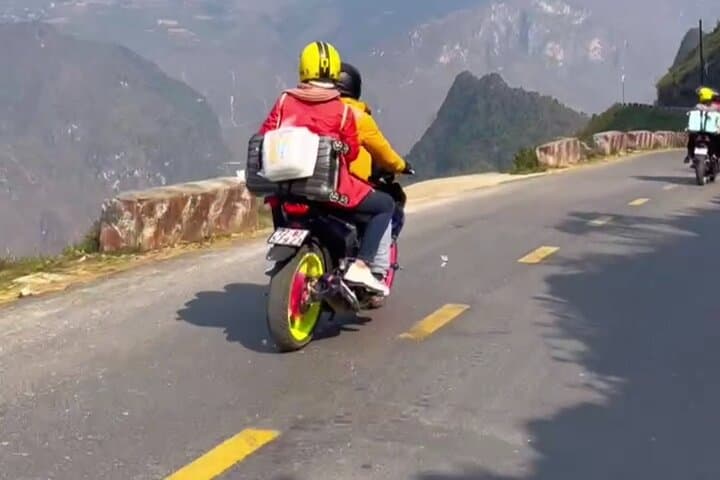
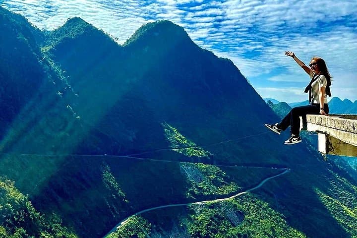
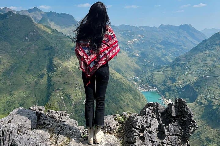
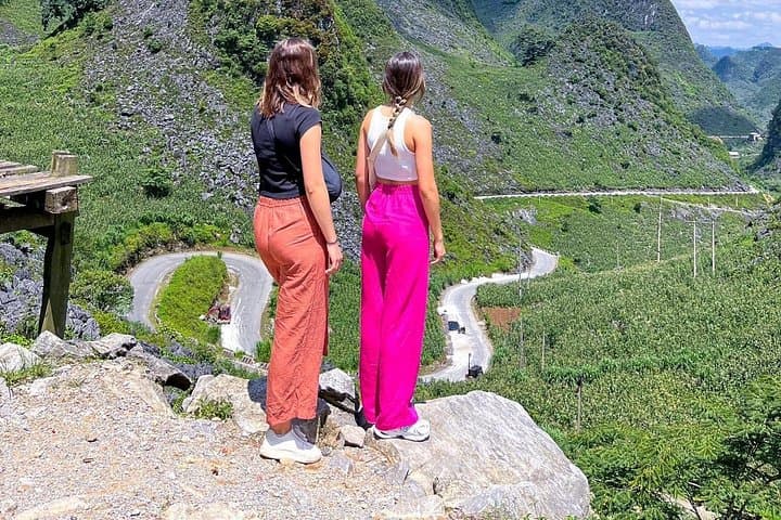
The road unfurls like a ribbon of slate and dust as the sleeping bus drops you into Ha Giang’s cool morning—mountains crowding the horizon, wind already testing your layers. On this three-day loop you ride carved switchbacks, feel the pass incline beneath you and watch the Nho Que River dare the canyon to hold it back.
The road unfurls like a ribbon of slate and dust as the sleeping bus drops you into Ha Giang’s cool morning—mountains crowding the horizon, wind already testing your layers. On this three-day loop you ride carved switchbacks, feel the pass incline beneath you and watch the Nho Que River dare the canyon to hold it back.
The journey threads through the Dong Van Karst Plateau Geopark (2,356 km²), where weathered limestone towers and plateaus record millennia of tectonic strain. Towns and markets are cultural crossroads for Hmong, Dao and Tay communities; century-old stone houses in Lung Cam and cliffside villages echo a patchwork of upland traditions. Ma Pi Leng rises toward 2,000 m—its road hewn into the mountain offers panoramas that make the long curves worth every careful lean.
Expect mostly paved but narrow, uneven roads with steep drop-offs, long riding stretches (the full loop approaches 300–350 km depending on side trips) and several multi-hour transfer legs—Sapa to Ha Giang by bus is roughly a 6-hour drive.
Practical edge: pack layered, windproof clothing, carry cash, and bring rain protection—weather shifts fast at altitude. If you ride yourself, basic motorbike control and confidence on tight hairpins are essential; otherwise hire an experienced local rider. Hydrate on the road, break for village meals, and allow extra time for photo stops at Quan Ba Heaven Gate, Van Chai cliffs, and the Tu San canyon boat on the Nho Que. Leave no trace: the karst terrain is fragile and village livelihoods depend on respectful travel. With common-sense gear and a steady pace, the Ha Giang Loop delivers raw highland scenery and a real sense of travel earned through motion.