THE ADVENTURE COLLECTIVE® · Independent discovery and booking for outdoor travel

Ride three days through Vietnam’s northernmost karst plateau: steep passes, ethnic villages, and the legendary Ma Pi Leng. This guided loop mixes dramatic geology with hands-on cultural encounters and simple homestays.
Ride three days through Vietnam’s northernmost karst plateau: steep passes, ethnic villages, and the legendary Ma Pi Leng. This guided loop mixes dramatic geology with hands-on cultural encounters and simple homestays.
A wind-carved ridge opens and the motorbike leans into a switchback — limestone teeth plunge into river valleys below and terraces ribbon the slopes. Over three days the Ha Giang Loop moves like a slow revelation: Bac Sum’s snake road, the sky-high Heaven Gate, Lung Cu’s flag tower looking toward China, and the dizzying sweep of Ma Pi Leng Pass where cliffs drop into the Nho Que River.
Verified experiences and guided adventures in the surrounding area.
Operated by Tiger Trail Travel · Ha Giang, Ha Giang Province
A wind-carved ridge opens and the motorbike leans into a switchback — limestone teeth plunge into river valleys below and terraces ribbon the slopes. Over three days the Ha Giang Loop moves like a slow revelation: Bac Sum’s snake road, the sky-high Heaven Gate, Lung Cu’s flag tower looking toward China, and the dizzying sweep of Ma Pi Leng Pass where cliffs drop into the Nho Que River.
This land is part of the Dong Van Karst Plateau, a UNESCO-recognized landscape shaped by millions of years of uplift and erosion. The region is also home to H’Mong, Tay, Lo Lo and other ethnic groups whose houses, markets and hemp-weaving traditions remain central to daily life. Tham Ma Road and the old H’Mong palaces recall an 18th–19th century frontier where horses and traders tested the mountains.
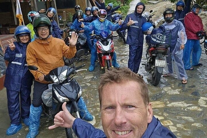
Expect gravel shoulders, steep grades and sudden weather shifts; many stretches were carved directly into rock and offer limited guardrails. Accommodations alternate between simple homestays and dorm-style hostels; meals typically highlight local rice, broths and mountain vegetables. Guides combine navigation with cultural translation — they’ll introduce weaving families, small clay-house hamlets and hidden viewpoints like Mau Due and Du Gia.
Practical notes: maintain conservative speeds on narrow passes, carry cash (small towns rarely accept cards), and plan for early starts to avoid fog and midday rain. Hydrate, layer for temperature swings, and keep a basic first-aid kit. For travelers with moderate fitness and some two-wheeler experience, the Loop delivers dramatic geology, close cultural encounters, and an unfiltered mountain road adventure.
moderate.
3 days (approx. 48–72 hours including riding and stops).
Moderate: able to sit and ride several hours a day and handle short hikes at altitude
Typical inclusions are three lunches and most dinners, three breakfasts, dorm-style or homestay accommodation (dorm bed listed), a local guide and motorcycle transport; check the operator link for exact details.
Most itineraries start in Ha Giang town and loop through Yen Minh, Dong Van and Meo Vac before returning to Ha Giang; confirm pickup point when booking.
Moderate riding experience is recommended due to winding mountain roads and variable surfaces; a guide can carry passengers if you prefer not to ride yourself.
Not recommended for travelers with spinal injuries or pregnant guests; travelers should have a moderate level of fitness and be prepared for high-altitude riding.
The Dong Van Karst Plateau records ancient marine limestone uplift; local H’Mong and other ethnic groups formed distinct cultural systems adapted to highland life over centuries.
The karst plateaus are ecologically fragile; travelers should avoid littering, stick to established paths, and support local homestays to help distribute tourism benefits.
Tiger Trail Travel operates guided outdoor trips and adventures with an emphasis on safety, stewardship, and memorable experiences.

A wind-carved ridge opens and the motorbike leans into a switchback — limestone teeth plunge into river valleys below and terraces ribbon the slopes. Over three days the Ha Giang Loop moves like a slow revelation: Bac Sum’s snake road, the sky-high Heaven Gate, Lung Cu’s flag tower looking toward China, and the dizzying sweep of Ma Pi Leng Pass where cliffs drop into the Nho Que River.
A wind-carved ridge opens and the motorbike leans into a switchback — limestone teeth plunge into river valleys below and terraces ribbon the slopes. Over three days the Ha Giang Loop moves like a slow revelation: Bac Sum’s snake road, the sky-high Heaven Gate, Lung Cu’s flag tower looking toward China, and the dizzying sweep of Ma Pi Leng Pass where cliffs drop into the Nho Que River.
This land is part of the Dong Van Karst Plateau, a UNESCO-recognized landscape shaped by millions of years of uplift and erosion. The region is also home to H’Mong, Tay, Lo Lo and other ethnic groups whose houses, markets and hemp-weaving traditions remain central to daily life. Tham Ma Road and the old H’Mong palaces recall an 18th–19th century frontier where horses and traders tested the mountains.
Expect gravel shoulders, steep grades and sudden weather shifts; many stretches were carved directly into rock and offer limited guardrails. Accommodations alternate between simple homestays and dorm-style hostels; meals typically highlight local rice, broths and mountain vegetables. Guides combine navigation with cultural translation — they’ll introduce weaving families, small clay-house hamlets and hidden viewpoints like Mau Due and Du Gia.
Practical notes: maintain conservative speeds on narrow passes, carry cash (small towns rarely accept cards), and plan for early starts to avoid fog and midday rain. Hydrate, layer for temperature swings, and keep a basic first-aid kit. For travelers with moderate fitness and some two-wheeler experience, the Loop delivers dramatic geology, close cultural encounters, and an unfiltered mountain road adventure.