THE ADVENTURE COLLECTIVE® · Independent discovery and booking for outdoor travel

Ride the dramatic Ha Giang Loop, trek the Sky Path to Ma Pi Leng, kayak the emerald Nho Que River and sleep riverside under the canyon stars. This 3-day small-group itinerary pairs cultural homestays with active outdoor time across the Dong Van Karst Plateau.
Ride the dramatic Ha Giang Loop, trek the Sky Path to Ma Pi Leng, kayak the emerald Nho Que River and sleep riverside under the canyon stars. This 3-day small-group itinerary pairs cultural homestays with active outdoor time across the Dong Van Karst Plateau.
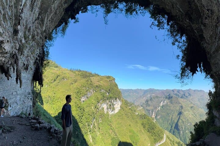
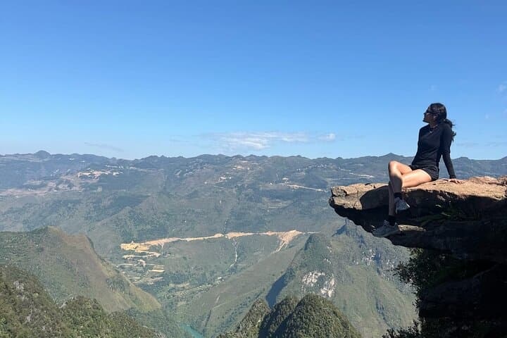
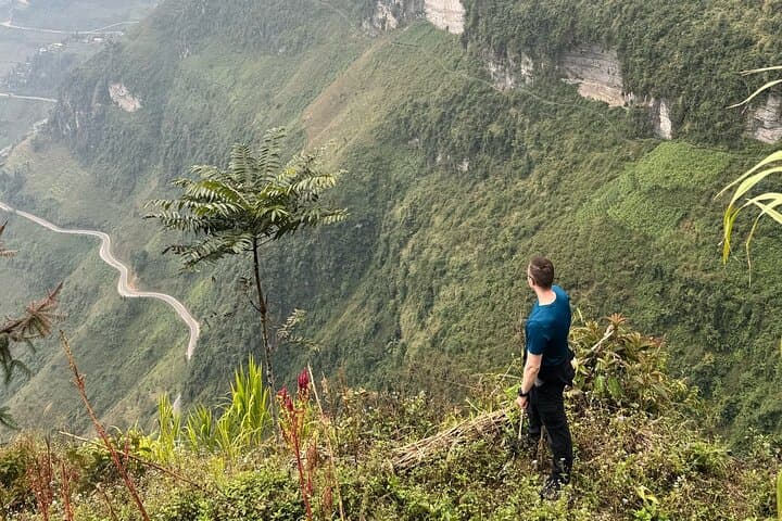
You set out before dawn on a ribbed mountain road; the bike’s hum fades and the world narrows to limestone spires and terraced fields. Clouds slide across the Dong Van Karst Plateau as you climb past Bac Sum Pass and the nine-turn switchbacks, then leave the pavement to follow a sky path that threads H'mong villages and cornfields toward Ma Pi Leng.
Verified experiences and guided adventures in the surrounding area.
Operated by Ha Giang Expeditions · Ha Giang, Ha Giang Province
You set out before dawn on a ribbed mountain road; the bike’s hum fades and the world narrows to limestone spires and terraced fields. Clouds slide across the Dong Van Karst Plateau as you climb past Bac Sum Pass and the nine-turn switchbacks, then leave the pavement to follow a sky path that threads H'mong villages and cornfields toward Ma Pi Leng.
This is a region carved by tectonic uplift and river incision — jagged karst folded into narrow canyons by the Nho Que River. The Vuong family mansion in Sa Phin reflects a late-19th/early-20th century mix of H’mong, Chinese and French influences, a reminder that these roads carry stories as old as the rocks.
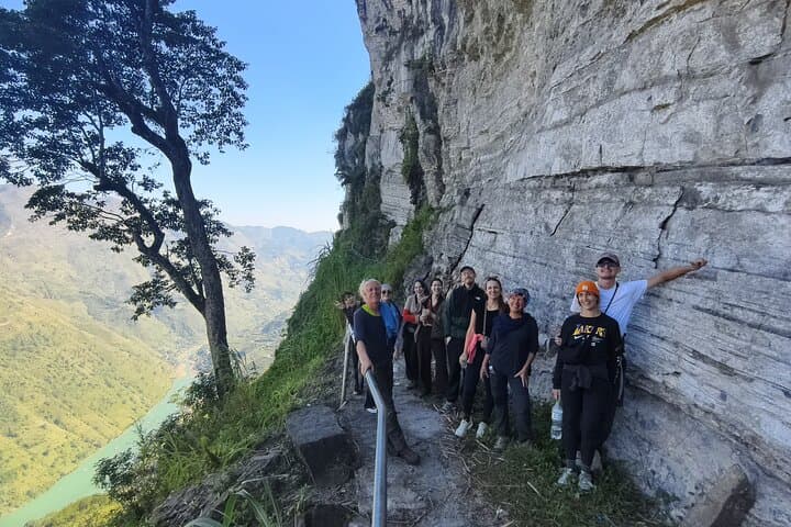
On foot you’ll cover trails of limestone dust and exposed roots; the Sky Path to White God Cliff is about 7 km with sweeping overlooks. Below, the Nho Que river moves like a patient force, daring you to paddle its emerald bends through Tu San Canyon. Nights are basic but comfortable: a riverside campfire, a local BBQ, and quiet that feels large.
Practicalities: this 3-day loop combines driven transfers, a moderate day hike, and an easy river paddle—no technical climbing required but expect uneven terrain and variable weather. Bring layered clothing, waterproofs, sturdy boots, and a small daypack for 6–8 hour outing days. Hydrate early in the day, respect community homestay customs, and allow slow travel time on narrow switchback roads. With small groups and community-focused hosts, this loop balances cultural contact with sustained outdoor time in one of northern Vietnam’s most dramatic landscapes.
moderate.
3 days.
Suitable for people who can hike 6–8 hours with elevation changes and sit in kayaks for 1–2 hours; basic endurance recommended.
The main hike is about 7 km with moderate climbs and uneven terrain; regular walkers in reasonable health should manage it with breaks.
Yes—the included kayaking section is calm and guided; paddling experience helps but instructors provide basic coaching and safety gear.
Overnight is at a riverside campsite with basic tents or homestay options nearby, communal meals, and simple facilities—comfortable but rustic.
Basic English may be limited; guides or hosts often use simple translation and gestures. Learning a few Vietnamese phrases or traveling with a guide improves communication.
The Dong Van Plateau has long been inhabited by H'mong and other hill peoples; stone mansions like Vuong’s reflect regional wealth from trading routes and historical local leadership.
The karst plateau and river canyon are sensitive to erosion and tourism pressure; stick to trails, avoid single-use plastics, and follow local guidance to minimize impact.
Ha Giang Expeditions operates guided outdoor trips and adventures with an emphasis on safety, stewardship, and memorable experiences.
You set out before dawn on a ribbed mountain road; the bike’s hum fades and the world narrows to limestone spires and terraced fields. Clouds slide across the Dong Van Karst Plateau as you climb past Bac Sum Pass and the nine-turn switchbacks, then leave the pavement to follow a sky path that threads H'mong villages and cornfields toward Ma Pi Leng.
You set out before dawn on a ribbed mountain road; the bike’s hum fades and the world narrows to limestone spires and terraced fields. Clouds slide across the Dong Van Karst Plateau as you climb past Bac Sum Pass and the nine-turn switchbacks, then leave the pavement to follow a sky path that threads H'mong villages and cornfields toward Ma Pi Leng.
This is a region carved by tectonic uplift and river incision — jagged karst folded into narrow canyons by the Nho Que River. The Vuong family mansion in Sa Phin reflects a late-19th/early-20th century mix of H’mong, Chinese and French influences, a reminder that these roads carry stories as old as the rocks.
On foot you’ll cover trails of limestone dust and exposed roots; the Sky Path to White God Cliff is about 7 km with sweeping overlooks. Below, the Nho Que river moves like a patient force, daring you to paddle its emerald bends through Tu San Canyon. Nights are basic but comfortable: a riverside campfire, a local BBQ, and quiet that feels large.
Practicalities: this 3-day loop combines driven transfers, a moderate day hike, and an easy river paddle—no technical climbing required but expect uneven terrain and variable weather. Bring layered clothing, waterproofs, sturdy boots, and a small daypack for 6–8 hour outing days. Hydrate early in the day, respect community homestay customs, and allow slow travel time on narrow switchback roads. With small groups and community-focused hosts, this loop balances cultural contact with sustained outdoor time in one of northern Vietnam’s most dramatic landscapes.