THE ADVENTURE COLLECTIVE® · Independent discovery and booking for outdoor travel

Ride the high passes and river gorges of northern Vietnam on a compact 3-day loop from Ha Giang. Expect dramatic limestone vistas, ethnic village visits, a boat trip on the Nho Que, and hands-on cultural stops in Dong Van.
Ride the high passes and river gorges of northern Vietnam on a compact 3-day loop from Ha Giang. Expect dramatic limestone vistas, ethnic village visits, a boat trip on the Nho Que, and hands-on cultural stops in Dong Van.
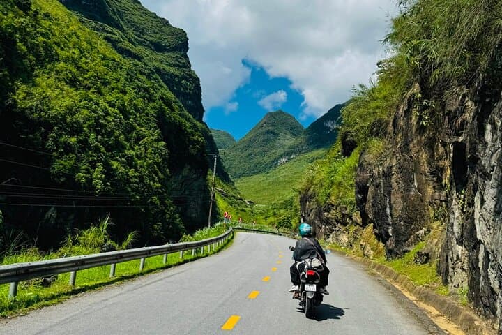
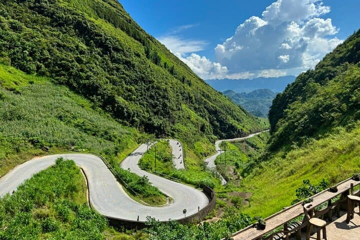
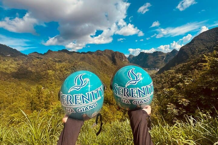
You crest a ridge and the road falls away—terraced fields and limestone spires slice into the horizon while the Nho Que River dares you to look down into its emerald ribbon far below. The Ha Giang Loop is equal parts road and revelation: hairpin climbs, wind-scoured plateaus, and villages where everyday life follows ancient rhythms.
Verified experiences and guided adventures in the surrounding area.
Operated by SERENITY HA GIANG · Dong Van, Ha Giang Province
You crest a ridge and the road falls away—terraced fields and limestone spires slice into the horizon while the Nho Que River dares you to look down into its emerald ribbon far below. The Ha Giang Loop is equal parts road and revelation: hairpin climbs, wind-scoured plateaus, and villages where everyday life follows ancient rhythms.
This three-day route threads through the Dong Van Karst Plateau, a UNESCO-recognized landscape shaped by uplifted limestone and millennia of erosion. The Lung Cu Flag Tower marks Vietnam’s northern edge, and the Quan Ba Twin Mountains—formed from folded sedimentary layers—stand like guardians to valley communities. Ethnic H’mong, Tay and Dao villages keep weaving, farming and market traditions alive; markets and homestays offer direct cultural exchange.
Expect long but attainable days: guided drives over Ma Pi Leng Pass, a short boat trip on the Nho Que, photo stops at Heaven Gate and the Lonely Tree, and visits to local weaving villages and century-old mansions. Roads vary from well-paved stretches to narrow, patched asphalt—rain and wind change conditions quickly.
Practical notes: travel light but bring windproof layers and solid footwear, carry water and cash, and allow buffer time for weather or market detours. Photography windows are best early or late in the day when light sculpts the cliffs. Respect local customs—ask before photographing people—and stay on designated paths to protect fragile karst soils.
This is a compact, immersive way to feel the geology and culture of Vietnam’s far north without sacrificing comfort or connection.
moderate.
3 days.
Moderate fitness—able to manage multi-hour travel days, short hikes, and uneven surfaces.
No—this guided tour includes vehicle transport and local drivers; riding a motorbike is optional and should only be attempted by experienced riders.
Road quality varies from paved to narrow patched asphalt; weather can switch quickly—expect wind at passes and rain in the monsoon season, which may impact driving times.
Accommodations are basic to comfortable homestays and bungalows in Dong Van and nearby villages, offering local meals and simple amenities.
Altitudes are moderate (not high-altitude mountain sickness territory), but travelers with heart or spinal issues are advised not to join; moderate fitness is required.
Ha Giang’s karst plateau has been home to H’mong, Tay and Dao peoples for centuries; Lung Cu Flag Tower symbolizes national history at Vietnam’s northern edge.
The karst landscape is fragile—stay on roads and trails, avoid single-use plastics, and support local homestays to benefit community-based conservation.
SERENITY HA GIANG operates guided outdoor trips and adventures with an emphasis on safety, stewardship, and memorable experiences.

You crest a ridge and the road falls away—terraced fields and limestone spires slice into the horizon while the Nho Que River dares you to look down into its emerald ribbon far below. The Ha Giang Loop is equal parts road and revelation: hairpin climbs, wind-scoured plateaus, and villages where everyday life follows ancient rhythms.
You crest a ridge and the road falls away—terraced fields and limestone spires slice into the horizon while the Nho Que River dares you to look down into its emerald ribbon far below. The Ha Giang Loop is equal parts road and revelation: hairpin climbs, wind-scoured plateaus, and villages where everyday life follows ancient rhythms.
This three-day route threads through the Dong Van Karst Plateau, a UNESCO-recognized landscape shaped by uplifted limestone and millennia of erosion. The Lung Cu Flag Tower marks Vietnam’s northern edge, and the Quan Ba Twin Mountains—formed from folded sedimentary layers—stand like guardians to valley communities. Ethnic H’mong, Tay and Dao villages keep weaving, farming and market traditions alive; markets and homestays offer direct cultural exchange.
Expect long but attainable days: guided drives over Ma Pi Leng Pass, a short boat trip on the Nho Que, photo stops at Heaven Gate and the Lonely Tree, and visits to local weaving villages and century-old mansions. Roads vary from well-paved stretches to narrow, patched asphalt—rain and wind change conditions quickly.
Practical notes: travel light but bring windproof layers and solid footwear, carry water and cash, and allow buffer time for weather or market detours. Photography windows are best early or late in the day when light sculpts the cliffs. Respect local customs—ask before photographing people—and stay on designated paths to protect fragile karst soils.
This is a compact, immersive way to feel the geology and culture of Vietnam’s far north without sacrificing comfort or connection.