THE ADVENTURE COLLECTIVE® · Independent discovery and booking for outdoor travel

Two days of mountain road, karst plateaus and hill-tribe culture: the Ha Giang Loop’s highlights are compacted into a private tour that reaches Ma Pi Leng and Dong Van. Expect high passes, narrow switchbacks, and intimate village visits with a local driver-guide.
Two days of mountain road, karst plateaus and hill-tribe culture: the Ha Giang Loop’s highlights are compacted into a private tour that reaches Ma Pi Leng and Dong Van. Expect high passes, narrow switchbacks, and intimate village visits with a local driver-guide.
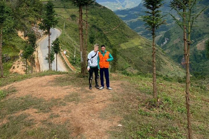
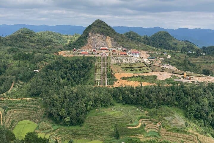
A low sun slides across limestone spires as the convoy peels out of Ha Giang city, engines rising and falling with each hairpin. The first day climbs through rice terraces and farm tracks toward Yen Minh, where terraces and karst towers push up from the valley floor like weathered teeth. Riders and passengers trade windows for open air—wind pressing at the face while villages unspool beneath.
Verified experiences and guided adventures in the surrounding area.
Operated by Authentic Hanoi Homestay & Travel · Ha Giang, Ha Giang Province
A low sun slides across limestone spires as the convoy peels out of Ha Giang city, engines rising and falling with each hairpin. The first day climbs through rice terraces and farm tracks toward Yen Minh, where terraces and karst towers push up from the valley floor like weathered teeth. Riders and passengers trade windows for open air—wind pressing at the face while villages unspool beneath.
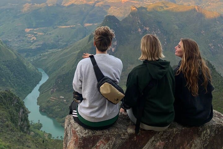
This compact two-day circuit takes in the Dong Van Karst Plateau, a UNESCO Global Geopark formed by uplifted Permian limestone. Cultural threads—the H’mong and other hill tribes—appear in embroidered jackets, market stalls, and stone houses such as the Vuong family “Hmong King” residence in Dong Van. Ma Pi Leng Pass, the high spine of the loop, drops precipitously to the Nho Que River, whose green ribbon dares you to look down.
Expect roughly 250–320 km of mountain roads over two days, with elevations climbing to around 1,200–1,500 m on the plateau. Roads are a mix of paved switches and rougher shoulder sections; the tour provides a motorbike with helmet or car option and a local driver-guide experienced on steep, narrow routes.
Practical notes: travel light, layer for rapid temperature shifts, and plan photography stops at dawn or late afternoon for the best light. Hydrate and carry cash—remote villages have limited card acceptance. The trip is rewarding for anyone comfortable with long days on a bike or in a car who wants a concentrated taste of Ha Giang’s geology, culture, and highland life.
moderate.
2 days (approx. 8–10 hours on the road across both days).
Moderate fitness recommended—able to handle long vehicle/bike days and short walks on uneven ground
The tour is moderate: most time is on a bike or in a car with short walks; moderate stamina helps for stepping around uneven village paths.
Options include riding with a licensed local driver (recommended) or arranging to ride your own bike if you have adequate experience—confirm at booking.
The tour includes breakfast, lunches and dinners listed, plus entrance fees for the attractions noted in the itinerary.
Mountain weather changes quickly—prepare for sun, wind, and intermittent rain; mornings are coolest and afternoons warm up considerably.
The Dong Van Karst Plateau was recognized as a UNESCO Global Geopark for its ancient limestone formations and unique karst topography, and the area has long been home to H’mong and other highland communities.
Karst landscapes are fragile; stick to roads and trails, avoid removing stones or plants, and support community-based homestays and local guides to keep tourism benefits local.
Authentic Hanoi Homestay & Travel operates guided outdoor trips and adventures with an emphasis on safety, stewardship, and memorable experiences.
A low sun slides across limestone spires as the convoy peels out of Ha Giang city, engines rising and falling with each hairpin. The first day climbs through rice terraces and farm tracks toward Yen Minh, where terraces and karst towers push up from the valley floor like weathered teeth. Riders and passengers trade windows for open air—wind pressing at the face while villages unspool beneath.
A low sun slides across limestone spires as the convoy peels out of Ha Giang city, engines rising and falling with each hairpin. The first day climbs through rice terraces and farm tracks toward Yen Minh, where terraces and karst towers push up from the valley floor like weathered teeth. Riders and passengers trade windows for open air—wind pressing at the face while villages unspool beneath.
This compact two-day circuit takes in the Dong Van Karst Plateau, a UNESCO Global Geopark formed by uplifted Permian limestone. Cultural threads—the H’mong and other hill tribes—appear in embroidered jackets, market stalls, and stone houses such as the Vuong family “Hmong King” residence in Dong Van. Ma Pi Leng Pass, the high spine of the loop, drops precipitously to the Nho Que River, whose green ribbon dares you to look down.
Expect roughly 250–320 km of mountain roads over two days, with elevations climbing to around 1,200–1,500 m on the plateau. Roads are a mix of paved switches and rougher shoulder sections; the tour provides a motorbike with helmet or car option and a local driver-guide experienced on steep, narrow routes.
Practical notes: travel light, layer for rapid temperature shifts, and plan photography stops at dawn or late afternoon for the best light. Hydrate and carry cash—remote villages have limited card acceptance. The trip is rewarding for anyone comfortable with long days on a bike or in a car who wants a concentrated taste of Ha Giang’s geology, culture, and highland life.