THE ADVENTURE COLLECTIVE® · Independent discovery and booking for outdoor travel

Drive the Ha Giang Loop in two days to reach Ma Pi Leng’s dizzying gorge, Dong Van’s high plateau, and the Lung Cu Flagpole. This small-group car tour blends long scenic drives with short cultural stops—ideal for travelers who want big views without a motorbike.
Drive the Ha Giang Loop in two days to reach Ma Pi Leng’s dizzying gorge, Dong Van’s high plateau, and the Lung Cu Flagpole. This small-group car tour blends long scenic drives with short cultural stops—ideal for travelers who want big views without a motorbike.
You step off a night sleeper and the air immediately feels different—thin, cool, edged with stone and pine. Headlights slice the valley as the minivan threads switchbacks toward the Dong Van Plateau, and the road opens to ridges that look as if someone stacked slate against the sky.
Verified experiences and guided adventures in the surrounding area.
Operated by ha giang open tour · Ha Giang, Ha Giang Province
You step off a night sleeper and the air immediately feels different—thin, cool, edged with stone and pine. Headlights slice the valley as the minivan threads switchbacks toward the Dong Van Plateau, and the road opens to ridges that look as if someone stacked slate against the sky.
The Ha Giang Loop follows a route shaped by geology and culture: ancient karst plateaus uplifted by tectonic forces, deep gorges carved by the Nho Que River and village clusters of Hmong, Dao and Lo Lo communities whose traditions remain visible in markets and architecture. Sites like the Hmong King’s Palace and Lung Cu Flagpole tell the human story; Ma Pi Leng Pass offers the geological one—sheer cliffs giving way to the green ribbon of river below.
Expect paved but narrow mountain roads, long drives (the trip includes the ~350 km sleeper from Hanoi and roughly 175 km of daytime driving through the loop), and elevations frequently above 1,000 m. Stops are short and vivid: panorama viewpoints, homestead visits, a short boat ride on the Nho Que, and optional markets on Sunday mornings.
Practical guidance: travel light, bring layers for cold mornings and wind on the passes, and plan for photography stops that require brief walks on uneven ground. Hydrate between long transfers, carry cash for small cafes and Panorama viewpoints, and respect local customs when visiting villages. The route rewards patience—mountains that seem to shift mood with the light, and a cultural landscape that invites slow attention.
easy.
2 days (approx. 48 hours).
Suitable for travelers who can manage long vehicle transfers and short walks on uneven ground; minimal fitness required.
The tour is low-impact—most time is in vehicle with short walks at viewpoints and villages; suitable for most fitness levels.
Yes, the itinerary includes a two-way sleeper bus from Hanoi plus local car transfers during the loop as described in the booking details.
Yes—meals are included but note the local cuisine focus; inform the operator in advance so they can accommodate needs where possible.
Yes—the loop is offered by car and minivan; you can see the same highlights without riding a motorbike.
The Dong Van Plateau is a karst region with a long history of multi-ethnic settlement; landmarks like the Hmong King’s Palace reflect 19th–20th century local leaders and traditions.
The karst landscape is fragile—stay on roads and paths, avoid littering and support community-run businesses to reduce tourism impact.
ha giang open tour operates guided outdoor trips and adventures with an emphasis on safety, stewardship, and memorable experiences.

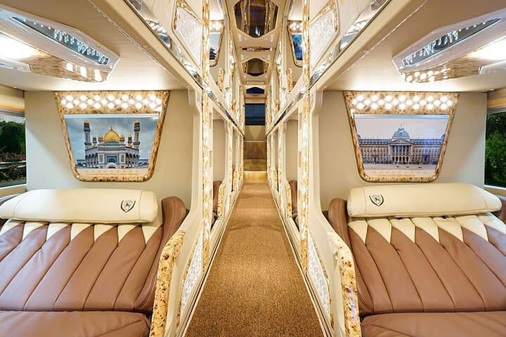
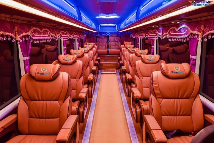
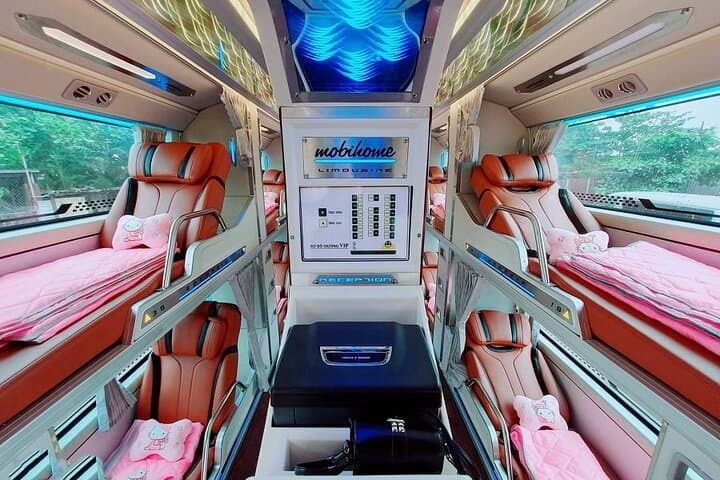
You step off a night sleeper and the air immediately feels different—thin, cool, edged with stone and pine. Headlights slice the valley as the minivan threads switchbacks toward the Dong Van Plateau, and the road opens to ridges that look as if someone stacked slate against the sky.
You step off a night sleeper and the air immediately feels different—thin, cool, edged with stone and pine. Headlights slice the valley as the minivan threads switchbacks toward the Dong Van Plateau, and the road opens to ridges that look as if someone stacked slate against the sky.
The Ha Giang Loop follows a route shaped by geology and culture: ancient karst plateaus uplifted by tectonic forces, deep gorges carved by the Nho Que River and village clusters of Hmong, Dao and Lo Lo communities whose traditions remain visible in markets and architecture. Sites like the Hmong King’s Palace and Lung Cu Flagpole tell the human story; Ma Pi Leng Pass offers the geological one—sheer cliffs giving way to the green ribbon of river below.
Expect paved but narrow mountain roads, long drives (the trip includes the ~350 km sleeper from Hanoi and roughly 175 km of daytime driving through the loop), and elevations frequently above 1,000 m. Stops are short and vivid: panorama viewpoints, homestead visits, a short boat ride on the Nho Que, and optional markets on Sunday mornings.
Practical guidance: travel light, bring layers for cold mornings and wind on the passes, and plan for photography stops that require brief walks on uneven ground. Hydrate between long transfers, carry cash for small cafes and Panorama viewpoints, and respect local customs when visiting villages. The route rewards patience—mountains that seem to shift mood with the light, and a cultural landscape that invites slow attention.