THE ADVENTURE COLLECTIVE® · Independent discovery and booking for outdoor travel

Four days of dramatic karst ridges, high mountain passes and village homestays on the Dong Van Plateau. This guided loop combines motorbike riding, short treks, a boat through Nho Que gorge and cultural encounters with local ethnic communities.
Four days of dramatic karst ridges, high mountain passes and village homestays on the Dong Van Plateau. This guided loop combines motorbike riding, short treks, a boat through Nho Que gorge and cultural encounters with local ethnic communities.
On a cold, predawn highway out of Hanoi, the sleeper bus eases into northern Vietnam and the world narrows to ridgelines and headlamps.
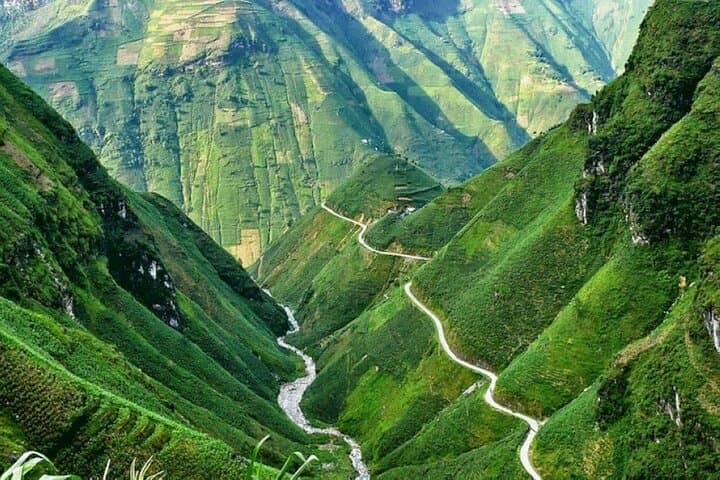
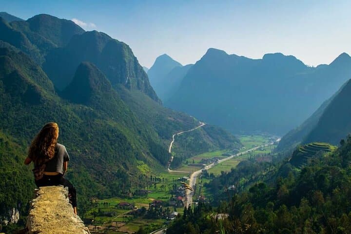
By morning the Ha Giang Loop opens: limestone spines rise from folded rice terraces, switchbacks thread through karst cliffs, and small villages punctuate the road. The route traverses Bac Sum Pass and Quan Ba’s Twin Mountains, climbs Tham Ma and Ma Pi Leng passes, and drops into the Nho Que gorge where the river dares you from below.
Verified experiences and guided adventures in the surrounding area.
Operated by Tiger Trail Travel · Ha Giang, Ha Giang Province
On a cold, predawn highway out of Hanoi, the sleeper bus eases into northern Vietnam and the world narrows to ridgelines and headlamps.
By morning the Ha Giang Loop opens: limestone spines rise from folded rice terraces, switchbacks thread through karst cliffs, and small villages punctuate the road. The route traverses Bac Sum Pass and Quan Ba’s Twin Mountains, climbs Tham Ma and Ma Pi Leng passes, and drops into the Nho Que gorge where the river dares you from below.
This region sits on the Dong Van Karst Plateau, sculpted from more than 400 million years of marine sediment and uplift; Hmong, Tay and Dao communities maintain distinctive dress, craft and seasonal festivals. The stone-and-timber Vuong family palace in Sa Phin recalls local power in the early 20th century, while Lung Khuy Cave exposes layered karst chambers carved by ancient seas.
Expect a mix of guided motorbike or minivan travel, short treks (1–3 km), a scenic boat on the Nho Que, homestays and roadside markets. Terrain alternates paved switchbacks, gravel village tracks and riverside trails; elevations commonly sit between 800–1,600 m depending on the pass. Weather can flip from sun to fog to rain in hours, so pack layers and waterproofs.
Practical guidance: travel with a local guide for narrow passes and translation, reserve homestays in advance, carry cash for remote villages, and allow extra time for road or weather delays. Hydrate often, wear ankle-support boots for short hikes, and ask permission before photographing people. Start early to catch clear mountain light views.
moderate.
4 days.
Suitable for travelers with basic fitness; able to handle short hikes (1–3 km) and long travel days with some elevation changes.
Most tours start with an overnight sleeper bus from Hanoi to Ha Giang city, where the loop begins; booking a tour that includes transport simplifies logistics.
Many sections are steep and gravelly; join as a pillion with an experienced local rider or travel by minivan if you are not confident on a motorbike.
Accommodations are primarily homestays and basic guesthouses—expect shared facilities, simple meals, and strong local hospitality.
Yes — depending on seasonal water levels; bring swimwear and check with your guide about safe spots and current conditions.
The Dong Van Karst Plateau preserves marine limestone uplifted over hundreds of millions of years; the Vuong Palace in Sa Phin reflects the influence of a prosperous local family in the early 20th century.
Tourism directly supports homestays and local markets but can strain water and waste systems; stick to trails, minimize plastic, and prefer local guides and homestays to spread economic benefits.
Tiger Trail Travel operates guided outdoor trips and adventures with an emphasis on safety, stewardship, and memorable experiences.


On a cold, predawn highway out of Hanoi, the sleeper bus eases into northern Vietnam and the world narrows to ridgelines and headlamps.
By morning the Ha Giang Loop opens: limestone spines rise from folded rice terraces, switchbacks thread through karst cliffs, and small villages punctuate the road. The route traverses Bac Sum Pass and Quan Ba’s Twin Mountains, climbs Tham Ma and Ma Pi Leng passes, and drops into the Nho Que gorge where the river dares you from below.
On a cold, predawn highway out of Hanoi, the sleeper bus eases into northern Vietnam and the world narrows to ridgelines and headlamps.
By morning the Ha Giang Loop opens: limestone spines rise from folded rice terraces, switchbacks thread through karst cliffs, and small villages punctuate the road. The route traverses Bac Sum Pass and Quan Ba’s Twin Mountains, climbs Tham Ma and Ma Pi Leng passes, and drops into the Nho Que gorge where the river dares you from below.
This region sits on the Dong Van Karst Plateau, sculpted from more than 400 million years of marine sediment and uplift; Hmong, Tay and Dao communities maintain distinctive dress, craft and seasonal festivals. The stone-and-timber Vuong family palace in Sa Phin recalls local power in the early 20th century, while Lung Khuy Cave exposes layered karst chambers carved by ancient seas.
Expect a mix of guided motorbike or minivan travel, short treks (1–3 km), a scenic boat on the Nho Que, homestays and roadside markets. Terrain alternates paved switchbacks, gravel village tracks and riverside trails; elevations commonly sit between 800–1,600 m depending on the pass. Weather can flip from sun to fog to rain in hours, so pack layers and waterproofs.
Practical guidance: travel with a local guide for narrow passes and translation, reserve homestays in advance, carry cash for remote villages, and allow extra time for road or weather delays. Hydrate often, wear ankle-support boots for short hikes, and ask permission before photographing people. Start early to catch clear mountain light views.