THE ADVENTURE COLLECTIVE® · Independent discovery and booking for outdoor travel

Three days of mountain passes, limestone panoramas and homestay nights—this motorbike loop takes you deep into Vietnam’s northern highlands. Expect winding roads, cultural stops, and changing weather; plan for boots, layers and a steady head on the throttle.
Three days of mountain passes, limestone panoramas and homestay nights—this motorbike loop takes you deep into Vietnam’s northern highlands. Expect winding roads, cultural stops, and changing weather; plan for boots, layers and a steady head on the throttle.
A cold dawn on the sleeper bus softens into blue light as you roll into Ha Giang city; the valley exhales mist and distant limestone teeth emerge like an anonymous audience. Riders regroup, helmets click, and the first twist of Bac Sum Pass throws the road into a ribbon that climbs and folds through forest and buckwheat fields.
Verified experiences and guided adventures in the surrounding area.
Operated by Authentic Travel HOI AN · Ha Giang City, Ha Giang Province
A cold dawn on the sleeper bus softens into blue light as you roll into Ha Giang city; the valley exhales mist and distant limestone teeth emerge like an anonymous audience. Riders regroup, helmets click, and the first twist of Bac Sum Pass throws the road into a ribbon that climbs and folds through forest and buckwheat fields.
This three-day loop threads the Dong Van karst plateau, Ma Pi Leng and Lung Cu flagpole—landscapes carved by uplift and weather into steep walls and narrow canyons. The Vuong (H'mong King) Palace and Lung Cam village speak to centuries of highland culture: layered houses, embroidered textiles, and markets where language and trade follow old routes. Rivers below dare you with turquoise runs; terraces climb like handrails for the people who work them.
Expect long riding days across variable surfaces—tarmac, patches of gravel and mountain dust—interspersed with short cultural stops and homestay nights. Weather changes fast at 1,500–2,000 m: sun can turn to wind and rain within an hour. Guided drivers handle tricky tight corners and steep passes, but prepare for sustained concentration and occasional tight shoulders on viewpoints.
Practical guidance: pack waterproof layers, high-traction shoes, and a good helmet; hydrate and pace yourself to compensate for altitude and cold mornings. Allow time for photography at Ma Pi Leng overlook and plan lightweight cash for village purchases. The route rewards patience: raw geology, living culture, and motorbike rhythm make this loop an active, elemental way to read Vietnam’s northern highlands.
moderate.
3 days (approx. 72 hours); daily riding 4–7 hours.
Basic stamina for long days of sitting and occasional short walks; ability to mount stairs and uneven homestay terrain.
No—many tours provide local drivers so you can ride as a passenger; if you want to drive, basic motorcycle experience is required and guides will assess suitability.
Mostly paved but with stretches of gravel, potholes and narrow shoulders on passes—expect slower progress and variable traction.
Passes reach roughly 1,500–2,000 m; most travelers tolerate this without issue but hydrate, avoid overexertion, and inform guides about prior conditions.
The itinerary includes homestay or hotel nights and several meals; bring cash for extras, snacks and small market purchases in villages.
Ha Giang’s highlands were shaped by uplifts of limestone and long human settlement by H'mong, Lô Lô and other groups; Vuong Palace reflects early 20th-century H'mong leadership and external influences.
The Dong Van karst plateau is ecologically sensitive—stay on established roads and support community-run homestays to minimize footprint.
Authentic Travel HOI AN operates guided outdoor trips and adventures with an emphasis on safety, stewardship, and memorable experiences.


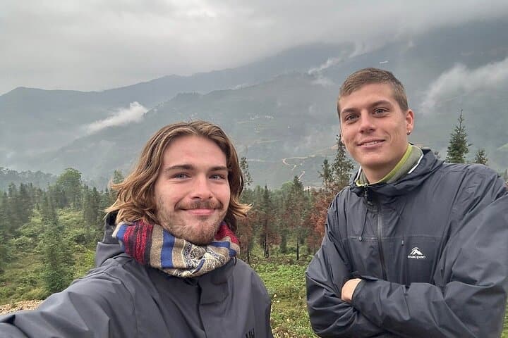
A cold dawn on the sleeper bus softens into blue light as you roll into Ha Giang city; the valley exhales mist and distant limestone teeth emerge like an anonymous audience. Riders regroup, helmets click, and the first twist of Bac Sum Pass throws the road into a ribbon that climbs and folds through forest and buckwheat fields.
A cold dawn on the sleeper bus softens into blue light as you roll into Ha Giang city; the valley exhales mist and distant limestone teeth emerge like an anonymous audience. Riders regroup, helmets click, and the first twist of Bac Sum Pass throws the road into a ribbon that climbs and folds through forest and buckwheat fields.
This three-day loop threads the Dong Van karst plateau, Ma Pi Leng and Lung Cu flagpole—landscapes carved by uplift and weather into steep walls and narrow canyons. The Vuong (H'mong King) Palace and Lung Cam village speak to centuries of highland culture: layered houses, embroidered textiles, and markets where language and trade follow old routes. Rivers below dare you with turquoise runs; terraces climb like handrails for the people who work them.
Expect long riding days across variable surfaces—tarmac, patches of gravel and mountain dust—interspersed with short cultural stops and homestay nights. Weather changes fast at 1,500–2,000 m: sun can turn to wind and rain within an hour. Guided drivers handle tricky tight corners and steep passes, but prepare for sustained concentration and occasional tight shoulders on viewpoints.
Practical guidance: pack waterproof layers, high-traction shoes, and a good helmet; hydrate and pace yourself to compensate for altitude and cold mornings. Allow time for photography at Ma Pi Leng overlook and plan lightweight cash for village purchases. The route rewards patience: raw geology, living culture, and motorbike rhythm make this loop an active, elemental way to read Vietnam’s northern highlands.