THE ADVENTURE COLLECTIVE® · Independent discovery and booking for outdoor travel

Ride the Ha Giang Loop over four days on semi-automatic motorbikes with local guides, homestays, and included meals. Experience Ma Pi Leng, Nho Que Canyon, and remote ethnic villages while practical logistics—fuel, training and insurance—are handled.
Ride the Ha Giang Loop over four days on semi-automatic motorbikes with local guides, homestays, and included meals. Experience Ma Pi Leng, Nho Que Canyon, and remote ethnic villages while practical logistics—fuel, training and insurance—are handled.
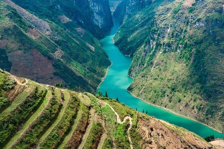
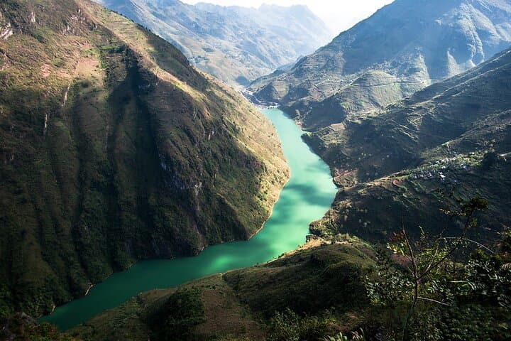
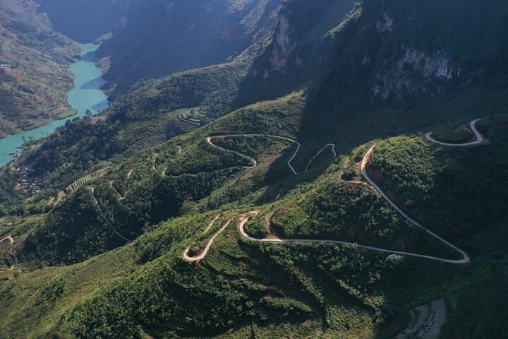
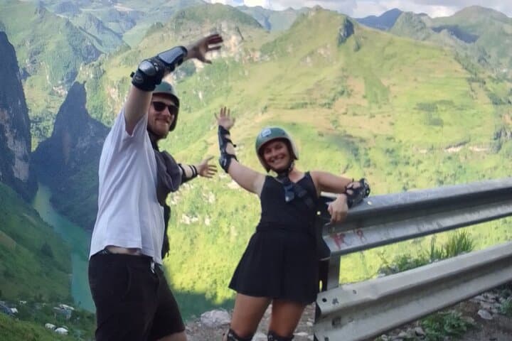
You kick away from Ha Giang town before dawn, the motorbike’s low thrum matching the slow opening of valley light. Limestone ridges sharpen like blades as the road snakes up through hairpin passes; clouds chase you across the ridges and the Nho Que River dares you to look over the rail into Tu San Canyon.
Verified experiences and guided adventures in the surrounding area.
Operated by Vietnam Travel Top · Ha Giang, Ha Giang Province
You kick away from Ha Giang town before dawn, the motorbike’s low thrum matching the slow opening of valley light. Limestone ridges sharpen like blades as the road snakes up through hairpin passes; clouds chase you across the ridges and the Nho Que River dares you to look over the rail into Tu San Canyon.
This four-day loop threads the Dong Van Karst Plateau Geopark—an ancient marine seabed now folded into jagged karst and terraced fields. The region carries a layered human story: Vuong’s royal palace in Sa Phin recalls early 20th‑century local power, Lung Cu Flag Tower marks Vietnam’s northernmost reach, and Tay and Hmong villages keep house music and corn wine alive in communal evenings.
Expect roughly 300–350 km of riding on semi‑automatic bikes with local easy riders, climbs to passes around 1,200–1,600 m, and mixed pavement that can turn rough after rain. Highlights are Ma Pi Leng’s cliff-carved views, a boat trip on the Nho Que through Tu San Canyon, and spelunking at Lung Khuy.
Practically, the trip is guided, includes homestays and most meals, and provides training on semi‑automatic bikes; gasoline and basic damage insurance are covered. Pack layered clothing, a durable helmet, and waterproofs—weather swings quickly at altitude. Plan shorter riding stretches in low light, hydrate often, and keep copies of your passport handy for immigration permission. For riders comfortable on narrow mountain roads, this loop is an intense, accessible way to meet Ha Giang’s landscape and its people.
moderate.
4 days (approx. 96 hours).
Comfortable sitting endurance and basic mobility for mounting/dismounting bikes; able to handle several hours of riding in a day.
Basic motorcycle handling is recommended; the operator provides short training on semi‑automatic bikes and often pairs less confident riders with an experienced easy rider.
Homestays are simple and locally run—expect shared facilities, hot meals when available, and close contact with local families and culture.
Typical inclusions are semi‑automatic motorbike, gasoline, some damage insurance, local guide/easy riders, most meals, homestay accommodation, and entrance fees listed in the itinerary; check the operator for any optional extras.
Riding continues in the rainy season but conditions can be slippery and visibility reduced; operators may change schedules for safety—follow guide advice and consider travel insurance.
The Dong Van Plateau has long been home to Hmong, Tay and other ethnic groups; Vuong’s palace in Sa Phin reflects a local ruling family influential in the early 20th century.
The Karst Plateau is fragile—stay on roads and trails, avoid single‑use plastics, and use homestays to support local economies; operators are increasingly focused on minimizing erosion and waste.
Vietnam Travel Top operates guided outdoor trips and adventures with an emphasis on safety, stewardship, and memorable experiences.
You kick away from Ha Giang town before dawn, the motorbike’s low thrum matching the slow opening of valley light. Limestone ridges sharpen like blades as the road snakes up through hairpin passes; clouds chase you across the ridges and the Nho Que River dares you to look over the rail into Tu San Canyon.
You kick away from Ha Giang town before dawn, the motorbike’s low thrum matching the slow opening of valley light. Limestone ridges sharpen like blades as the road snakes up through hairpin passes; clouds chase you across the ridges and the Nho Que River dares you to look over the rail into Tu San Canyon.
This four-day loop threads the Dong Van Karst Plateau Geopark—an ancient marine seabed now folded into jagged karst and terraced fields. The region carries a layered human story: Vuong’s royal palace in Sa Phin recalls early 20th‑century local power, Lung Cu Flag Tower marks Vietnam’s northernmost reach, and Tay and Hmong villages keep house music and corn wine alive in communal evenings.
Expect roughly 300–350 km of riding on semi‑automatic bikes with local easy riders, climbs to passes around 1,200–1,600 m, and mixed pavement that can turn rough after rain. Highlights are Ma Pi Leng’s cliff-carved views, a boat trip on the Nho Que through Tu San Canyon, and spelunking at Lung Khuy.
Practically, the trip is guided, includes homestays and most meals, and provides training on semi‑automatic bikes; gasoline and basic damage insurance are covered. Pack layered clothing, a durable helmet, and waterproofs—weather swings quickly at altitude. Plan shorter riding stretches in low light, hydrate often, and keep copies of your passport handy for immigration permission. For riders comfortable on narrow mountain roads, this loop is an intense, accessible way to meet Ha Giang’s landscape and its people.