THE ADVENTURE COLLECTIVE® · Independent discovery and booking for outdoor travel

Four days on Vietnam's northern edge—winding passes, karst cliffs and ethnic villages—delivered by guides and easy riders. This premium loop pairs comfort homestays with off-the-beaten-path stops like Lung Cu and the Nho Que canyon.
Four days on Vietnam's northern edge—winding passes, karst cliffs and ethnic villages—delivered by guides and easy riders. This premium loop pairs comfort homestays with off-the-beaten-path stops like Lung Cu and the Nho Que canyon.
You arrive at dawn on a narrow provincial road; mist unspools from terraced fields and a string of motorcycles hums like a low tide. The Ha Giang Loop grabs hold just past the city—steep passes, jagged karst ridgelines, and rivers that dare you to slow down and look. Over four days you ride hidden tracks, walk a short canyon trail, and float on the Nho Que beneath the Ma Pi Leng cliffs.
Verified experiences and guided adventures in the surrounding area.
Operated by Ha Giang Loopers Tour · Ha Giang, Ha Giang Province
You arrive at dawn on a narrow provincial road; mist unspools from terraced fields and a string of motorcycles hums like a low tide. The Ha Giang Loop grabs hold just past the city—steep passes, jagged karst ridgelines, and rivers that dare you to slow down and look. Over four days you ride hidden tracks, walk a short canyon trail, and float on the Nho Que beneath the Ma Pi Leng cliffs.
This region sits on the Dong Van Karst Plateau, a landscape carved by limestone uplift and deep river incision. Centuries of H'Mong, Dao and Tay culture dot the route—stilt houses, indigo textiles and Lung Tam's hand looms telling stories about local identity and trade with the border. Geology and culture are inseparable here: stone folds that look like ribs, villages clinging to slopes, and a borderland history that shaped markets and palates.
Expect paved but narrow mountain roads with intermittent gravel shoulders; daily ride distances average 80–120 km, total loop around 300–350 km, and elevations range roughly 300–1,700 m. The itinerary mixes easy riding with a one-hour trek to falls and a short boat on the Nho Que—no technical climbing required.
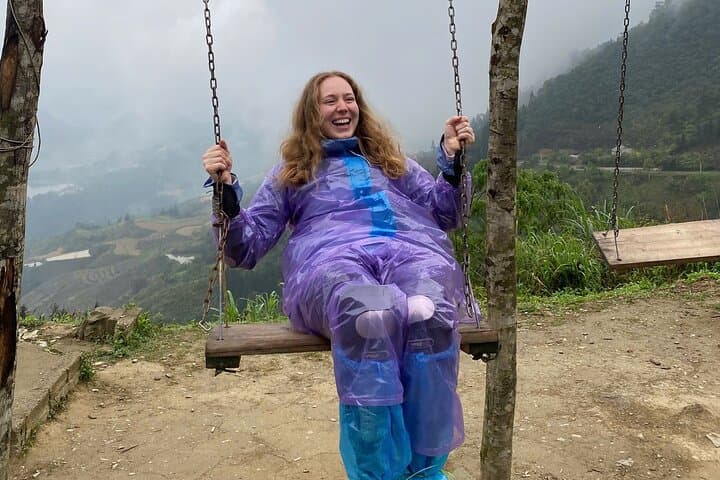
Practical edge: travel light, layer for sudden temperature swings, hydrate for the altitude, and carry cash—small vendors in villages rarely take cards. Guides and easy riders handle navigation and helmets; bring a compact rain shell, sturdy shoes, sunscreen and a sense of curiosity. Timing rides for morning light gives the best views and cooler conditions.
moderate.
4 days (daily riding 4–6 hours).
Comfortable sitting for multiple hours and able to do short hikes of 30–60 minutes; basic mobility for homestay stairs.
No—most tours include easy riders (drivers). If you want to ride yourself, inform the operator and ensure you have appropriate experience and a local license.
This premium loop uses private homestays, bungalows or hotels with private bathrooms—simple but comfortable, often with scenic views.
Trekking is short and moderate—typically around one hour to waterfalls or viewpoints on uneven terrain; basic mobility and sturdy shoes are sufficient.
Altitudes are moderate; stay hydrated, avoid heavy meals before long rides and take motion-sickness medication if prone to nausea on winding roads.
Ha Giang sits on a historic frontier between Vietnam and China; the Dong Van plateau hosted trading routes and H'mong cultural centers that persist today.
The karst plateau is fragile—stick to trails, avoid disturbing terraces, and support local homestays that reinvest in community livelihoods.
Ha Giang Loopers Tour operates guided outdoor trips and adventures with an emphasis on safety, stewardship, and memorable experiences.

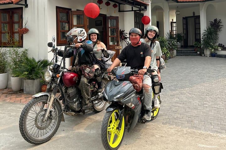
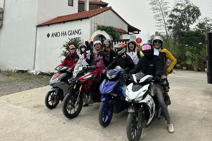
You arrive at dawn on a narrow provincial road; mist unspools from terraced fields and a string of motorcycles hums like a low tide. The Ha Giang Loop grabs hold just past the city—steep passes, jagged karst ridgelines, and rivers that dare you to slow down and look. Over four days you ride hidden tracks, walk a short canyon trail, and float on the Nho Que beneath the Ma Pi Leng cliffs.
You arrive at dawn on a narrow provincial road; mist unspools from terraced fields and a string of motorcycles hums like a low tide. The Ha Giang Loop grabs hold just past the city—steep passes, jagged karst ridgelines, and rivers that dare you to slow down and look. Over four days you ride hidden tracks, walk a short canyon trail, and float on the Nho Que beneath the Ma Pi Leng cliffs.
This region sits on the Dong Van Karst Plateau, a landscape carved by limestone uplift and deep river incision. Centuries of H'Mong, Dao and Tay culture dot the route—stilt houses, indigo textiles and Lung Tam's hand looms telling stories about local identity and trade with the border. Geology and culture are inseparable here: stone folds that look like ribs, villages clinging to slopes, and a borderland history that shaped markets and palates.
Expect paved but narrow mountain roads with intermittent gravel shoulders; daily ride distances average 80–120 km, total loop around 300–350 km, and elevations range roughly 300–1,700 m. The itinerary mixes easy riding with a one-hour trek to falls and a short boat on the Nho Que—no technical climbing required.
Practical edge: travel light, layer for sudden temperature swings, hydrate for the altitude, and carry cash—small vendors in villages rarely take cards. Guides and easy riders handle navigation and helmets; bring a compact rain shell, sturdy shoes, sunscreen and a sense of curiosity. Timing rides for morning light gives the best views and cooler conditions.