THE ADVENTURE COLLECTIVE® · Independent discovery and booking for outdoor travel

Three days on the Ha Giang Loop take you over Ma Pi Leng’s vertiginous pass, through Dong Van’s karst plateau and down to the Nho Que River. Expect steep switchbacks, homestays, and immersive hill-tribe culture with guided transfers from Hanoi.
Three days on the Ha Giang Loop take you over Ma Pi Leng’s vertiginous pass, through Dong Van’s karst plateau and down to the Nho Que River. Expect steep switchbacks, homestays, and immersive hill-tribe culture with guided transfers from Hanoi.
You push through pre-dawn humidity on a sleeper bus and wake to a raw, vertical horizon—limestone spires, terraced fields and a road that climbs without apology. By midday the Ma Pi Leng Pass unfurls: a narrow ribbon of pavement threading cliffs that drop toward the green ribbon of the Nho Que River. Wind teases at your jacket; the valley seems to dare you to look down.
Verified experiences and guided adventures in the surrounding area.
Operated by Red Gecko Travel · Ha Giang, Ha Giang Province
You push through pre-dawn humidity on a sleeper bus and wake to a raw, vertical horizon—limestone spires, terraced fields and a road that climbs without apology. By midday the Ma Pi Leng Pass unfurls: a narrow ribbon of pavement threading cliffs that drop toward the green ribbon of the Nho Que River. Wind teases at your jacket; the valley seems to dare you to look down.
This three-day loop follows the Dong Van Karst Plateau, a UNESCO Global Geopark where karst towers and fissured plateaus record millions of years of uplift and erosion. Hmong, Dao and Tay communities have farmed these slopes for generations; the Hmong King’s Palace in Sa Phin offers a window into local history and clan power in the early 20th century. Geologically the area is limestone and shale, cut into sharp ridgelines and deep river gorges—expect rocky outcrops, steep passes and sudden microclimates.
Practically: the route covers roughly 200–300 km of mountain roads with steep switchbacks and short treks such as the Sky Path at Ma Pi Leng (altitude near 2,000 m). Accommodation alternates between homestays and small hotels; meals are local and filling. Bring layered clothing for wide temperature swings, footwear with good grip for wet trails, and a small daypack for water and documents. Allow extra time for slow vehicle sections, photo stops and village visits. If you plan to ride, basic motorbike skills help; otherwise travel with a guide or easy rider. Start early each day to avoid midday haze and to catch clearer valley light.
moderate.
3 days.
Moderate fitness—comfortable walking, handling stairs and short hikes; stamina for full days on a bike or in a vehicle.
Most travelers take the included overnight sleeper bus from Hanoi to Ha Giang city; expect a 6–8 hour journey depending on traffic and stops.
No—this tour provides local drivers or easy riders; basic motorbike experience is only needed if you choose to ride independently.
Accommodations range from simple homestays to small mountain hotels; expect basic facilities but strong local hospitality and home-cooked meals.
The road is passable by vehicle with guardrails in places but is exposed; if you are sensitive to heights, ride as a passenger and avoid standing too close to cliff edges.
The Dong Van Karst Plateau was recognized as a UNESCO Global Geopark; local chieftains like the Vuong family shaped regional politics in the early 20th century.
Tourism pressures and agriculture affect fragile karst soils—stick to marked paths, minimize plastic waste and support homestays that follow local waste practices.
Red Gecko Travel operates guided outdoor trips and adventures with an emphasis on safety, stewardship, and memorable experiences.

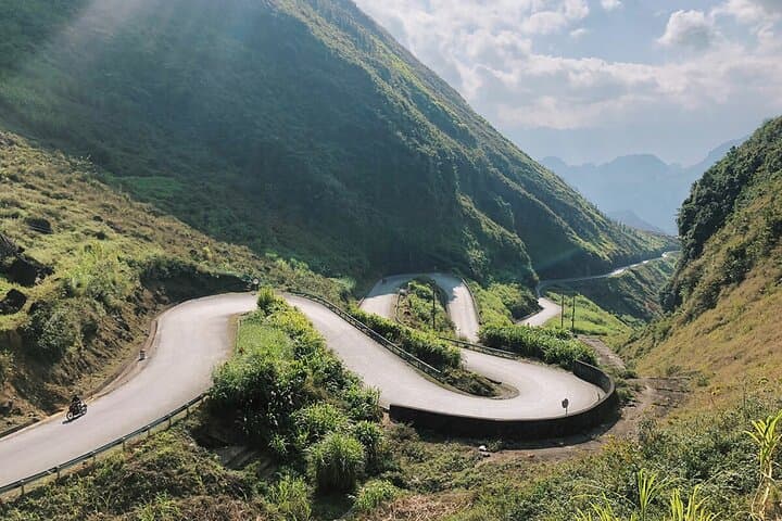
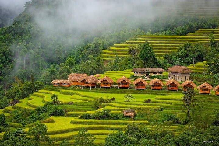
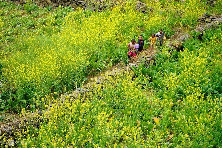
You push through pre-dawn humidity on a sleeper bus and wake to a raw, vertical horizon—limestone spires, terraced fields and a road that climbs without apology. By midday the Ma Pi Leng Pass unfurls: a narrow ribbon of pavement threading cliffs that drop toward the green ribbon of the Nho Que River. Wind teases at your jacket; the valley seems to dare you to look down.
You push through pre-dawn humidity on a sleeper bus and wake to a raw, vertical horizon—limestone spires, terraced fields and a road that climbs without apology. By midday the Ma Pi Leng Pass unfurls: a narrow ribbon of pavement threading cliffs that drop toward the green ribbon of the Nho Que River. Wind teases at your jacket; the valley seems to dare you to look down.
This three-day loop follows the Dong Van Karst Plateau, a UNESCO Global Geopark where karst towers and fissured plateaus record millions of years of uplift and erosion. Hmong, Dao and Tay communities have farmed these slopes for generations; the Hmong King’s Palace in Sa Phin offers a window into local history and clan power in the early 20th century. Geologically the area is limestone and shale, cut into sharp ridgelines and deep river gorges—expect rocky outcrops, steep passes and sudden microclimates.
Practically: the route covers roughly 200–300 km of mountain roads with steep switchbacks and short treks such as the Sky Path at Ma Pi Leng (altitude near 2,000 m). Accommodation alternates between homestays and small hotels; meals are local and filling. Bring layered clothing for wide temperature swings, footwear with good grip for wet trails, and a small daypack for water and documents. Allow extra time for slow vehicle sections, photo stops and village visits. If you plan to ride, basic motorbike skills help; otherwise travel with a guide or easy rider. Start early each day to avoid midday haze and to catch clearer valley light.