THE ADVENTURE COLLECTIVE® · Independent discovery and booking for outdoor travel

See Bonaire’s coastline, pink salt ponds, Rincon and flamingo flats in a focused three‑hour loop with a local guide. Small groups, hotel or ship pickup, and plenty of photo stops make this an efficient introduction to the island’s geology, culture and wildlife.
See Bonaire’s coastline, pink salt ponds, Rincon and flamingo flats in a focused three‑hour loop with a local guide. Small groups, hotel or ship pickup, and plenty of photo stops make this an efficient introduction to the island’s geology, culture and wildlife.
You step off the ship into a warm trade wind that pushes salt-sweet air down Kaya Grandi as your small van pulls away. Windows open, the coastline flickers between deep Caribbean blue and pale, glassy shallows; limestone cliffs respond to each swell with a sharp slap. This three-hour island loop stitches together Kralendijk’s colorful main street, windswept pink salt ponds, quiet slaving‑era huts and the scrubby hills that frame Brandaris, Bonaire’s highest point.
Verified experiences and guided adventures in the surrounding area.
Operated by Bonaire Tours Center · Kralendijk, Bonaire
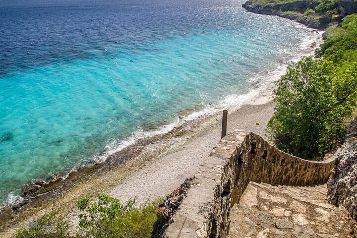
You step off the ship into a warm trade wind that pushes salt-sweet air down Kaya Grandi as your small van pulls away. Windows open, the coastline flickers between deep Caribbean blue and pale, glassy shallows; limestone cliffs respond to each swell with a sharp slap. This three-hour island loop stitches together Kralendijk’s colorful main street, windswept pink salt ponds, quiet slaving‑era huts and the scrubby hills that frame Brandaris, Bonaire’s highest point.
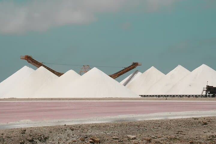
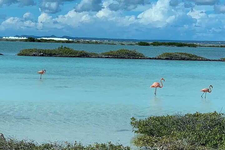
Geology here is stark: exposed limestone, fossilized reef terraces and salt flats shaped by centuries of evaporation and wind. Culturally the island carries Dutch, African and indigenous influences — seen in Rincon’s oldest houses and in local cactus distilleries where traditional flavors are still distilled. Wildlife is visible at the roadside: flocks of flamingoes in the salt ponds and the occasional donkey grazing near coastal scrub.
Practical guide: the tour is easy on fitness but heavy on stops for photos and short walks — wear closed-toe shoes for rocky viewpoints and bring reef‑safe sunscreen. Expect about three hours including pick‑up and return to ship or hotel; guides are local and offer commentary on history, salt production and marine conservation. If you’re on a cruise, verify pickup point and ship return window with your guide; they aim to return passengers to the pier well before departure. Bring a refillable water bottle, a light layer for wind, and a camera with a polarizing filter to cut glare on the salt ponds. This is an accessible, sensory way to read Bonaire’s landscape in a single sweep.
easy.
3 hours.
Suitable for most fitness levels; involves short walks on uneven ground and brief stair access at some viewpoints.
Yes—the tour offers pickup and drop‑off from the cruise terminal or most hotels and apartments; confirm your pickup point and arrival details when booking.
Yes—it's labeled easy and accommodates all physical levels; short walks are optional and vehicles are air‑conditioned with seatbelts.
Flamingoes are often visible at the salt flats but sightings depend on season and water levels; guides also point out donkeys and shorebirds from a respectful distance.
Guides typically provide bottled water and may stop at a distillery for a complimentary tasting; bring snacks if you prefer more food between stops.
Bonaire’s economy was historically tied to salt evaporation and small‑scale agriculture; the Slaves’ Huts and salt pans along the coast reflect that layered past.
Bonaire is home to a protected marine park and flamingo reserve; visitors are asked to avoid disturbing wildlife, use marked paths and choose reef‑safe products to reduce impacts.
Bonaire Tours Center operates guided outdoor trips and adventures with an emphasis on safety, stewardship, and memorable experiences.
You step off the ship into a warm trade wind that pushes salt-sweet air down Kaya Grandi as your small van pulls away. Windows open, the coastline flickers between deep Caribbean blue and pale, glassy shallows; limestone cliffs respond to each swell with a sharp slap. This three-hour island loop stitches together Kralendijk’s colorful main street, windswept pink salt ponds, quiet slaving‑era huts and the scrubby hills that frame Brandaris, Bonaire’s highest point.
You step off the ship into a warm trade wind that pushes salt-sweet air down Kaya Grandi as your small van pulls away. Windows open, the coastline flickers between deep Caribbean blue and pale, glassy shallows; limestone cliffs respond to each swell with a sharp slap. This three-hour island loop stitches together Kralendijk’s colorful main street, windswept pink salt ponds, quiet slaving‑era huts and the scrubby hills that frame Brandaris, Bonaire’s highest point.
Geology here is stark: exposed limestone, fossilized reef terraces and salt flats shaped by centuries of evaporation and wind. Culturally the island carries Dutch, African and indigenous influences — seen in Rincon’s oldest houses and in local cactus distilleries where traditional flavors are still distilled. Wildlife is visible at the roadside: flocks of flamingoes in the salt ponds and the occasional donkey grazing near coastal scrub.
Practical guide: the tour is easy on fitness but heavy on stops for photos and short walks — wear closed-toe shoes for rocky viewpoints and bring reef‑safe sunscreen. Expect about three hours including pick‑up and return to ship or hotel; guides are local and offer commentary on history, salt production and marine conservation. If you’re on a cruise, verify pickup point and ship return window with your guide; they aim to return passengers to the pier well before departure. Bring a refillable water bottle, a light layer for wind, and a camera with a polarizing filter to cut glare on the salt ponds. This is an accessible, sensory way to read Bonaire’s landscape in a single sweep.