THE ADVENTURE COLLECTIVE® · Independent discovery and booking for outdoor travel

Leave Plaza Nueva and let the city's river lead you out of cobbles and into orchards. This 15 km guided hike traces Granada’s waterways, acequias, and low foothills while pairing urban history with open-country views.
Leave Plaza Nueva and let the city's river lead you out of cobbles and into orchards. This 15 km guided hike traces Granada’s waterways, acequias, and low foothills while pairing urban history with open-country views.
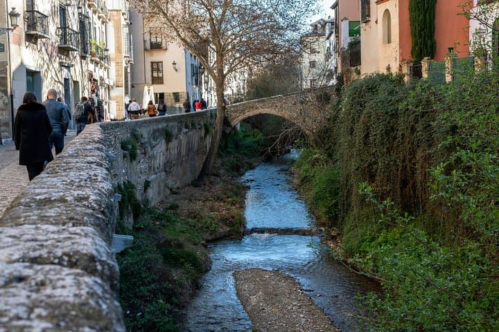
A cool morning in Plaza Nueva, the guide holds a small sign while the city wakes around you — church bells, market deliveries, and the river ahead that seems to pull the town toward the plain. The Genil (the river most guidebooks point to) threads through Granada like a living seam; this 15 km route follows its banks out of the old quarter and into irrigated fields, forgotten chapels, and low ridgelines that open toward the Sierra Nevada’s foothills.
Verified experiences and guided adventures in the surrounding area.
Operated by Not Just a Tourist · Granada, Andalusia
A cool morning in Plaza Nueva, the guide holds a small sign while the city wakes around you — church bells, market deliveries, and the river ahead that seems to pull the town toward the plain. The Genil (the river most guidebooks point to) threads through Granada like a living seam; this 15 km route follows its banks out of the old quarter and into irrigated fields, forgotten chapels, and low ridgelines that open toward the Sierra Nevada’s foothills.
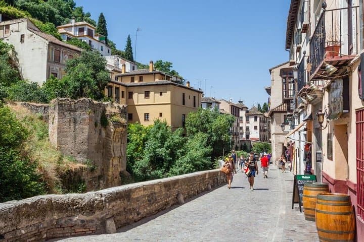
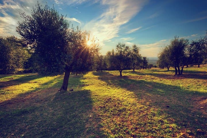
Walkers cross stone bridges that remember Roman and Moorish traffic, pass irrigation acequias still shaped by Andalusian water management, and move from cobbled alleys into open farmland where citrus and olive trees lean toward the water. Geology here is obvious — river-polished stones give way to alluvial terraces and fertile soils that explain why settlements cluster on these slopes. Cultural traces are constant: whitewashed houses, working orchards, and small shrines tucked beside the path.
Practical guidance: expect roughly 15 km of mostly well-packed paths and quiet country roads over about 6–7 hours with stops. Wear sturdy walking shoes, carry at least 1.5–2 liters of water (more in summer), and bring layered clothing for variable shade and sun. The route suits hikers with a moderate fitness level; guides provide local context and small-group pacing, and public transit connects back to central Granada. Start early to avoid heat, respect acequias and private fields, and plan snacks—the tour recommends fruits and nuts. This is a day that pairs city history with a tangible countryside finish, an accessible way to read Granada’s landscape by foot.
moderate.
6–7 hours.
Suitable for hikers who regularly walk 10–15 km and can handle mixed terrain and some uneven surfaces.
Meet and finish at the fountain in Plaza Nueva; the guide will carry a 'Not Just a Tourist' sign for easy recognition.
The tour is about 15 km and runs roughly 6–7 hours with stops; it’s moderate—good for anyone used to day hikes of this length.
There are limited services outside the city—use facilities before departure and bring snacks; guides schedule brief stops.
Tours may be canceled for bad weather; cancel at least 24 hours in advance for a full refund under the listed policy.
Granada’s acequia system dates back to the Islamic period and shaped both irrigation and settlement patterns along the Genil and its tributaries.
Stay on paths and avoid disturbing acequias and fields; water in Andalusia is scarce in summer, so minimize wastage and pack out waste.
Not Just a Tourist operates guided outdoor trips and adventures with an emphasis on safety, stewardship, and memorable experiences.
A cool morning in Plaza Nueva, the guide holds a small sign while the city wakes around you — church bells, market deliveries, and the river ahead that seems to pull the town toward the plain. The Genil (the river most guidebooks point to) threads through Granada like a living seam; this 15 km route follows its banks out of the old quarter and into irrigated fields, forgotten chapels, and low ridgelines that open toward the Sierra Nevada’s foothills.
A cool morning in Plaza Nueva, the guide holds a small sign while the city wakes around you — church bells, market deliveries, and the river ahead that seems to pull the town toward the plain. The Genil (the river most guidebooks point to) threads through Granada like a living seam; this 15 km route follows its banks out of the old quarter and into irrigated fields, forgotten chapels, and low ridgelines that open toward the Sierra Nevada’s foothills.
Walkers cross stone bridges that remember Roman and Moorish traffic, pass irrigation acequias still shaped by Andalusian water management, and move from cobbled alleys into open farmland where citrus and olive trees lean toward the water. Geology here is obvious — river-polished stones give way to alluvial terraces and fertile soils that explain why settlements cluster on these slopes. Cultural traces are constant: whitewashed houses, working orchards, and small shrines tucked beside the path.
Practical guidance: expect roughly 15 km of mostly well-packed paths and quiet country roads over about 6–7 hours with stops. Wear sturdy walking shoes, carry at least 1.5–2 liters of water (more in summer), and bring layered clothing for variable shade and sun. The route suits hikers with a moderate fitness level; guides provide local context and small-group pacing, and public transit connects back to central Granada. Start early to avoid heat, respect acequias and private fields, and plan snacks—the tour recommends fruits and nuts. This is a day that pairs city history with a tangible countryside finish, an accessible way to read Granada’s landscape by foot.