THE ADVENTURE COLLECTIVE® · Independent discovery and booking for outdoor travel

This 16-day circuit links Gokyo’s turquoise lakes with Everest Base Camp via the Cho La Pass, mixing high passes, glacier views and Sherpa culture. Expect steep daily climbs, rugged terrain and exceptional panoramic vantage points at Gokyo Ri and Kala Patthar.
This 16-day circuit links Gokyo’s turquoise lakes with Everest Base Camp via the Cho La Pass, mixing high passes, glacier views and Sherpa culture. Expect steep daily climbs, rugged terrain and exceptional panoramic vantage points at Gokyo Ri and Kala Patthar.
A pre-dawn flight into Lukla drops you into a narrow airstrip clinging to a ridge; prayer flags snap and the trail unfurls upward. Over the next two weeks the landscape shifts from rhododendron forest to moraine and ice — glaciers creak like distant machinery and turquoise Gokyo Lakes dare you closer with their mirror-calm. You cross Cho La Pass (approx. 5,400–5,420 m), stand on Gokyo Ri (5,357 m) and watch Everest’s ridge edge the sky from Kala Patthar (≈5,550 m).
Verified experiences and guided adventures in the surrounding area.
Operated by Mountain Travel Nepal · Kathmandu, Bagmati Province
A pre-dawn flight into Lukla drops you into a narrow airstrip clinging to a ridge; prayer flags snap and the trail unfurls upward. Over the next two weeks the landscape shifts from rhododendron forest to moraine and ice — glaciers creak like distant machinery and turquoise Gokyo Lakes dare you closer with their mirror-calm. You cross Cho La Pass (approx. 5,400–5,420 m), stand on Gokyo Ri (5,357 m) and watch Everest’s ridge edge the sky from Kala Patthar (≈5,550 m).
The route threads Sherpa villages, mani walls and monasteries: Tengboche’s gompa remains a regional cultural center where monks' horns call and Himalayan Buddhism shapes daily life. Geologically you walk on young uplifted crust and glacial till; moraines and terminal ice mark recent glacial retreat, visible around Ngozumpa Glacier below Gokyo.
Practically, expect roughly 120–140 km total walking distributed over 16 days with daily gains that can top 700–900 m on acclimatization days and passes. Terrain alternates packed trail, loose scree, stone staircases and short glacier approaches near Cho La (may require crampons in late season). Lodges (tea houses) provide simple meals and beds; hot water and electricity are intermittent at higher camps. Acclimatize deliberately: schedule two nights at Namche and one at Dingboche or similar. Hydrate, monitor for acute mountain sickness, and travel with a licensed guide and insurance covering helicopter evacuation. Aim for spring (pre-monsoon) or autumn windows for stable weather and clearer views. With preparation the route rewards with some of the region’s best high-altitude panoramas and a genuine off-the-beaten-track feel.
challenging.
16 days.
Good cardiovascular fitness with prior multi-day trekking experience and the ability to carry a 8–12 kg daypack; comfortable on sustained uphill and rough terrain.
Spring (late March–May) and autumn (September–November) offer the most stable weather and best visibility for mountain views.
No technical climbing is required for the standard route, but basic experience with crampons/ice-axe is useful in shoulder seasons; a guide is recommended.
You need a TIMS card and a Sagarmatha National Park permit; your operator or guide typically arranges these.
This is a high-altitude trek reaching >5,300 m; AMS is a real risk—proper acclimatization, pacing and being prepared to descend are essential.
The Khumbu has long been home to Sherpa communities, whose Tibetan Buddhist culture and trail-building shaped the modern trekking routes; Tengboche Monastery is a regional religious hub.
Glacial retreat and increased trekking pressure strain water and waste systems; use local waste-disposal practices and carry out non-biodegradable trash when possible.
Mountain Travel Nepal operates guided outdoor trips and adventures with an emphasis on safety, stewardship, and memorable experiences.
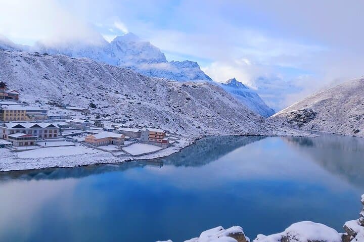
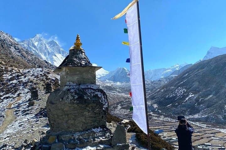
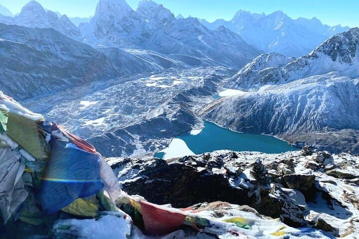
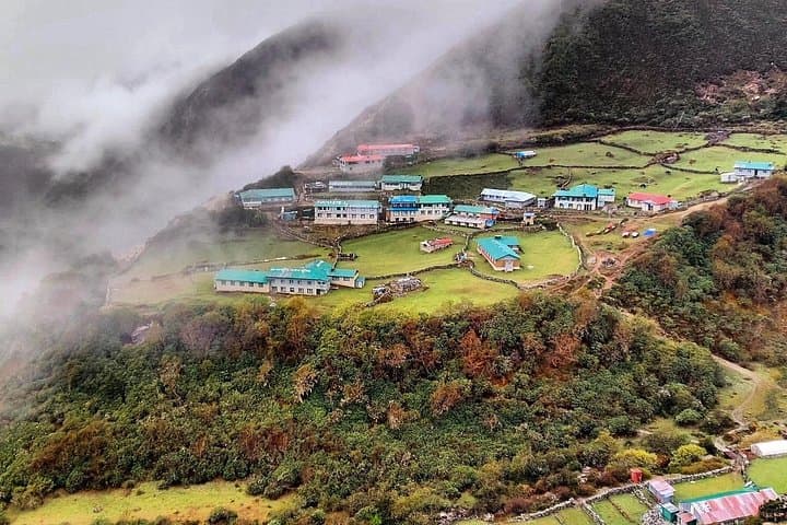
A pre-dawn flight into Lukla drops you into a narrow airstrip clinging to a ridge; prayer flags snap and the trail unfurls upward. Over the next two weeks the landscape shifts from rhododendron forest to moraine and ice — glaciers creak like distant machinery and turquoise Gokyo Lakes dare you closer with their mirror-calm. You cross Cho La Pass (approx. 5,400–5,420 m), stand on Gokyo Ri (5,357 m) and watch Everest’s ridge edge the sky from Kala Patthar (≈5,550 m).
A pre-dawn flight into Lukla drops you into a narrow airstrip clinging to a ridge; prayer flags snap and the trail unfurls upward. Over the next two weeks the landscape shifts from rhododendron forest to moraine and ice — glaciers creak like distant machinery and turquoise Gokyo Lakes dare you closer with their mirror-calm. You cross Cho La Pass (approx. 5,400–5,420 m), stand on Gokyo Ri (5,357 m) and watch Everest’s ridge edge the sky from Kala Patthar (≈5,550 m).
The route threads Sherpa villages, mani walls and monasteries: Tengboche’s gompa remains a regional cultural center where monks' horns call and Himalayan Buddhism shapes daily life. Geologically you walk on young uplifted crust and glacial till; moraines and terminal ice mark recent glacial retreat, visible around Ngozumpa Glacier below Gokyo.
Practically, expect roughly 120–140 km total walking distributed over 16 days with daily gains that can top 700–900 m on acclimatization days and passes. Terrain alternates packed trail, loose scree, stone staircases and short glacier approaches near Cho La (may require crampons in late season). Lodges (tea houses) provide simple meals and beds; hot water and electricity are intermittent at higher camps. Acclimatize deliberately: schedule two nights at Namche and one at Dingboche or similar. Hydrate, monitor for acute mountain sickness, and travel with a licensed guide and insurance covering helicopter evacuation. Aim for spring (pre-monsoon) or autumn windows for stable weather and clearer views. With preparation the route rewards with some of the region’s best high-altitude panoramas and a genuine off-the-beaten-track feel.