THE ADVENTURE COLLECTIVE® · Independent discovery and booking for outdoor travel

Drive into a landscape of squat hoodoos and GPS-triggered stories with this self-guided audio tour of Goblin Valley State Park. Stop for pictographs, short hikes and sunset views on a flexible 5–6 hour exploration.
Drive into a landscape of squat hoodoos and GPS-triggered stories with this self-guided audio tour of Goblin Valley State Park. Stop for pictographs, short hikes and sunset views on a flexible 5–6 hour exploration.
You pull off Highway 24 where the red dirt opens into a small valley dotted with squat, wind-sculpted hoodoos that look like a crowd frozen mid-argument. The audio guide begins, a steady voice over ambient desert wind, and the road unwinds past Temple Mountain Junction toward clustered goblins, pictograph panels and a visitor center with flushing toilets — a small comfort in a big landscape.
Verified experiences and guided adventures in the surrounding area.
Operated by Shaka Guide Apps · Hanksville, Utah
You pull off Highway 24 where the red dirt opens into a small valley dotted with squat, wind-sculpted hoodoos that look like a crowd frozen mid-argument. The audio guide begins, a steady voice over ambient desert wind, and the road unwinds past Temple Mountain Junction toward clustered goblins, pictograph panels and a visitor center with flushing toilets — a small comfort in a big landscape.
Goblin Valley sits on Entrada sandstone formed 170 million years ago; weak layers eroded into rounded fins and isolated pinnacles. Indigenous Fremont and ancestral Pueblo peoples left pictographs in nearby washes — human figures and animals painted on stone — while later ranchers and travellers mapped routes across the basin. The park’s Three Sisters and Goblin Overlook make practical vantage points for sunset and aerial photography; Temple Mountain Wash hides a pictograph panel worth slowing for.
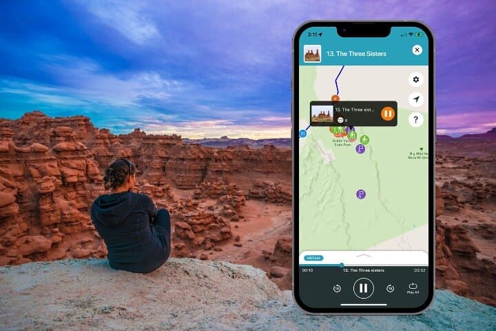
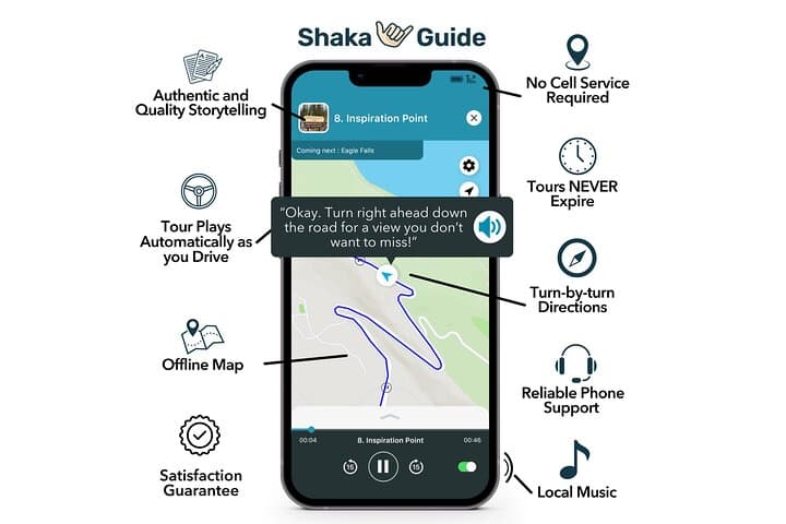
The self-guided audio tour uses GPS-triggered narration and maps so you can stop when you want: hike a 1.8-mile out-and-back to narrow slots, inspect the pictographs, then climb a short trail to a panoramic overlook. Expect sandy trails, compacted dirt, and tight narrows where you’ll sidestep rock. Wildlife is sparse but present — lizards bask on stones and ravens ride thermals.
Practical notes: download the Shaka Guide tour and offline maps on Wi‑Fi, bring 2–3 liters of water per person, sun protection and sturdy closed-toe shoes. Start mid-morning or arrive for sunset; parking can fill on holiday weekends. The audio tour gives context without the crowds — a private, flexible way to read the rocks and follow the valley’s slow, erosive storytelling.
easy.
5–6 hours.
Suitable for most fitness levels; expect short moderate hikes (up to 1.8 miles) on sandy, uneven terrain.
No; the tour and maps can be downloaded in advance via the Shaka Guide app and work offline using GPS.
The tour notes indicate wheelchair accessibility for some areas and the Visitor Center, but many trails are sandy and uneven and may be difficult off paved surfaces.
Service animals are allowed per the tour details; normal pet rules at Goblin Valley State Park should be checked with park authorities before bringing pets.
Early morning or late afternoon/sunset offers cooler temperatures and the strongest light for photographing the goblins; mid‑day can be very hot in summer.
Entrada sandstone here dates to the Jurassic; Fremont and ancestral Pueblo peoples left pictographs in washes that are still visible today.
Stick to marked trails and avoid climbing fragile hoodoos — the soft sandstone erodes quickly under foot traffic. Pack out all trash and limit group impacts at pictograph sites.
Shaka Guide Apps operates guided outdoor trips and adventures with an emphasis on safety, stewardship, and memorable experiences.


You pull off Highway 24 where the red dirt opens into a small valley dotted with squat, wind-sculpted hoodoos that look like a crowd frozen mid-argument. The audio guide begins, a steady voice over ambient desert wind, and the road unwinds past Temple Mountain Junction toward clustered goblins, pictograph panels and a visitor center with flushing toilets — a small comfort in a big landscape.
You pull off Highway 24 where the red dirt opens into a small valley dotted with squat, wind-sculpted hoodoos that look like a crowd frozen mid-argument. The audio guide begins, a steady voice over ambient desert wind, and the road unwinds past Temple Mountain Junction toward clustered goblins, pictograph panels and a visitor center with flushing toilets — a small comfort in a big landscape.
Goblin Valley sits on Entrada sandstone formed 170 million years ago; weak layers eroded into rounded fins and isolated pinnacles. Indigenous Fremont and ancestral Pueblo peoples left pictographs in nearby washes — human figures and animals painted on stone — while later ranchers and travellers mapped routes across the basin. The park’s Three Sisters and Goblin Overlook make practical vantage points for sunset and aerial photography; Temple Mountain Wash hides a pictograph panel worth slowing for.
The self-guided audio tour uses GPS-triggered narration and maps so you can stop when you want: hike a 1.8-mile out-and-back to narrow slots, inspect the pictographs, then climb a short trail to a panoramic overlook. Expect sandy trails, compacted dirt, and tight narrows where you’ll sidestep rock. Wildlife is sparse but present — lizards bask on stones and ravens ride thermals.
Practical notes: download the Shaka Guide tour and offline maps on Wi‑Fi, bring 2–3 liters of water per person, sun protection and sturdy closed-toe shoes. Start mid-morning or arrive for sunset; parking can fill on holiday weekends. The audio tour gives context without the crowds — a private, flexible way to read the rocks and follow the valley’s slow, erosive storytelling.