THE ADVENTURE COLLECTIVE® · Independent discovery and booking for outdoor travel

Follow a mountain road of hairpins, skywalks and high-alpine lakes above Geirangerfjord. This shore excursion combines dramatic viewpoints—Flydalsjuvet, Mt. Dalsnibba and the Eagle Road—with manageable walking and memorable photo stops.
Follow a mountain road of hairpins, skywalks and high-alpine lakes above Geirangerfjord. This shore excursion combines dramatic viewpoints—Flydalsjuvet, Mt. Dalsnibba and the Eagle Road—with manageable walking and memorable photo stops.
You climb into a coach that hugs mountainsides while the fjord falls away below—sheer rock, slivers of waterfall and the blue-black river of the Geirangerfjord waiting in the valley. The road carves hairpins out of granite; at Flydalsjuvet the valley opens and the village drops like a model under glass. Higher still, the air thins and the Geiranger Skywalk on Mt. Dalsnibba gives a vertigo-tinged panorama over snow patches and the lake Djupvatnet at roughly 1,000 m.
Verified experiences and guided adventures in the surrounding area.
Operated by Norway Excursions AS · Geiranger, Møre og Romsdal
You climb into a coach that hugs mountainsides while the fjord falls away below—sheer rock, slivers of waterfall and the blue-black river of the Geirangerfjord waiting in the valley. The road carves hairpins out of granite; at Flydalsjuvet the valley opens and the village drops like a model under glass. Higher still, the air thins and the Geiranger Skywalk on Mt. Dalsnibba gives a vertigo-tinged panorama over snow patches and the lake Djupvatnet at roughly 1,000 m.
Geirangerfjord is a classic glacial trough, cut deep by ice during the last Ice Age and now protected as part of the West Norwegian Fjords UNESCO site. The Eagle Road (Ørnevegen) is a historic, steep mountain route with engineered hairpins that offer shifting vantage points of the Seven Sisters waterfall cascading into the fjord. Local culture here blends small-scale mountain farming and maritime traditions; farms cling to steep slopes and summer mountain pastures are still in seasonal use.
Practical side: the full loop is a short, mostly vehicle-based excursion with multiple photo stops and short, level walks—good for travelers of most abilities. Roads above Geiranger can remain snowbound into May; weather changes fast at altitude so dress in layers, protect camera gear from spray and wind, and allow time for slow traffic at lookout points. Expect three to four hours total, with some steep viewpoints accessed by short stairways or ramps. Bring a windproof shell, sturdy shoes for slick surfaces, and daylight for the best photographic light.
easy.
3–4 hours.
Suitable for most fitness levels—primarily vehicle-based with short, mostly level walks to viewpoints
The tour runs about 3–4 hours total, including multiple photo stops and a visit to Dalsnibba (when the road is open).
No—snow and avalanche risk may keep the Dalsnibba road closed into late spring; operators will substitute alternate viewpoints if necessary.
Yes—most of the trip is coach-based with short, easy walks to lookouts; accessible options are commonly available but confirm specific mobility needs at booking.
Yes—the Eagle Road and multiple overlooks provide clear views of the Seven Sisters as it drops into the fjord; photo stops are part of the itinerary.
The Geirangerfjord was carved by glaciers during the last Ice Age and the area is part of the West Norwegian Fjords UNESCO World Heritage site.
Heavy cruise traffic and tourism pressure are managed through protected-area rules and visitor guidelines—stay on marked paths and avoid disturbing shoreline vegetation.
Norway Excursions AS operates guided outdoor trips and adventures with an emphasis on safety, stewardship, and memorable experiences.
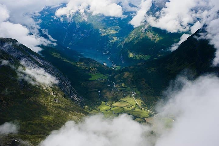
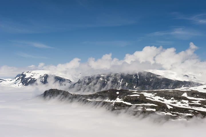
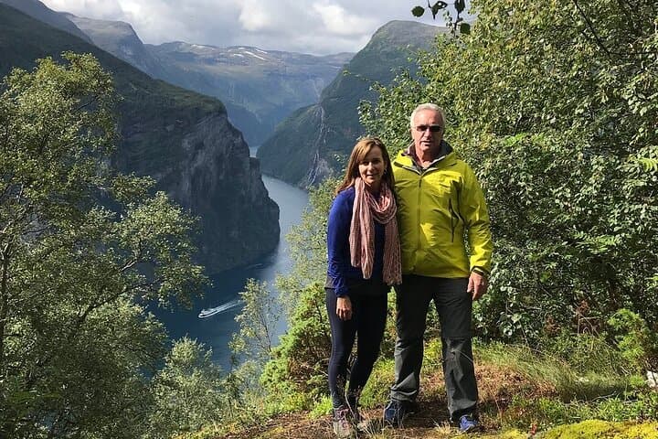
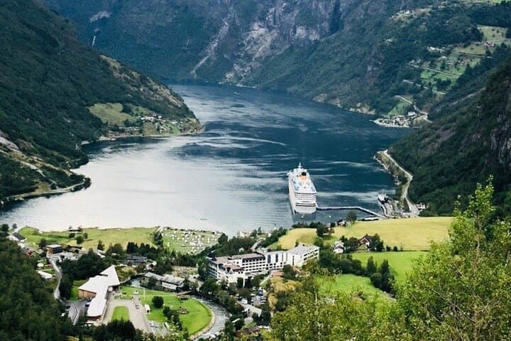
You climb into a coach that hugs mountainsides while the fjord falls away below—sheer rock, slivers of waterfall and the blue-black river of the Geirangerfjord waiting in the valley. The road carves hairpins out of granite; at Flydalsjuvet the valley opens and the village drops like a model under glass. Higher still, the air thins and the Geiranger Skywalk on Mt. Dalsnibba gives a vertigo-tinged panorama over snow patches and the lake Djupvatnet at roughly 1,000 m.
You climb into a coach that hugs mountainsides while the fjord falls away below—sheer rock, slivers of waterfall and the blue-black river of the Geirangerfjord waiting in the valley. The road carves hairpins out of granite; at Flydalsjuvet the valley opens and the village drops like a model under glass. Higher still, the air thins and the Geiranger Skywalk on Mt. Dalsnibba gives a vertigo-tinged panorama over snow patches and the lake Djupvatnet at roughly 1,000 m.
Geirangerfjord is a classic glacial trough, cut deep by ice during the last Ice Age and now protected as part of the West Norwegian Fjords UNESCO site. The Eagle Road (Ørnevegen) is a historic, steep mountain route with engineered hairpins that offer shifting vantage points of the Seven Sisters waterfall cascading into the fjord. Local culture here blends small-scale mountain farming and maritime traditions; farms cling to steep slopes and summer mountain pastures are still in seasonal use.
Practical side: the full loop is a short, mostly vehicle-based excursion with multiple photo stops and short, level walks—good for travelers of most abilities. Roads above Geiranger can remain snowbound into May; weather changes fast at altitude so dress in layers, protect camera gear from spray and wind, and allow time for slow traffic at lookout points. Expect three to four hours total, with some steep viewpoints accessed by short stairways or ramps. Bring a windproof shell, sturdy shoes for slick surfaces, and daylight for the best photographic light.