THE ADVENTURE COLLECTIVE® · Independent discovery and booking for outdoor travel

A full-day, 18 km trek across Langbiang’s three peaks that climbs to 2,167 m, passing pine forest, plantations, and Lat village. Expect varied terrain, cultural encounters, and sweeping highland views.
A full-day, 18 km trek across Langbiang’s three peaks that climbs to 2,167 m, passing pine forest, plantations, and Lat village. Expect varied terrain, cultural encounters, and sweeping highland views.
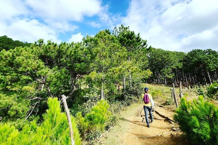
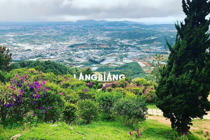
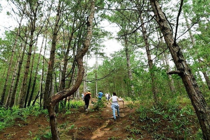
You step off the minivan into thin, cool air and the trail pulls you upward through rows of coffee and vegetable terraces. Pines close ranks like a dark green corridor; open ridgelines expose wide, rolling shoulders that lead to the three summits of Langbiang. The mountain presses at the sky—clouds gather and move as if testing your pace.
Verified experiences and guided adventures in the surrounding area.
Operated by GADT Travel · Da Lat, Lam Dong
You step off the minivan into thin, cool air and the trail pulls you upward through rows of coffee and vegetable terraces. Pines close ranks like a dark green corridor; open ridgelines expose wide, rolling shoulders that lead to the three summits of Langbiang. The mountain presses at the sky—clouds gather and move as if testing your pace.
Langbiang sits in Vietnam’s Central Highlands and carries both geological heft and cultural stories: steep volcanic ridges sculpted by erosion, capped by weathered basalt, and human memory in the K'Ho (Lat) community who have lived these slopes for generations. The peak’s name comes from a local legend of two lovers, Lang and Biang, and the area remains a place where traditional handicrafts and mountain agriculture still shape daily life.
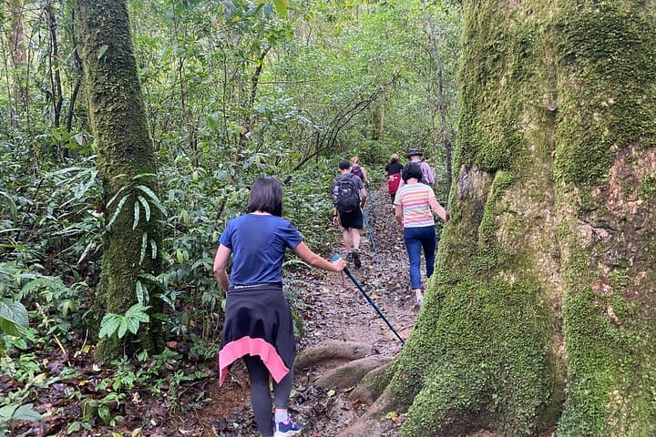
On an 18 km loop that peaks at about 2,167 m, expect transitions from evergreen pine stands to broadleaf jungle and open grassland. Wildlife announces itself in bird calls and small mammal rustles; river gullies and springs punctuate the route. A cultural stop at Lat village provides context and an easy close to the day.
Practical guidance: the route is a sustained day trek of roughly 8 hours with significant ups and downs—bring sturdy boots, 1–2 L of water, sun and rain protection, and trekking poles if you use them. Descents can be hard on knees; pace conservatively and stick to marked trails. Start early to avoid afternoon storms and bring cash for village purchases.
moderate.
8 hours.
Moderate fitness required—regular walkers who are comfortable with sustained climbs and descents will manage well.
The scheduled route is about 18 km and runs around 8 hours with several sustained climbs and descents; it’s rated moderate—good fitness and steady hiking experience are recommended.
Yes—the trip includes an English-speaking guide, pickup and drop-off from central Da Lat hotels, and a packed picnic lunch and bottled water.
The highest point on the route reaches approximately 2,167 meters above sea level—expect cooler temperatures and more wind near the summits.
Facilities are limited; restrooms and small stalls are typically available at the trailhead and Lat village, so bring essentials and cash for village purchases.
Langbiang’s peaks rise from volcanic and sedimentary rock and are tied to local K'Ho (Lat) culture and the legend of Lang and Biang; the zone has long been an agroforestry landscape.
Stay on marked trails to reduce erosion on steep slopes; support local guides and buy crafts locally to help the village economy while keeping campfires and litter out of the forest.
GADT Travel operates guided outdoor trips and adventures with an emphasis on safety, stewardship, and memorable experiences.
You step off the minivan into thin, cool air and the trail pulls you upward through rows of coffee and vegetable terraces. Pines close ranks like a dark green corridor; open ridgelines expose wide, rolling shoulders that lead to the three summits of Langbiang. The mountain presses at the sky—clouds gather and move as if testing your pace.
You step off the minivan into thin, cool air and the trail pulls you upward through rows of coffee and vegetable terraces. Pines close ranks like a dark green corridor; open ridgelines expose wide, rolling shoulders that lead to the three summits of Langbiang. The mountain presses at the sky—clouds gather and move as if testing your pace.
Langbiang sits in Vietnam’s Central Highlands and carries both geological heft and cultural stories: steep volcanic ridges sculpted by erosion, capped by weathered basalt, and human memory in the K'Ho (Lat) community who have lived these slopes for generations. The peak’s name comes from a local legend of two lovers, Lang and Biang, and the area remains a place where traditional handicrafts and mountain agriculture still shape daily life.
On an 18 km loop that peaks at about 2,167 m, expect transitions from evergreen pine stands to broadleaf jungle and open grassland. Wildlife announces itself in bird calls and small mammal rustles; river gullies and springs punctuate the route. A cultural stop at Lat village provides context and an easy close to the day.
Practical guidance: the route is a sustained day trek of roughly 8 hours with significant ups and downs—bring sturdy boots, 1–2 L of water, sun and rain protection, and trekking poles if you use them. Descents can be hard on knees; pace conservatively and stick to marked trails. Start early to avoid afternoon storms and bring cash for village purchases.