THE ADVENTURE COLLECTIVE® · Independent discovery and booking for outdoor travel

An 8‑hour guided hike from Água D’Alto to the crater lake Lagoa do Fogo—travel through levadas, heather and volcanic terrain to one of São Miguel’s clearest alpine lakes. Practical, scenic and rooted in Azorean geology.
An 8‑hour guided hike from Água D’Alto to the crater lake Lagoa do Fogo—travel through levadas, heather and volcanic terrain to one of São Miguel’s clearest alpine lakes. Practical, scenic and rooted in Azorean geology.
You emerge from a ribbon of cryptomeria into cold, clear air; the mountain opens and the lake waits below like a caldera-cut mirror. The trail begins near Água D’Alto on São Miguel’s south coast and climbs through grazing pastures, water levadas, and stands of endemic heather until the rim reveals Lagoa do Fogo’s intense blue.
Verified experiences and guided adventures in the surrounding area.
Operated by Fun Activities - Azores Adventure · Ponta Delgada, Azores
You emerge from a ribbon of cryptomeria into cold, clear air; the mountain opens and the lake waits below like a caldera-cut mirror. The trail begins near Água D’Alto on São Miguel’s south coast and climbs through grazing pastures, water levadas, and stands of endemic heather until the rim reveals Lagoa do Fogo’s intense blue.
Geology here is recent and readable: you’re on the flanks of the island’s youngest stratovolcano, where pumice, basalt and ash shaped a crater that now holds one of Portugal’s most pristine lakes. Human history is quieter—small farms, ancient levadas and coastal fishing villages such as Vila Franca do Campo mark centuries of island life and adaptation.
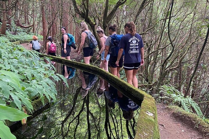
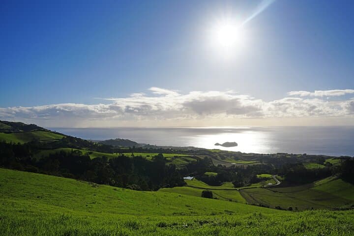
The hike is an active conversation with the island: levadas that once moved water now reflect cedar trunks; hydrangeas push color along the descent; offshore, the ocean reminds you how close volcanic land meets sea. Expect roughly 10–14 km total with about 500–700 m of elevation change depending on route choices, on mixed singletrack, pasture paths and some steeper volcanic scree. Guides typically provide a picnic lunch by the lake shore.
Practical notes: start early for calmer weather and clearer views, bring layered rain protection (the Azores weather changes fast), sturdy boots and 1.5–2 liters of water. Trails are generally waymarked but can be muddy; trekking poles help on descents. Respect reserve rules: no swimming in protected zones, stick to paths and pack out waste. With steady pacing this full-day loop is accessible to hikers with moderate fitness and rewards persistence with expansive views and intimate contact with São Miguel’s volcanic heart.
moderate.
8 hours.
Moderate fitness—comfortable walking on uneven terrain for multiple hours and handling 500–700 m elevation change.
The guided full-day is about 8 hours, typically 10–14 km with 500–700 m elevation change; rated moderate—steady pace and basic trail experience recommended.
Lagoa do Fogo lies within a natural reserve and swimming is discouraged or restricted in some areas—follow guide instructions and signage.
Most operators include pickup and drop‑off from central locations such as Ponta Delgada; confirm pickup point when booking.
Guides usually provide a picnic lunch, but bring any personal snacks and account for dietary needs in booking questions.
Lagoa do Fogo sits within the crater of São Miguel’s youngest stratovolcano; levadas are historic irrigation channels built over centuries.
The area is part of a protected natural reserve—stick to trails, avoid disturbing vegetation and pack out all waste to protect fragile endemic habitats.
Fun Activities - Azores Adventure operates guided outdoor trips and adventures with an emphasis on safety, stewardship, and memorable experiences.
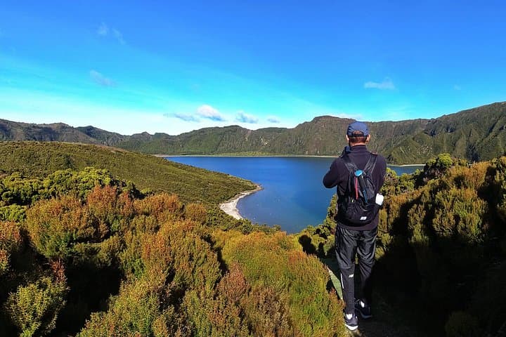
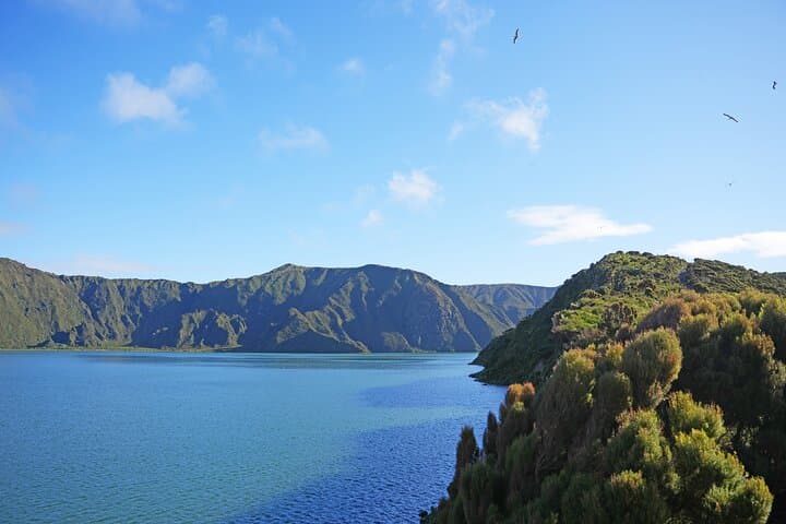
You emerge from a ribbon of cryptomeria into cold, clear air; the mountain opens and the lake waits below like a caldera-cut mirror. The trail begins near Água D’Alto on São Miguel’s south coast and climbs through grazing pastures, water levadas, and stands of endemic heather until the rim reveals Lagoa do Fogo’s intense blue.
You emerge from a ribbon of cryptomeria into cold, clear air; the mountain opens and the lake waits below like a caldera-cut mirror. The trail begins near Água D’Alto on São Miguel’s south coast and climbs through grazing pastures, water levadas, and stands of endemic heather until the rim reveals Lagoa do Fogo’s intense blue.
Geology here is recent and readable: you’re on the flanks of the island’s youngest stratovolcano, where pumice, basalt and ash shaped a crater that now holds one of Portugal’s most pristine lakes. Human history is quieter—small farms, ancient levadas and coastal fishing villages such as Vila Franca do Campo mark centuries of island life and adaptation.
The hike is an active conversation with the island: levadas that once moved water now reflect cedar trunks; hydrangeas push color along the descent; offshore, the ocean reminds you how close volcanic land meets sea. Expect roughly 10–14 km total with about 500–700 m of elevation change depending on route choices, on mixed singletrack, pasture paths and some steeper volcanic scree. Guides typically provide a picnic lunch by the lake shore.
Practical notes: start early for calmer weather and clearer views, bring layered rain protection (the Azores weather changes fast), sturdy boots and 1.5–2 liters of water. Trails are generally waymarked but can be muddy; trekking poles help on descents. Respect reserve rules: no swimming in protected zones, stick to paths and pack out waste. With steady pacing this full-day loop is accessible to hikers with moderate fitness and rewards persistence with expansive views and intimate contact with São Miguel’s volcanic heart.