THE ADVENTURE COLLECTIVE® · Independent discovery and booking for outdoor travel

Walk across freshly formed lava fields with a professional geologist and learn the science behind Iceland’s 2021 eruption. This small-group hike from Reykjavík combines hands-on geology with a rugged, exposed walk to a crater viewpoint.
Walk across freshly formed lava fields with a professional geologist and learn the science behind Iceland’s 2021 eruption. This small-group hike from Reykjavík combines hands-on geology with a rugged, exposed walk to a crater viewpoint.
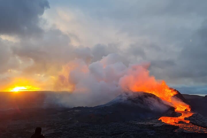
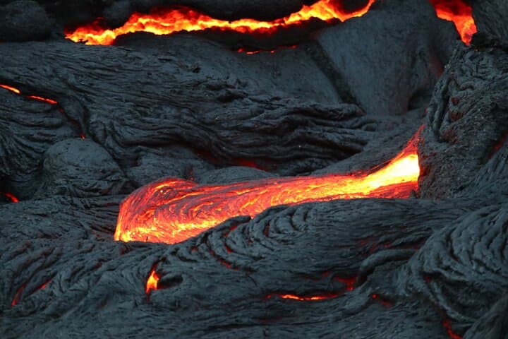
You step off the bus into a landscape that still smells faintly of sulfur and iron — a black expanse of glassy, fractured lava stretching toward a low volcanic cone. Wind pushes across the Reykjanes Peninsula and, under a sky that can flip from clear to stormy in an hour, your guide — a professional geologist — points out fresh crust, blocky ʻaʻā flow textures, and the hairline seams where tectonic plates meet.
Verified experiences and guided adventures in the surrounding area.
Operated by Geoadventures Iceland · Reykjavík, Reykjanes Peninsula
You step off the bus into a landscape that still smells faintly of sulfur and iron — a black expanse of glassy, fractured lava stretching toward a low volcanic cone. Wind pushes across the Reykjanes Peninsula and, under a sky that can flip from clear to stormy in an hour, your guide — a professional geologist — points out fresh crust, blocky ʻaʻā flow textures, and the hairline seams where tectonic plates meet.
This site rose to global attention in 2021 when fissures opened and rewrote local maps. Geologically the area sits on the Mid-Atlantic Ridge where Eurasian and North American plates pull apart; what you walk on is newly formed basalt, mostly fine-grained and sharp-edged. Culturally the peninsula has fishing and seafaring roots, and recent eruptions have drawn scientists and photographers while reshaping grazing and travel routes.
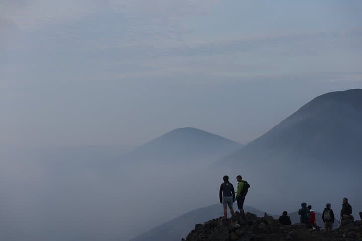
Expect a steady, exposed hike across uneven, jagged terrain. The walk to the main crater viewpoint typically takes 1–1.5 hours each way over lava fields that test ankle stability. Guides explain lava chemistry, cooling patterns, and how heat and steam alter surfaces; visible molten lava is uncommon but the terrain itself is a live classroom.
Practical tips: wear stiff, treaded boots and bring windproof layers, 1–2 liters of water, and a headlamp if conditions call for it. Check weather and cancellations — tours run from Reykjavík and include transport; cancelations occur for poor weather or safety. Respect cordoned areas: the crust may be unstable and vegetation recovery is slow. This is a compact, intense encounter with Earth’s recent work — part science field trip, part raw hike.
moderate.
4–6 hours.
Moderate fitness — able to hike 3–5 miles over uneven terrain with some elevation and sustained exposure to wind and cold.
The walk is typically about 1–1.5 hours each way across uneven lava fields; the full tour including transport runs 4–6 hours.
Visible molten lava is rare and cannot be guaranteed; the main draw is fresh volcanic landforms and geology explained by your guide.
Not recommended for children under 12 due to rough terrain and safety considerations noted by the operator.
The tour provider may cancel for unsafe weather; you’ll be eligible for a refund if you cancel at least 24 hours beforehand per the operator’s policy.
The Reykjanes Peninsula is an active volcanic zone on the Mid-Atlantic Ridge; the 2021 Fagradalsfjall eruption created new lava fields and altered local routes.
The fresh lava fields are fragile—avoid kicking or walking on early moss and lichen; follow guide instructions to limit erosion and protect slow-recovering habitats.
Geoadventures Iceland operates guided outdoor trips and adventures with an emphasis on safety, stewardship, and memorable experiences.
You step off the bus into a landscape that still smells faintly of sulfur and iron — a black expanse of glassy, fractured lava stretching toward a low volcanic cone. Wind pushes across the Reykjanes Peninsula and, under a sky that can flip from clear to stormy in an hour, your guide — a professional geologist — points out fresh crust, blocky ʻaʻā flow textures, and the hairline seams where tectonic plates meet.
You step off the bus into a landscape that still smells faintly of sulfur and iron — a black expanse of glassy, fractured lava stretching toward a low volcanic cone. Wind pushes across the Reykjanes Peninsula and, under a sky that can flip from clear to stormy in an hour, your guide — a professional geologist — points out fresh crust, blocky ʻaʻā flow textures, and the hairline seams where tectonic plates meet.
This site rose to global attention in 2021 when fissures opened and rewrote local maps. Geologically the area sits on the Mid-Atlantic Ridge where Eurasian and North American plates pull apart; what you walk on is newly formed basalt, mostly fine-grained and sharp-edged. Culturally the peninsula has fishing and seafaring roots, and recent eruptions have drawn scientists and photographers while reshaping grazing and travel routes.
Expect a steady, exposed hike across uneven, jagged terrain. The walk to the main crater viewpoint typically takes 1–1.5 hours each way over lava fields that test ankle stability. Guides explain lava chemistry, cooling patterns, and how heat and steam alter surfaces; visible molten lava is uncommon but the terrain itself is a live classroom.
Practical tips: wear stiff, treaded boots and bring windproof layers, 1–2 liters of water, and a headlamp if conditions call for it. Check weather and cancellations — tours run from Reykjavík and include transport; cancelations occur for poor weather or safety. Respect cordoned areas: the crust may be unstable and vegetation recovery is slow. This is a compact, intense encounter with Earth’s recent work — part science field trip, part raw hike.