THE ADVENTURE COLLECTIVE® · Independent discovery and booking for outdoor travel

Walk an ancient ocean floor at 2,500 m where wind-carved salt ridges and dunes create a moonlike expanse. This guided loop balances cinematic views with practical logistics — timed for afternoon light and altitude-aware pacing.
Walk an ancient ocean floor at 2,500 m where wind-carved salt ridges and dunes create a moonlike expanse. This guided loop balances cinematic views with practical logistics — timed for afternoon light and altitude-aware pacing.
A visit to Valle de la Luna begins with the air thinning and the horizon sharpening — ridged salt formations and powdered dunes rise like weathered sculptures under a flat sky. Travelers step out at roughly 2,500 meters elevation into a 400+ km² depression where wind and intermittent water have carved tight ravines, sharp spires and broad salt flats that change color as the sun slides.
Verified experiences and guided adventures in the surrounding area.
Operated by TourGo · San Pedro de Atacama, Antofagasta Region
A visit to Valle de la Luna begins with the air thinning and the horizon sharpening — ridged salt formations and powdered dunes rise like weathered sculptures under a flat sky. Travelers step out at roughly 2,500 meters elevation into a 400+ km² depression where wind and intermittent water have carved tight ravines, sharp spires and broad salt flats that change color as the sun slides.
Geologists call this region an ancient oceanic floor; layers of evaporites and volcanic deposits explain the moonscape look and the old name Las Salinas, a reference to historic salt workings. Culture and history are subtle here: indigenous Atacameño groups have long traversed the basin and nearby oases supplied caravans. The land reads like a slow-motion chronicle of erosion — cliffs, badlands, and pointed walls that catch light and shadow differently every hour.
Practically, expect mixed terrain: packed salt crust, scree slopes and sandfields with short steep pitches; many guided loops cover 3–6 km with minimal sustained elevation gain but constant uneven footing. Best timing is late afternoon into sunset when temperatures moderate and colors intensify. Bring sun protection, 2–3 liters of water, ankle-support boots and layers for rapid temperature drops. Altitude can affect breathing and pace, so move deliberately and hydrate before and during the outing.
A guided tour will add interpretation and safe access to fragile zones — stay on trails, pack out waste, and respect archaeological sites. Valle de la Luna rewards slow observation: the landscape shifts with wind, light and your boots, daring you to read its long, patient history.
moderate.
4–5 hours.
Moderate fitness; comfortable walking 3–6 km on uneven terrain and able to manage short steep sections at altitude.
Guided visits commonly last 3–5 hours including transport and interpretation; on-site walking loops are often 3–6 km total.
Most routes are non-technical but uneven footing and sand require good shoes and moderate fitness; altitude may make easy distances feel harder.
Late afternoon into sunset offers the best light and cooler temperatures, but mornings are also pleasant and less windy.
At about 2,500 m some visitors experience mild shortness of breath or headache—take it slow, hydrate, and avoid heavy exertion on arrival day.
Valle de la Luna sits on uplifted marine deposits; salt extraction historically gave it the name Las Salinas and traces of past human use appear in nearby oases.
This fragile desert surface erodes easily—stay on designated paths, take all waste out and avoid disturbing geological or archaeological features.
TourGo operates guided outdoor trips and adventures with an emphasis on safety, stewardship, and memorable experiences.
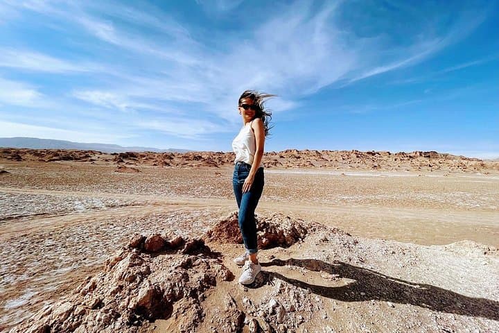
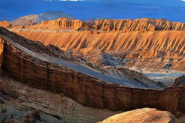
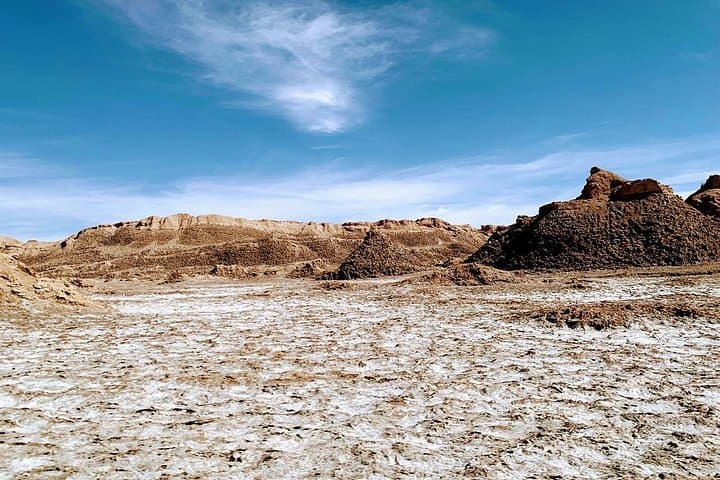
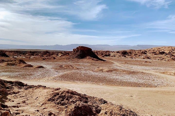
A visit to Valle de la Luna begins with the air thinning and the horizon sharpening — ridged salt formations and powdered dunes rise like weathered sculptures under a flat sky. Travelers step out at roughly 2,500 meters elevation into a 400+ km² depression where wind and intermittent water have carved tight ravines, sharp spires and broad salt flats that change color as the sun slides.
A visit to Valle de la Luna begins with the air thinning and the horizon sharpening — ridged salt formations and powdered dunes rise like weathered sculptures under a flat sky. Travelers step out at roughly 2,500 meters elevation into a 400+ km² depression where wind and intermittent water have carved tight ravines, sharp spires and broad salt flats that change color as the sun slides.
Geologists call this region an ancient oceanic floor; layers of evaporites and volcanic deposits explain the moonscape look and the old name Las Salinas, a reference to historic salt workings. Culture and history are subtle here: indigenous Atacameño groups have long traversed the basin and nearby oases supplied caravans. The land reads like a slow-motion chronicle of erosion — cliffs, badlands, and pointed walls that catch light and shadow differently every hour.
Practically, expect mixed terrain: packed salt crust, scree slopes and sandfields with short steep pitches; many guided loops cover 3–6 km with minimal sustained elevation gain but constant uneven footing. Best timing is late afternoon into sunset when temperatures moderate and colors intensify. Bring sun protection, 2–3 liters of water, ankle-support boots and layers for rapid temperature drops. Altitude can affect breathing and pace, so move deliberately and hydrate before and during the outing.
A guided tour will add interpretation and safe access to fragile zones — stay on trails, pack out waste, and respect archaeological sites. Valle de la Luna rewards slow observation: the landscape shifts with wind, light and your boots, daring you to read its long, patient history.