THE ADVENTURE COLLECTIVE® · Independent discovery and booking for outdoor travel

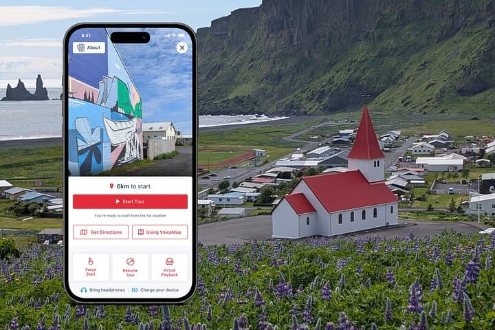
Walk from the red-roofed Víkurkirkja through Vík’s compact center to the dramatic black sands of Reynisfjara with a downloadable GPS audio guide. Expect geology, local history, and practical safety notes on one easy loop.
Walk from the red-roofed Víkurkirkja through Vík’s compact center to the dramatic black sands of Reynisfjara with a downloadable GPS audio guide. Expect geology, local history, and practical safety notes on one easy loop.
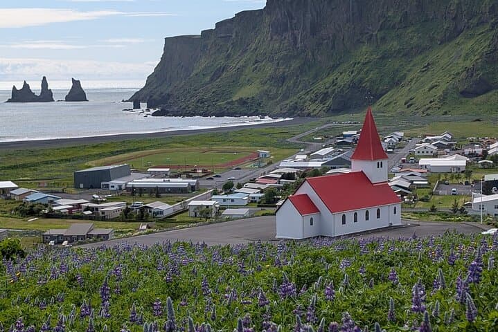
A wind that smells of sea and sulfur greets you as you step off the bus and climb toward the red-roofed Víkurkirkja. The church perches on a grassy knoll above the compact village, its white walls doubling as a community evacuation point should Katla wake under the ice-cap.
Verified experiences and guided adventures in the surrounding area.
Operated by VoiceMap Audio Tours · Vík, Southern Region
A wind that smells of sea and sulfur greets you as you step off the bus and climb toward the red-roofed Víkurkirkja. The church perches on a grassy knoll above the compact village, its white walls doubling as a community evacuation point should Katla wake under the ice-cap.
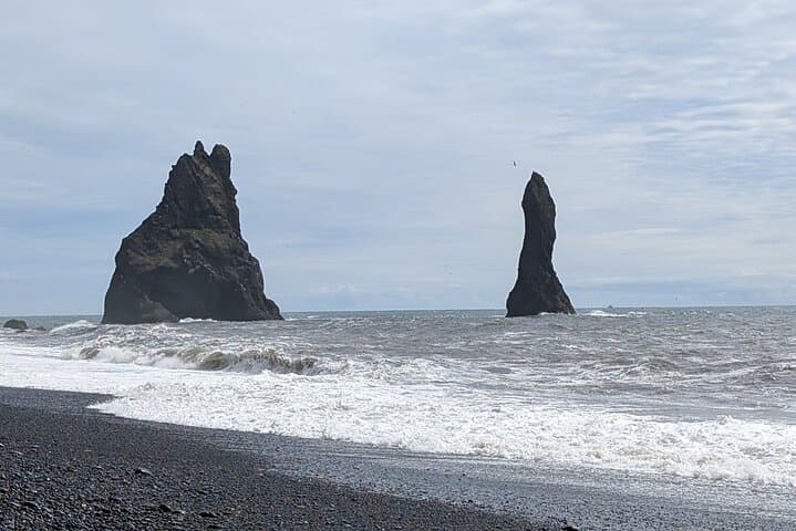
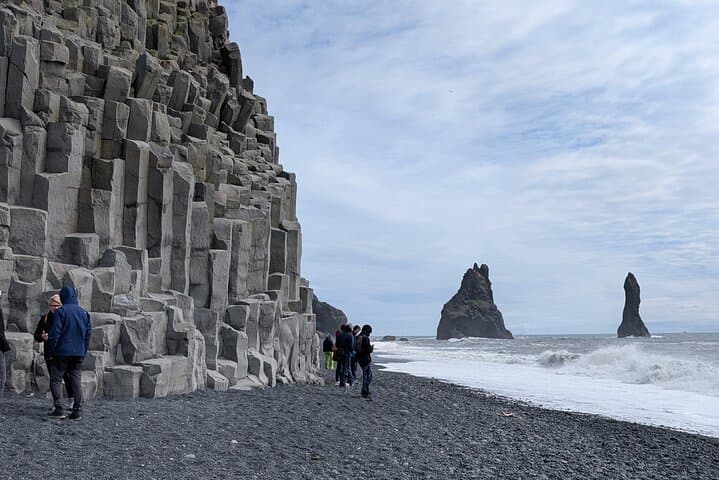
This self-guided walk threads together Vík’s practical fishing heritage and dramatic geology. You’ll pass low-profile modern touches—the Lava Show and local brewery—before the route opens to the black sand where Reynisdrangar’s basalt columns and sea stacks rise like weathered sentinels. The coastline here is a lesson in erosion: pillow lavas, columnar basalt, and wave-carved cliffs that record centuries of volcanic and oceanic force.
Local culture in Vík is shaped by the mountain and the glacier above—Mýrdalsjökull—and by decades of fishing life that rebuilt the village after storms and ash. Small museums and cafés anchor community memory; Icelanders here remain practical and safety-minded, signs of that in the visible evacuation routes.
Practical guidance: download the VoiceMap tour before you arrive and bring headphones and a charged phone. Allow 40–60 minutes to follow the mapped route at a relaxed pace; add time if you linger at the beach or museum. Weather turns fast—layer and wear waterproof footwear. Never turn your back on the surf: sneaker waves and strong currents make Reynisfjara hazardous, and barriers should be respected. Morning light and long summer days offer the best visibility; winter visits demand microspikes and shorter daylight planning.
easy.
40–60 minutes.
Suitable for most fitness levels; mostly flat walking with short slopes near the church
The tour is designed to be completed in 40–60 minutes at a steady pace; allow extra time to explore sites and viewpoints.
No — this is a self‑guided GPS audio tour; you redeem a code in the VoiceMap app and follow turn‑by‑turn directions.
The beach is accessible, but dangerous sneaker waves are common; always obey warning signs and stay well back from the surf edge.
The church is usually closed to general public access and is noted as an evacuation point; the tour uses it as the recognizable start location but doesn’t include entry.
Vík grew as a fishing and service village shaped by storms, ash falls, and the presence of Katla beneath Mýrdalsjökull; the community maintains practical evacuation infrastructure.
Stick to paths and marked viewpoints to protect nesting birds and fragile moss-covered lava; do not remove rocks or shells and pack out all trash.
VoiceMap Audio Tours operates guided outdoor trips and adventures with an emphasis on safety, stewardship, and memorable experiences.
A wind that smells of sea and sulfur greets you as you step off the bus and climb toward the red-roofed Víkurkirkja. The church perches on a grassy knoll above the compact village, its white walls doubling as a community evacuation point should Katla wake under the ice-cap.
A wind that smells of sea and sulfur greets you as you step off the bus and climb toward the red-roofed Víkurkirkja. The church perches on a grassy knoll above the compact village, its white walls doubling as a community evacuation point should Katla wake under the ice-cap.
This self-guided walk threads together Vík’s practical fishing heritage and dramatic geology. You’ll pass low-profile modern touches—the Lava Show and local brewery—before the route opens to the black sand where Reynisdrangar’s basalt columns and sea stacks rise like weathered sentinels. The coastline here is a lesson in erosion: pillow lavas, columnar basalt, and wave-carved cliffs that record centuries of volcanic and oceanic force.
Local culture in Vík is shaped by the mountain and the glacier above—Mýrdalsjökull—and by decades of fishing life that rebuilt the village after storms and ash. Small museums and cafés anchor community memory; Icelanders here remain practical and safety-minded, signs of that in the visible evacuation routes.
Practical guidance: download the VoiceMap tour before you arrive and bring headphones and a charged phone. Allow 40–60 minutes to follow the mapped route at a relaxed pace; add time if you linger at the beach or museum. Weather turns fast—layer and wear waterproof footwear. Never turn your back on the surf: sneaker waves and strong currents make Reynisfjara hazardous, and barriers should be respected. Morning light and long summer days offer the best visibility; winter visits demand microspikes and shorter daylight planning.