THE ADVENTURE COLLECTIVE® · Independent discovery and booking for outdoor travel

Reach Thailand’s rooftop in a day: cool cloud forest, a summit shrine, rushing waterfalls and short walks — all within an easy drive from Chiang Mai. Read on for what to expect, what to pack and local insights to make the most of the Doi Inthanon experience.
Reach Thailand’s rooftop in a day: cool cloud forest, a summit shrine, rushing waterfalls and short walks — all within an easy drive from Chiang Mai. Read on for what to expect, what to pack and local insights to make the most of the Doi Inthanon experience.
A cold, thin wind pushes through moss-draped branches as the road climbs toward the summit of Doi Inthanon. At 2,565 meters the air tastes different — cleaner, cooler — and a shrine to Chao Inthawitchayanon marks where mountain and culture meet. Visitors arrive to sweeping viewpoints, falls plunging through granite steps, and short forest walks that let the park’s biodiversity move close.
Verified experiences and guided adventures in the surrounding area.
Operated by I Asia Thailand · Chiang Mai, Chiang Mai Province
A cold, thin wind pushes through moss-draped branches as the road climbs toward the summit of Doi Inthanon. At 2,565 meters the air tastes different — cleaner, cooler — and a shrine to Chao Inthawitchayanon marks where mountain and culture meet. Visitors arrive to sweeping viewpoints, falls plunging through granite steps, and short forest walks that let the park’s biodiversity move close.
The park sits on the highest massif in Thailand and was designated a national park in the early 1970s to protect its high-elevation cloud forest and watershed. Geologically the range is older granite and metamorphic rock; soils and elevation create pockets of cool-climate plant communities rare in the tropics. Culturally, the summit shrine and nearby Hmong and Karen communities speak to long human ties to these slopes — markets and royal agricultural projects are visible reminders of that history.
Practically, most day tours from Chiang Mai combine a series of short stops: a summit viewpoint and shrine, Wachirathan Waterfall, a picnic or open-air lunch, and a short walk such as Michael’s Trail through cloud forest. Expect minimal sustained elevation gain on the short trails (generally under ~100 m) but bring warm layers — temperatures can drop sharply. Trails are a mix of packed dirt, roots and occasional steps; during the rainy season sections get muddy and slick. Hydrate, wear grippy footwear, respect temple clothing rules, and leave no trace: stay on paths, carry out waste, and avoid feeding wildlife. For people who want a compact, wildlife-rich mountain day with cultural stops and accessible walking, Doi Inthanon delivers a cool, immediate contrast to Chiang Mai’s lowland heat.
moderate.
7–9 hours.
Suitable for people with basic fitness — able to stand and walk for short uphill sections and handle stairs; not technical.
The summit is 2,565 m. Most visitors feel only mild breathlessness on exertion; pacing, hydration and a warm layer are usually sufficient.
Most organized day tours include park entry, a guide, lunch and round-trip transport from Chiang Mai city hotels — confirm inclusions with your operator.
Michael’s Trail is a short interpretive loop through cloud forest suitable for most abilities; the route involves gentle grades and boardwalks or dirt paths with minimal elevation change.
Yes — dress modestly (no bare shoulders or short skirts/shorts), remove shoes inside certain areas, and be respectful when photographing worshippers.
The summit shrine honors Chao Inthawitchayanon, a former ruler associated with conservation of the watershed; the park was designated in the 1970s to protect highland forests.
Heavy visitation concentrates impacts near viewpoints and trails; stick to paths, avoid single-use plastics, and support local projects that restore native forest.
I Asia Thailand operates guided outdoor trips and adventures with an emphasis on safety, stewardship, and memorable experiences.
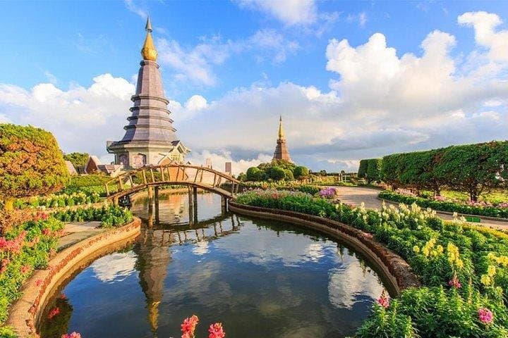
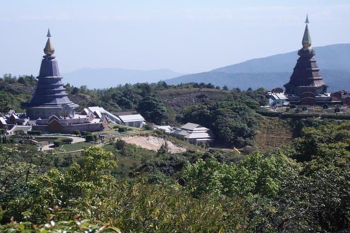
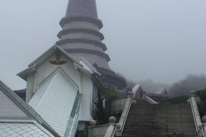

A cold, thin wind pushes through moss-draped branches as the road climbs toward the summit of Doi Inthanon. At 2,565 meters the air tastes different — cleaner, cooler — and a shrine to Chao Inthawitchayanon marks where mountain and culture meet. Visitors arrive to sweeping viewpoints, falls plunging through granite steps, and short forest walks that let the park’s biodiversity move close.
A cold, thin wind pushes through moss-draped branches as the road climbs toward the summit of Doi Inthanon. At 2,565 meters the air tastes different — cleaner, cooler — and a shrine to Chao Inthawitchayanon marks where mountain and culture meet. Visitors arrive to sweeping viewpoints, falls plunging through granite steps, and short forest walks that let the park’s biodiversity move close.
The park sits on the highest massif in Thailand and was designated a national park in the early 1970s to protect its high-elevation cloud forest and watershed. Geologically the range is older granite and metamorphic rock; soils and elevation create pockets of cool-climate plant communities rare in the tropics. Culturally, the summit shrine and nearby Hmong and Karen communities speak to long human ties to these slopes — markets and royal agricultural projects are visible reminders of that history.
Practically, most day tours from Chiang Mai combine a series of short stops: a summit viewpoint and shrine, Wachirathan Waterfall, a picnic or open-air lunch, and a short walk such as Michael’s Trail through cloud forest. Expect minimal sustained elevation gain on the short trails (generally under ~100 m) but bring warm layers — temperatures can drop sharply. Trails are a mix of packed dirt, roots and occasional steps; during the rainy season sections get muddy and slick. Hydrate, wear grippy footwear, respect temple clothing rules, and leave no trace: stay on paths, carry out waste, and avoid feeding wildlife. For people who want a compact, wildlife-rich mountain day with cultural stops and accessible walking, Doi Inthanon delivers a cool, immediate contrast to Chiang Mai’s lowland heat.