THE ADVENTURE COLLECTIVE® · Independent discovery and booking for outdoor travel

A 17-day photography expedition through the Khumbu that pairs classic Everest viewpoints with the glacial turquoise lakes of Gokyo. Plan for high-altitude days, teahouse nights, and exceptional dawn light from Kala Patthar and Gokyo Ri.
A 17-day photography expedition through the Khumbu that pairs classic Everest viewpoints with the glacial turquoise lakes of Gokyo. Plan for high-altitude days, teahouse nights, and exceptional dawn light from Kala Patthar and Gokyo Ri.
The morning light slices the Himalayan horizon as a small plane noses toward Lukla—the gateway to the Khumbu—and the expedition begins. Trekkers move through prayer-fluttered villages, cross suspension bridges over the Dudh Kosi, and climb through rhododendron forests into a landscape that gets thinner at each step. Peaks loom closer: Ama Dablam’s serrated face, the bulk of Lhotse, and the icy line of Everest itself.
Verified experiences and guided adventures in the surrounding area.
Operated by Places Nepal Trek & Tours · Gokyo, Province No. 1
The morning light slices the Himalayan horizon as a small plane noses toward Lukla—the gateway to the Khumbu—and the expedition begins. Trekkers move through prayer-fluttered villages, cross suspension bridges over the Dudh Kosi, and climb through rhododendron forests into a landscape that gets thinner at each step. Peaks loom closer: Ama Dablam’s serrated face, the bulk of Lhotse, and the icy line of Everest itself.
This 17-day photography-focused itinerary combines classical Everest trekking (Lukla–Namche–Tengboche–Dingboche–Lobuche–Gorakshep) with detours to Gokyo Valley and Gokyo Ri, offering views from Kala Patthar (~5,643 m) and Gokyo Ri (~5,360 m). Geologically, you’re crossing uplifted metamorphic and glacial terrain—moraine fields, the Ngozumpa Glacier, and turquoise glacial lakes formed by melt and moraine dams.
Culturally the route threads Sherpa villages, gompas, and memorial stones honoring climbers; visitors will encounter prayer wheels, mani walls, and local hospitality in teahouses. Photography windows are disciplined by altitude and weather: dawn and dusk yield the sharpest light, while midday offers clearer distant peaks after morning haze.
Practically, expect long days on rocky trails with elevation gains that demand paced ascents and rest days for acclimatization in Namche and Dingboche. Lukla flights can be relocated to Manthali—plan buffer days. Carry layered insulation, sun protection, a warm sleeping system, and enough battery power for cameras at cold temps. Hydrate smartly, monitor oxygen with a pulse oximeter, and respect the rhythm of altitude: slow, steady, photograph often.
difficult.
16–17 days.
Strong aerobic fitness with experience in multi-day high-altitude trekking; ability to hike 6–8 hours on uneven terrain at 4,000–5,600 m.
Yes—timers and permits include the Sagarmatha National Park permit and TIMS card; tour operator handles permits but carry copies.
Very possible—Lukla is highly weather-dependent; operators often reroute flights to Manthali (a 5–6 hour drive from Kathmandu) during congestion or poor weather.
Prior exposure helps, but with a licensed guide, proper acclimatization days, and fitness training most experienced trekkers complete the route safely.
Routine travel vaccinations plus altitude awareness; bring a first-aid kit, altitude meds if prescribed, and use pulse oximetry monitoring provided by guides.
The Khumbu was historically traversed by Tibetan-Sherpa trade routes; modern trekking grew after Edmund Hillary supported schools and hospitals in the region following 1950s expeditions.
Sagarmatha National Park enforces permit systems to limit impacts; stick to established trails, avoid single-use plastics, and respect local waste-management rules.
Places Nepal Trek & Tours operates guided outdoor trips and adventures with an emphasis on safety, stewardship, and memorable experiences.
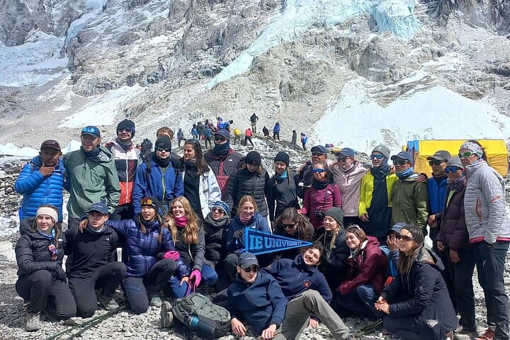
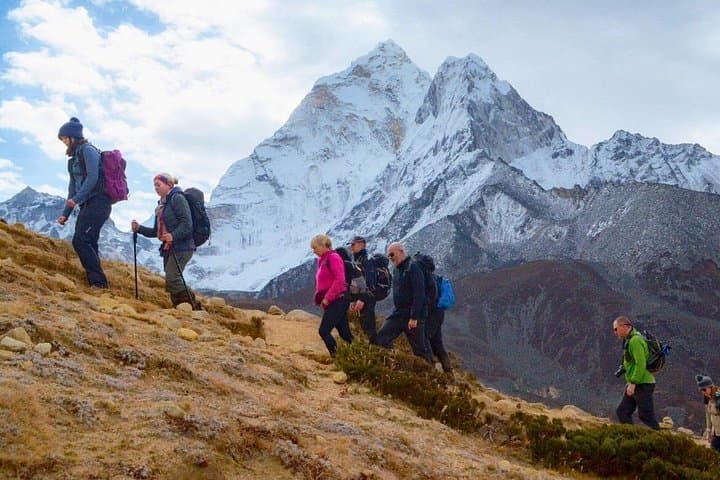
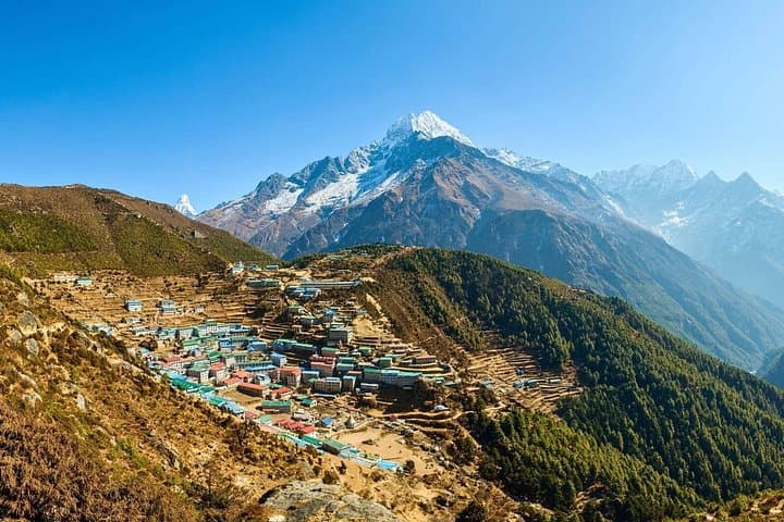
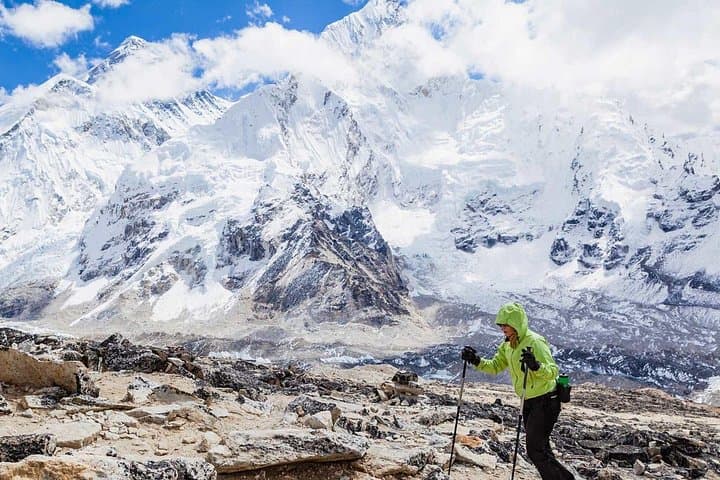
The morning light slices the Himalayan horizon as a small plane noses toward Lukla—the gateway to the Khumbu—and the expedition begins. Trekkers move through prayer-fluttered villages, cross suspension bridges over the Dudh Kosi, and climb through rhododendron forests into a landscape that gets thinner at each step. Peaks loom closer: Ama Dablam’s serrated face, the bulk of Lhotse, and the icy line of Everest itself.
The morning light slices the Himalayan horizon as a small plane noses toward Lukla—the gateway to the Khumbu—and the expedition begins. Trekkers move through prayer-fluttered villages, cross suspension bridges over the Dudh Kosi, and climb through rhododendron forests into a landscape that gets thinner at each step. Peaks loom closer: Ama Dablam’s serrated face, the bulk of Lhotse, and the icy line of Everest itself.
This 17-day photography-focused itinerary combines classical Everest trekking (Lukla–Namche–Tengboche–Dingboche–Lobuche–Gorakshep) with detours to Gokyo Valley and Gokyo Ri, offering views from Kala Patthar (~5,643 m) and Gokyo Ri (~5,360 m). Geologically, you’re crossing uplifted metamorphic and glacial terrain—moraine fields, the Ngozumpa Glacier, and turquoise glacial lakes formed by melt and moraine dams.
Culturally the route threads Sherpa villages, gompas, and memorial stones honoring climbers; visitors will encounter prayer wheels, mani walls, and local hospitality in teahouses. Photography windows are disciplined by altitude and weather: dawn and dusk yield the sharpest light, while midday offers clearer distant peaks after morning haze.
Practically, expect long days on rocky trails with elevation gains that demand paced ascents and rest days for acclimatization in Namche and Dingboche. Lukla flights can be relocated to Manthali—plan buffer days. Carry layered insulation, sun protection, a warm sleeping system, and enough battery power for cameras at cold temps. Hydrate smartly, monitor oxygen with a pulse oximeter, and respect the rhythm of altitude: slow, steady, photograph often.