THE ADVENTURE COLLECTIVE® · Independent discovery and booking for outdoor travel

Combine the alpine lakes of Gokyo with a summit dawn at Kalapathar and a visit to Everest Base Camp on a demanding 15–17 day trek. This guide covers what to expect—terrain, culture, logistics and essential prep—so you can plan with confidence.
Combine the alpine lakes of Gokyo with a summit dawn at Kalapathar and a visit to Everest Base Camp on a demanding 15–17 day trek. This guide covers what to expect—terrain, culture, logistics and essential prep—so you can plan with confidence.
A thin, cold light slices the Himalayan skyline as trekkers climb from Gorakshep toward Kalapathar, breath visible in the high air. The world below—tea houses, moraine, and distant expedition tents—shrinks into a rocky map; above, Everest and its neighbors hold court in raw, glinting stone.
Verified experiences and guided adventures in the surrounding area.
Operated by Hit The Himalaya · Lukla, Province No. 1
A thin, cold light slices the Himalayan skyline as trekkers climb from Gorakshep toward Kalapathar, breath visible in the high air. The world below—tea houses, moraine, and distant expedition tents—shrinks into a rocky map; above, Everest and its neighbors hold court in raw, glinting stone.
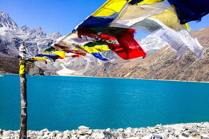
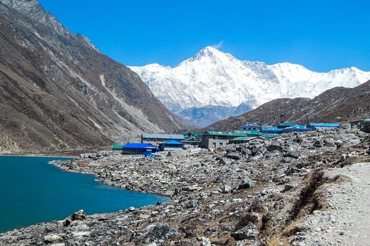
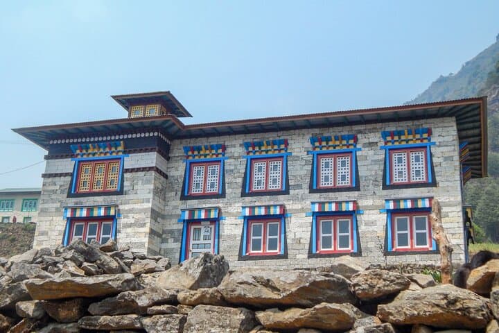
The combined Gokyo–EBC route threads two classic Khumbu valleys divided by the Cho-La Pass (≈5,367 m). Geologically recent uplift and active glaciation shape the route: moraines, crevassed glacier tongues and sapphire oligotrophic lakes like Gokyo I–III. Culturally, the trail moves through Sherpa villages—Namche Bazaar’s market energy, Mani walls, and Tengboche’s monastery reveal Buddhism’s living presence and mountaineering history from Hillary and Tenzing to modern expeditions.
Expect sustained elevation gain: Lukla (2,840 m) to Gokyo Ri (5,357 m) and EBC (≈5,360 m) over 15–17 days, with daily hikes of 4–8 hours and technical sections on the Cho-La that can be icy and loose. Weather shifts fast—sunlit ridgelines freeze into wind-swept knife-edges by afternoon—and water sources become scarce above tree line.
Practical guidance: pace for acclimatization (built-in rest days at Namche and Gokyo), pack layered insulation and a lightweight sleeping bag rated to -10°C, carry a water filter and emergency altitude medication, and budget extra days for Lukla flight delays. Guided groups supply permits, lodge accommodation and porters; for independent trekkers, register permits (TIMS/Sagarmatha NP) and have robust emergency evacuation insurance. Move early on high passes, respect local culture, and leave no trace—these mountains keep what you forget.
challenging.
15–17 days.
Strong cardiovascular fitness and experience with multi-day high‑altitude hiking; able to carry a daypack for 6–8 hour days.
Yes—register with TIMS and obtain the Sagarmatha National Park permit; tour operators typically arrange these for guided groups.
Spring (March–May) and autumn (Sept–Nov) offer the most stable weather, clearer views and fuller teahouse services.
Risk is significant; the itinerary includes acclimatization days but monitor symptoms, ascend slowly, and be prepared to descend if severe signs occur—carry acetazolamide only under medical advice.
Fit beginners can attempt it with a guided group and proper acclimatization, but prior multi-day hiking experience at high altitude is strongly recommended.
The Khumbu has long been inhabited by Sherpa communities and became a focal point of mountaineering after the 1953 Everest ascent; lodges and routes evolved from porter trails and pilgrimage paths.
Sagarmatha National Park regulates trekking and waste; visitors should carry out non-biodegradable waste and minimize single-use plastic to protect fragile alpine lakes and glaciers.
Hit The Himalaya operates guided outdoor trips and adventures with an emphasis on safety, stewardship, and memorable experiences.
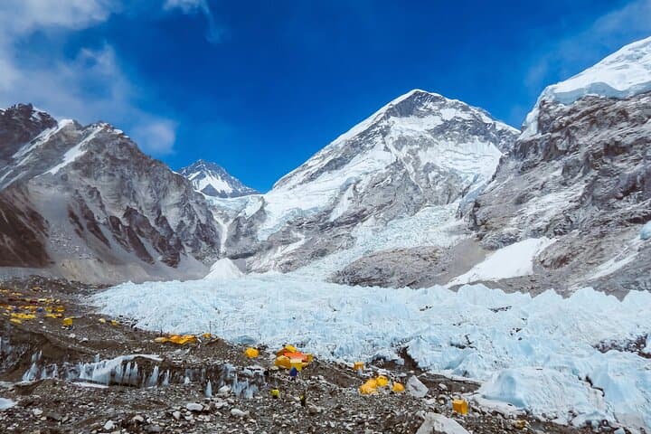
A thin, cold light slices the Himalayan skyline as trekkers climb from Gorakshep toward Kalapathar, breath visible in the high air. The world below—tea houses, moraine, and distant expedition tents—shrinks into a rocky map; above, Everest and its neighbors hold court in raw, glinting stone.
A thin, cold light slices the Himalayan skyline as trekkers climb from Gorakshep toward Kalapathar, breath visible in the high air. The world below—tea houses, moraine, and distant expedition tents—shrinks into a rocky map; above, Everest and its neighbors hold court in raw, glinting stone.
The combined Gokyo–EBC route threads two classic Khumbu valleys divided by the Cho-La Pass (≈5,367 m). Geologically recent uplift and active glaciation shape the route: moraines, crevassed glacier tongues and sapphire oligotrophic lakes like Gokyo I–III. Culturally, the trail moves through Sherpa villages—Namche Bazaar’s market energy, Mani walls, and Tengboche’s monastery reveal Buddhism’s living presence and mountaineering history from Hillary and Tenzing to modern expeditions.
Expect sustained elevation gain: Lukla (2,840 m) to Gokyo Ri (5,357 m) and EBC (≈5,360 m) over 15–17 days, with daily hikes of 4–8 hours and technical sections on the Cho-La that can be icy and loose. Weather shifts fast—sunlit ridgelines freeze into wind-swept knife-edges by afternoon—and water sources become scarce above tree line.
Practical guidance: pace for acclimatization (built-in rest days at Namche and Gokyo), pack layered insulation and a lightweight sleeping bag rated to -10°C, carry a water filter and emergency altitude medication, and budget extra days for Lukla flight delays. Guided groups supply permits, lodge accommodation and porters; for independent trekkers, register permits (TIMS/Sagarmatha NP) and have robust emergency evacuation insurance. Move early on high passes, respect local culture, and leave no trace—these mountains keep what you forget.