THE ADVENTURE COLLECTIVE® · Independent discovery and booking for outdoor travel

Download a self-guided map that strings together secluded beaches, crystal rivers, karst caves and El Yunque trails on Puerto Rico’s east coast. Perfect if you have a rental car and want freedom to explore at your own pace.
Download a self-guided map that strings together secluded beaches, crystal rivers, karst caves and El Yunque trails on Puerto Rico’s east coast. Perfect if you have a rental car and want freedom to explore at your own pace.
You roll off the highway and the air immediately changes — humid, green, heavy with salt and the song of coquí frogs. A downloaded PDF map becomes your companion: push one link and the road to a secret waterfall unfurls in your phone; tap another and a short trail through mangroves leads to a beach with water so clear it pushes you toward the surf. This is eastern Puerto Rico — a place where rainforest valleys push water down to the Caribbean and caves cut into limestone cliffs hold cool shade.
Verified experiences and guided adventures in the surrounding area.
Operated by El Yunque Tours - The most AMAZING adventure in Puerto Rico (Private tour / transportation included) · Fajardo, Puerto Rico
You roll off the highway and the air immediately changes — humid, green, heavy with salt and the song of coquí frogs. A downloaded PDF map becomes your companion: push one link and the road to a secret waterfall unfurls in your phone; tap another and a short trail through mangroves leads to a beach with water so clear it pushes you toward the surf. This is eastern Puerto Rico — a place where rainforest valleys push water down to the Caribbean and caves cut into limestone cliffs hold cool shade.
The landscape is shaped by volcanic uplifts and coastal limestone; El Yunque’s steep ridges collect cloud and feed rivers that have carved pools and cascades for centuries. Taino place names still mark the coastline while Spanish colonial history waits in Old San Juan’s forts and lighthouses. Local fishing villages keep traditions alive; roadside kiosks sell seafood fritters and cold coconut water.
Practical planning matters: this product is a self-guided map, not a guide. Expect to drive between sites (rental car required), hike short to moderate trails, and navigate a mix of paved roads and dirt tracks. Check weather closely — rivers can flash from calm to dangerous after rain. Pack reef-safe sunscreen, a snorkel or mask for coral flats, sturdy water shoes for slick rocks, and a small dry bag for phones; arrive early to avoid crowds on popular beaches and respect marine reserves and local private property. With planning and caution, the map unlocks a flexible, high-reward loop through Puerto Rico’s wild eastern edge.
moderate.
3 days.
Moderate fitness; expect short hikes (30–90 minutes) and some stairs/uneven terrain
No — this product is a self-guided PDF with Google Maps links; a rental car and basic navigation skills are needed.
Most beaches and trails are free, but some protected areas or ferry trips (to Culebra/Vieques) require fees or reservations — check local park and ferry websites.
Only in good weather and at designated pools — rivers can swell rapidly after rain, so always check conditions and avoid cloudy skies.
Night visits are best with local operators who know entry points and safety protocols; the map notes locations but guided kayak tours are safer for first-time visitors.
The east coast blends Taíno place names and Spanish-colonial history; lighthouses and fort ruins record centuries of seafaring and settlement.
Many coastal and marine sites are part of reserves—use reef-safe products, avoid walking on coral, and carry out all trash to protect fragile ecosystems.
El Yunque Tours - The most AMAZING adventure in Puerto Rico (Private tour / transportation included) operates guided outdoor trips and adventures with an emphasis on safety, stewardship, and memorable experiences.

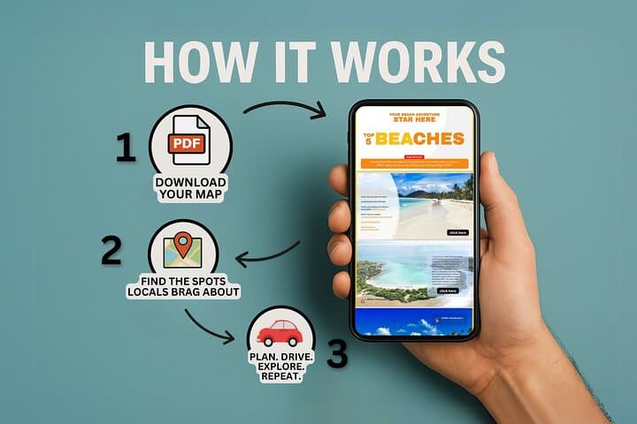


You roll off the highway and the air immediately changes — humid, green, heavy with salt and the song of coquí frogs. A downloaded PDF map becomes your companion: push one link and the road to a secret waterfall unfurls in your phone; tap another and a short trail through mangroves leads to a beach with water so clear it pushes you toward the surf. This is eastern Puerto Rico — a place where rainforest valleys push water down to the Caribbean and caves cut into limestone cliffs hold cool shade.
You roll off the highway and the air immediately changes — humid, green, heavy with salt and the song of coquí frogs. A downloaded PDF map becomes your companion: push one link and the road to a secret waterfall unfurls in your phone; tap another and a short trail through mangroves leads to a beach with water so clear it pushes you toward the surf. This is eastern Puerto Rico — a place where rainforest valleys push water down to the Caribbean and caves cut into limestone cliffs hold cool shade.
The landscape is shaped by volcanic uplifts and coastal limestone; El Yunque’s steep ridges collect cloud and feed rivers that have carved pools and cascades for centuries. Taino place names still mark the coastline while Spanish colonial history waits in Old San Juan’s forts and lighthouses. Local fishing villages keep traditions alive; roadside kiosks sell seafood fritters and cold coconut water.
Practical planning matters: this product is a self-guided map, not a guide. Expect to drive between sites (rental car required), hike short to moderate trails, and navigate a mix of paved roads and dirt tracks. Check weather closely — rivers can flash from calm to dangerous after rain. Pack reef-safe sunscreen, a snorkel or mask for coral flats, sturdy water shoes for slick rocks, and a small dry bag for phones; arrive early to avoid crowds on popular beaches and respect marine reserves and local private property. With planning and caution, the map unlocks a flexible, high-reward loop through Puerto Rico’s wild eastern edge.