THE ADVENTURE COLLECTIVE® · Independent discovery and booking for outdoor travel

Beat the crowds with a dawn ascent of Santa Ana Volcano and watch the emerald crater lake reveal itself as the sun climbs. This early-morning hike pairs volcanic geology with panoramic views of Coatepeque Lake and a relaxed lakeside lunch.
Beat the crowds with a dawn ascent of Santa Ana Volcano and watch the emerald crater lake reveal itself as the sun climbs. This early-morning hike pairs volcanic geology with panoramic views of Coatepeque Lake and a relaxed lakeside lunch.
Before dawn the trail smells of damp earth and pine; headlamps carve a thin ribbon of light while the volcano’s silhouette cuts the sky. By the time the sun slips over the rim, you’re above cloud and coffee country, standing at a crater rim that holds an uncanny emerald lake — its surface like a piece of sky trapped in stone.
Verified experiences and guided adventures in the surrounding area.
Operated by Tunco Life Tours El Salvador · Santa Ana, Santa Ana Department
Before dawn the trail smells of damp earth and pine; headlamps carve a thin ribbon of light while the volcano’s silhouette cuts the sky. By the time the sun slips over the rim, you’re above cloud and coffee country, standing at a crater rim that holds an uncanny emerald lake — its surface like a piece of sky trapped in stone.
Santa Ana (Ilamatepec) is El Salvador’s highest volcano and one of its most active. The summit sits on layers of andesitic lava and ash deposited over millennia; eruptions as recent as 2005 reshaped the crater and reinforced its reputation. Indigenous Pipil communities and later colonial farmers have long read the land here—coffee terraces and crater lakes are part of a landscape shaped by fire and human hands.
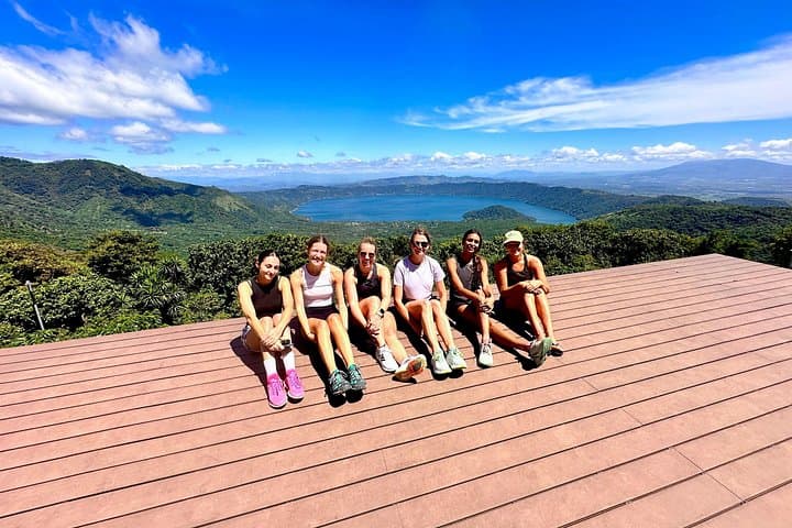
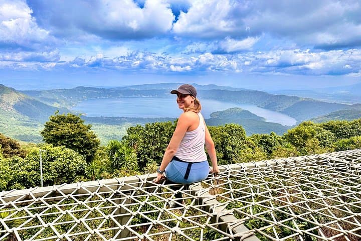
The route climbs through cloud forest, volcanic scree, and open ridges. Local bilingual guides point out fumaroles, native tree species, and photo-perfect viewpoints overlooking Coatepeque Lake, another volcanic caldera that stretches like a deep blue counterpoint to the summit’s green eye.
Practical notes: the outing is a 7–9 hour round trip with steady climbs and uneven footing; start early to avoid heat and crowds. Bring layered clothing for temperature swings, 2–3 liters of water, sturdy boots, and sun protection. Expect thin air and loose volcanic rock underfoot; poles help on descents.
Post-hike, most groups pause at a nearby restaurant for waterfront views of Coatepeque—an ideal cooldown after a volcanic morning.
moderate.
7–9 hours.
Suitable for people with regular fitness who can manage continuous uphill walking and uneven terrain; some altitude tolerance helpful.
It’s rated moderate: expect steady uphill sections, loose rock, and a 4-hour round-trip hiking time to the summit from the trailhead; overall tour time is 7–9 hours including transfers and lunch.
The summit is around 2,300–2,400 m (7,500–7,900 ft); some visitors notice mild breathlessness—pacing, hydration, and rest breaks minimize symptoms.
A local bilingual guide is strongly recommended for navigation, safety on volcanic terrain, and interpretation of geology and history—many tours include one.
Typical inclusions are hotel pickup/drop-off, air-conditioned transport, bilingual guide, admission fees, and a post-hike lunch with views of Coatepeque Lake (confirm on booking).
Santa Ana (Ilamatepec) has long influenced local settlement patterns; its eruptions shaped fertile soils used for coffee plantations and have marked regional history, including notable activity in 2005.
The crater lake and surrounding cloud forest are sensitive; stay on trail, avoid littering, and follow guide instructions to limit erosion and protect native habitat.
Tunco Life Tours El Salvador operates guided outdoor trips and adventures with an emphasis on safety, stewardship, and memorable experiences.
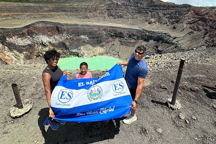
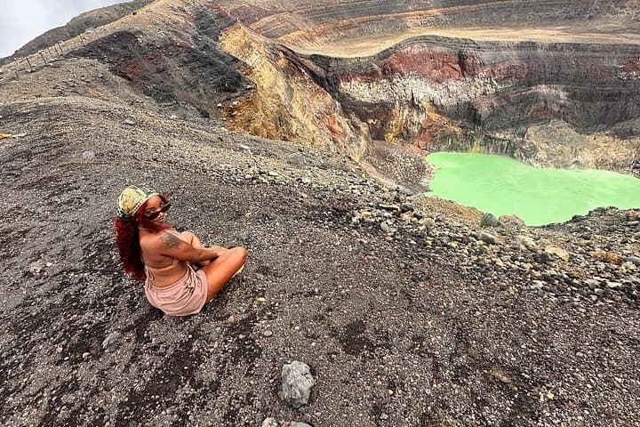
Before dawn the trail smells of damp earth and pine; headlamps carve a thin ribbon of light while the volcano’s silhouette cuts the sky. By the time the sun slips over the rim, you’re above cloud and coffee country, standing at a crater rim that holds an uncanny emerald lake — its surface like a piece of sky trapped in stone.
Before dawn the trail smells of damp earth and pine; headlamps carve a thin ribbon of light while the volcano’s silhouette cuts the sky. By the time the sun slips over the rim, you’re above cloud and coffee country, standing at a crater rim that holds an uncanny emerald lake — its surface like a piece of sky trapped in stone.
Santa Ana (Ilamatepec) is El Salvador’s highest volcano and one of its most active. The summit sits on layers of andesitic lava and ash deposited over millennia; eruptions as recent as 2005 reshaped the crater and reinforced its reputation. Indigenous Pipil communities and later colonial farmers have long read the land here—coffee terraces and crater lakes are part of a landscape shaped by fire and human hands.
The route climbs through cloud forest, volcanic scree, and open ridges. Local bilingual guides point out fumaroles, native tree species, and photo-perfect viewpoints overlooking Coatepeque Lake, another volcanic caldera that stretches like a deep blue counterpoint to the summit’s green eye.
Practical notes: the outing is a 7–9 hour round trip with steady climbs and uneven footing; start early to avoid heat and crowds. Bring layered clothing for temperature swings, 2–3 liters of water, sturdy boots, and sun protection. Expect thin air and loose volcanic rock underfoot; poles help on descents.
Post-hike, most groups pause at a nearby restaurant for waterfront views of Coatepeque—an ideal cooldown after a volcanic morning.