THE ADVENTURE COLLECTIVE® · Independent discovery and booking for outdoor travel

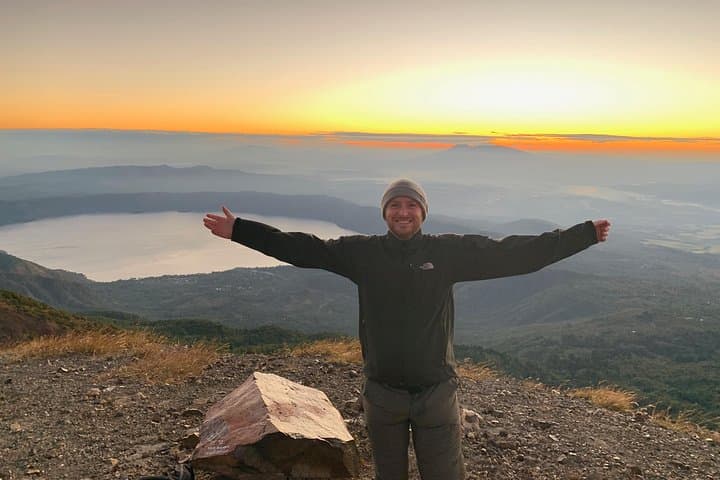
Beat the buses and mid-day heat with privileged early access to Santa Ana (Ilamatepec). This guided hike moves from cloud forest to fumarole-dotted crater rim, offering geological insight, sweeping views of Coatepeque Lake and a quieter summit experience.
Beat the buses and mid-day heat with privileged early access to Santa Ana (Ilamatepec). This guided hike moves from cloud forest to fumarole-dotted crater rim, offering geological insight, sweeping views of Coatepeque Lake and a quieter summit experience.
Before dawn the road to Cerro Verde peels away from the valley and the headlamp pool in your pack is the only human light for miles. The guide checks names, hands out permits, and the group treads into a cloud forest where mist clings to ferns like a hesitant traveler. The path climbs, first soft underfoot with leaf litter and coffee plants pressing close, then harder — broken basalt and ash that remember hotter times. Higher up the trees thin as if someone told the forest to give way; wind takes over and the landscape opens to a volcanic wasteland that seems to breathe: fumaroles hiss, sulfur steams, and the crater waits like a bowl of turquoise fire.
Verified experiences and guided adventures in the surrounding area.
Operated by Alfredo Avalos - Licensed Tour Guide in El Salvador · Santa Ana, Santa Ana Department
Before dawn the road to Cerro Verde peels away from the valley and the headlamp pool in your pack is the only human light for miles. The guide checks names, hands out permits, and the group treads into a cloud forest where mist clings to ferns like a hesitant traveler. The path climbs, first soft underfoot with leaf litter and coffee plants pressing close, then harder — broken basalt and ash that remember hotter times. Higher up the trees thin as if someone told the forest to give way; wind takes over and the landscape opens to a volcanic wasteland that seems to breathe: fumaroles hiss, sulfur steams, and the crater waits like a bowl of turquoise fire.
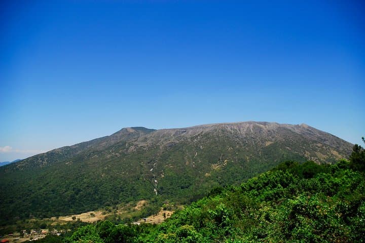
Santa Ana (Ilamatepec) is the tallest peak in El Salvador and sits on the western edge of the Apaneca volcanic belt. Its last major historic eruption reshaped local agriculture and folklore; residents still point to the caldera lake of Coatepeque below as a quiet contrast to Ilamatepec’s heat. Geologically the mountain is a stratovolcano — layers of ash, lava and debris stacked over millennia — and the crater lake’s teal color comes from dissolved sulfur and mineral activity. Culturally the hike traverses working coffee lands and territories that supported Indigenous Pipil communities, and your guide will parse how colonial-era land use and modern coffee farming have both shaped the slopes you pass.
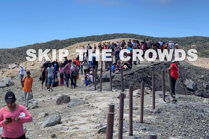
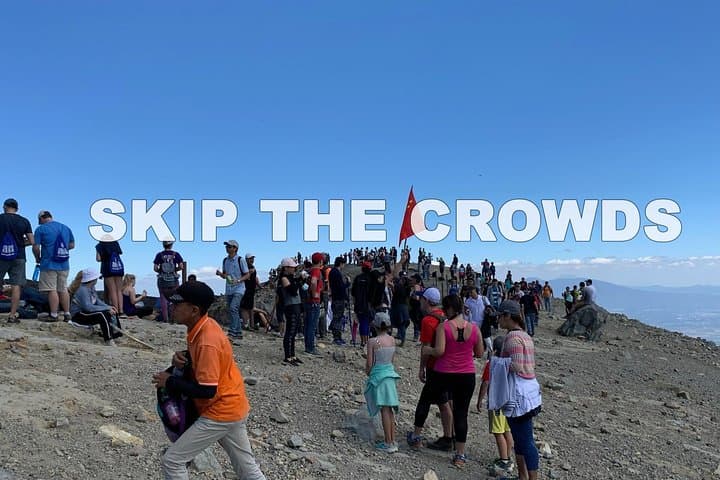
The experience is interpretative, not just a walk: expect geology talks at miradores, explanations of fumaroles and the crater’s acid lake, and stops to view Coatepeque’s blue mirror. With privileged early access you beat the thermal midday winds and the crowds that bottleneck on the rim; mornings bring cleaner light and a quieter crater listen.
Practical guide: the trail is roughly 8 km round-trip with about 600–800 m of elevation gain depending on the start point, and terrain shifts from humid forest roots to loose ash and rock near the rim. Plan 7–8 hours including transport from San Salvador or time to and from hotels in Santa Ana. Wear stiff-soled hiking boots and layers — temperatures swing from cool cloud-forest air to sharp wind on the summit. Bring at least 2 liters of water, sun protection, and a light rain shell; the park provides entry and interpretive guidance, and hiking poles are useful on steep, loose sections. Altitude is modest but will take your breath on steeper pitches; pace yourself.
If you want silence and better weather windows, early departures like this one matter: the mountain often clears before midday, and the view from the rim — fumaroles spitting sulfur, the acid lake’s uncanny color, and Coatepeque laid out like a cartographic afterthought — rewards the effort. Go prepared, go respectful, and the volcano will reveal both its heat and its stories.
moderate.
7–8 hours (including transport).
Should be comfortable hiking steady uphill for several hours; moderate cardiovascular fitness needed.
Moderate fitness is required—you should be comfortable hiking uphill for several hours and able to manage uneven terrain.
Yes; the tour includes admissions to the protected area and park facility use as listed in inclusions.
The guiding portion on the trail is roughly 4–6 hours round-trip; the total tour (including transport and lunch stop) runs about 7–8 hours.
Altitude is not extreme but the summit is cool and can make exertion feel harder—pacing and hydration mitigate most issues.
Yes—the listing notes a longer summit hike is available; ask the operator when booking to arrange a more challenging route.
Expect cloud-forest birds and small mammals; the protected area hosts a high percentage of El Salvador’s known species, but sightings depend on season and time of day.
The Apaneca volcanic belt has shaped local settlement and agriculture for centuries; Santa Ana’s eruptions influenced colonial-era land use and modern coffee cultivation.
Parque Nacional Los Volcanes protects cloud forest and highland biodiversity; visitors are asked to stay on trails, pack out waste, and support local guides to minimize impact.
Alfredo Avalos - Licensed Tour Guide in El Salvador operates guided outdoor trips and adventures with an emphasis on safety, stewardship, and memorable experiences.
Before dawn the road to Cerro Verde peels away from the valley and the headlamp pool in your pack is the only human light for miles. The guide checks names, hands out permits, and the group treads into a cloud forest where mist clings to ferns like a hesitant traveler. The path climbs, first soft underfoot with leaf litter and coffee plants pressing close, then harder — broken basalt and ash that remember hotter times. Higher up the trees thin as if someone told the forest to give way; wind takes over and the landscape opens to a volcanic wasteland that seems to breathe: fumaroles hiss, sulfur steams, and the crater waits like a bowl of turquoise fire.
Before dawn the road to Cerro Verde peels away from the valley and the headlamp pool in your pack is the only human light for miles. The guide checks names, hands out permits, and the group treads into a cloud forest where mist clings to ferns like a hesitant traveler. The path climbs, first soft underfoot with leaf litter and coffee plants pressing close, then harder — broken basalt and ash that remember hotter times. Higher up the trees thin as if someone told the forest to give way; wind takes over and the landscape opens to a volcanic wasteland that seems to breathe: fumaroles hiss, sulfur steams, and the crater waits like a bowl of turquoise fire.
Santa Ana (Ilamatepec) is the tallest peak in El Salvador and sits on the western edge of the Apaneca volcanic belt. Its last major historic eruption reshaped local agriculture and folklore; residents still point to the caldera lake of Coatepeque below as a quiet contrast to Ilamatepec’s heat. Geologically the mountain is a stratovolcano — layers of ash, lava and debris stacked over millennia — and the crater lake’s teal color comes from dissolved sulfur and mineral activity. Culturally the hike traverses working coffee lands and territories that supported Indigenous Pipil communities, and your guide will parse how colonial-era land use and modern coffee farming have both shaped the slopes you pass.
The experience is interpretative, not just a walk: expect geology talks at miradores, explanations of fumaroles and the crater’s acid lake, and stops to view Coatepeque’s blue mirror. With privileged early access you beat the thermal midday winds and the crowds that bottleneck on the rim; mornings bring cleaner light and a quieter crater listen.
Practical guide: the trail is roughly 8 km round-trip with about 600–800 m of elevation gain depending on the start point, and terrain shifts from humid forest roots to loose ash and rock near the rim. Plan 7–8 hours including transport from San Salvador or time to and from hotels in Santa Ana. Wear stiff-soled hiking boots and layers — temperatures swing from cool cloud-forest air to sharp wind on the summit. Bring at least 2 liters of water, sun protection, and a light rain shell; the park provides entry and interpretive guidance, and hiking poles are useful on steep, loose sections. Altitude is modest but will take your breath on steeper pitches; pace yourself.
If you want silence and better weather windows, early departures like this one matter: the mountain often clears before midday, and the view from the rim — fumaroles spitting sulfur, the acid lake’s uncanny color, and Coatepeque laid out like a cartographic afterthought — rewards the effort. Go prepared, go respectful, and the volcano will reveal both its heat and its stories.